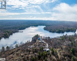
Lake Joseph - (Muskoka Lakes)
Lake Joseph is located to the west of Lake Rosseau in the central area of Muskoka. Like Lake Rosseau, Lake Joseph also extends into Seguin Township in Parry Sound District. Access may be gained to Lake Joseph via Hwy #69 and #632 as well as Muskoka Roads #7 and #169. Lake Joseph drains into Lake Rosseau by way of the Joseph River and also via the Port Sandfield “cut” located at Cox Bay.
Average traveling time from the GTA to Lake Joseph - (Muskoka Lakes) is 2 hours 27 mins
This Lake Median Lake Average Lake | |
Lake Joseph is 5460 hectares (13492 Acres) in size The median size lake in our area is 71 hectares or 175 Acres (average size 398 hectares) | 5460 71 398 |
|
Lake Joseph has a maximum depth 93 meters (305 ft)
The median depth of lakes in our area is 13.5 m or 44 ft (average depth 18 m) | 93 13.5 18 |
| The median depth of Lake Joseph is 25.00 m (82 ft) | 25.00 5.2 7 |
|
Lake Joseph Perimeter 140.00 km (86.99 Miles)
The median perimiter of lakes in our area is 3.3 km or 2.05 miles (average Perimiter 3.61 km) | 140.00 3.3 4 |
| Lake Joseph Island/s Perimeter 91.00 km (56.54 Miles) | |
|
Lake Joseph Altitude 225 m (738 ft)
The median altitude of lakes in our area is 290 m or 951 ft (average Altitude is 289 m) | 225 290 289 |
|
Water Clarity of Lake Joseph (median 3.2 m) 6.70 m (22ft)
The median Secchi Depth of lakes in our area is 3.2 m or 10 ft (average Secchi Depth is 3 m) | 6.70 3.2 3 |
| 5 % of Lake Joseph shorline is wetland. The median percentage of shoreline which is wetland of lakes in our area is 9 % (average Percentage of shoreline which is wetland 10) % |
Percentage of Shoreline which is wetland 5 9 10 |
|
Lake Joseph's phosphorus content in water is 4.80 ug/L
The median Phosphorus content in the water of lakes in our area is 8 ug/l (average Phosphorus content 9 ug/L | 4.80 8 9 |
| Lake Joseph's watershed area feeding the Lake (excluding lake) 55.0 km2 (13591 acres) | |
| Lake Trout found in Lake Joseph: Yes | |
| Drainage Basin of Lake Joseph Lake Rosseau | |
| Lake Joseph is in the Township of Medora | |
| Local Name of Lake Joseph is Lake Joe | |
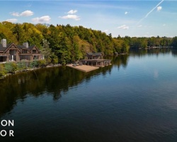
| Shoreline Development on Lake Joseph is: intense; urban, commercial, shoreline residentia | |
| Public Access to Lake Joseph public; public launches in Cox Bay, Foot’s Bay and numerous marinas Boat Launch | |
| Water Level Management regulated; water level is controlled by an MNR owned and operated dam at Port Carling, Flows and levels are governed by the Muskoka River Water Management Plan | |
| Major Fish Species in Lake Joseph , lake whitefish, , , muskellunge (I), , (I 1987), , (I) | |
| Other Fish Species in Lake Joseph , , cisco, spottail shiner, American eel (O), trout-perch,central mudminnow, (I), slimy sculpin, bluntnose minnow, margined madtom, mottled sculpin, blacknose shiner, creek chub, ninespine stickleback, brook stickleback, , banded killifish, , Iowa darter, (I), golden shiner | |
| Other Species in Lake Joseph spiny water flea (I 1989) | |
| Notes: E: extirpated, I: introduced – intentional or accidental, O: occasional, R: remnant, S: currently stocked, ?: status uncertain, 2009: year of first record or introduction if known, blank: presumed native | |
| Much of the above data for Lake Joseph is compliments of the Muskoka Water Web maintained by The District Municipality of Muskoka | |
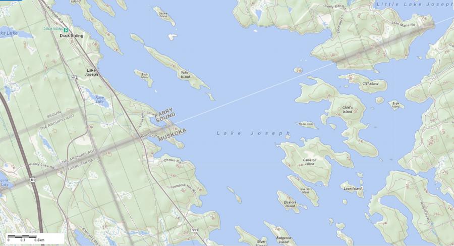
Maps of Lake Joseph
Topographical Map of Lake Joseph in Muskoka Lakes
Legend
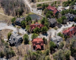
 Buildings surrounding Lake Joseph
 Buildings surrounding Lake Joseph
 Conservation Area surrounding Lake Joseph
 Contours of land surrounding Lake Joseph
 Index Contour
 Rapids
 Spot Height
 Water Falls
 Water Falls/Rapids
 Waterbody Elevation
 Watercourse
 Wetland surrounding Lake Joseph
 Wooded Area surrounding Lake Joseph
Zoning Map of Lake Joseph in Muskoka Lakes
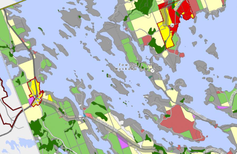
Legend of Muskoka Lakes Zoning Map - Lake Joseph
Waterfront ResidentialEnvironmentally Protected
Community Residential
Open Space
Rural
Residential Rural
Waterfront Landing
Waterfront Commercial
Waterbody Open Space
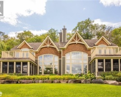
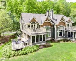
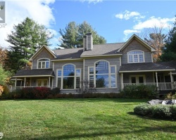
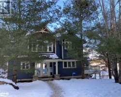
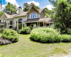
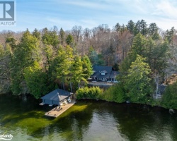
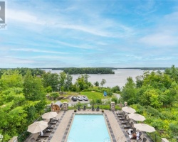
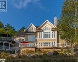
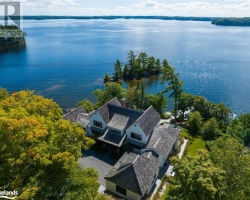
Cottages for Sale on Lake Joseph

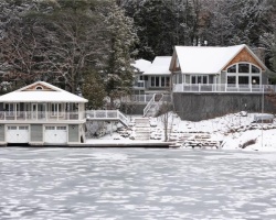
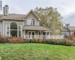
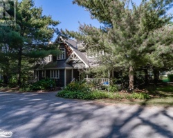
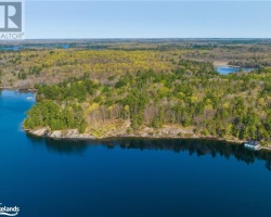
Cottages for Sale close to Lake Joseph
Lake Videos
This video is courtesy of ecottagefilms.com This video is courtesy of ecottagefilms.com This video is courtesy of ecottagefilms.com This video is courtesy of ecottagefilms.com This video is courtesy of ecottagefilms.com This video is courtesy of ecottagefilms.com This video is courtesy of ecottagefilms.com This video is courtesy of ecottagefilms.com This video is courtesy of ecottagefilms.com This video is courtesy of ecottagefilms.com This video is courtesy of ecottagefilms.com This video is courtesy of ecottagefilms.com This video is courtesy of ecottagefilms.com This video is courtesy of ecottagefilms.com This video is courtesy of ecottagefilms.com This video is courtesy of ecottagefilms.com This video is courtesy of ecottagefilms.com This video is courtesy of ecottagefilms.com This video is courtesy of ecottagefilms.com This video is courtesy of ecottagefilms.com This video is courtesy of ecottagefilms.com This video is courtesy of ecottagefilms.com This video is courtesy of ecottagefilms.com This video is courtesy of ecottagefilms.com This video is courtesy of ecottagefilms.com This video is courtesy of ecottagefilms.com This video is courtesy of ecottagefilms.com This video is courtesy of ecottagefilms.com This video is courtesy of ecottagefilms.com This video is courtesy of ecottagefilms.com This video is courtesy of ecottagefilms.com This video is courtesy of ecottagefilms.com This video is courtesy of ecottagefilms.com This video is courtesy of ecottagefilms.com This video is courtesy of ecottagefilms.com This video is courtesy of ecottagefilms.com This video is courtesy of ecottagefilms.com This video is courtesy of ecottagefilms.com This video is courtesy of ecottagefilms.com This video is courtesy of ecottagefilms.com This video is courtesy of ecottagefilms.com This video is courtesy of ecottagefilms.com This video is courtesy of ecottagefilms.com This video is courtesy of ecottagefilms.com This video is courtesy of ecottagefilms.com This video is courtesy of ecottagefilms.com This video is courtesy of ecottagefilms.com This video is courtesy of ecottagefilms.com This video is courtesy of ecottagefilms.com This video is courtesy of ecottagefilms.com This video is courtesy of ecottagefilms.com This video is courtesy of ecottagefilms.com This video is courtesy of ecottagefilms.com This video is courtesy of ecottagefilms.com This video is courtesy of ecottagefilms.com This video is courtesy of ecottagefilms.com This video is courtesy of ecottagefilms.com This video is courtesy of ecottagefilms.com This video is courtesy of ecottagefilms.com This video is courtesy of ecottagefilms.com This video is courtesy of ecottagefilms.com This video is courtesy of ecottagefilms.com This video is courtesy of ecottagefilms.com This video is courtesy of ecottagefilms.com This video is courtesy of ecottagefilms.com This video is courtesy of ecottagefilms.com This video is courtesy of ecottagefilms.com Previously listed Cottages on Lake Joseph
201 GLEN ABBEY Way Unit# 3, Seguin, P2A2W8 was previously listed 2024-02-22, mls# 40527618
4 GRAY'S Road, Seguin Humphrey, P2A2W8 was previously listed 2024-02-02, mls# 40536437
1205 2 JOE RIVER Road, Port Carling, P0B1G0 was previously listed 2023-10-31, mls# 40381254
320 STANLEY HOUSE Road, Seguin, P0C1J0 was previously listed 2023-10-31, mls# 40386842
1027 CHOWN Road, MacTier, P0C1H0 was previously listed 2023-10-31, mls# 40394255
1611 PENINSULA Road, Port Carling, P0B1J0 was previously listed 2023-10-31, mls# 40416489
4 GRAY'S Road, Seguin Humphrey, P2A2W8 was previously listed 2023-10-31, mls# 40421342
28B GORDON POINT Lane, Seguin, P0C1H0 was previously listed 2023-10-31, mls# 40436867
201 GLEN ABBEY Way Unit# 3, Seguin, P2A2W8 was previously listed 2023-10-31, mls# 40482470
301 EMERALD HILLS Court, Seguin Humphrey, P2A2W8 was previously listed 2023-10-31, mls# 40482274
16 SPRUCE HILL Drive, Seguin, P0C1J0 was previously listed 2023-10-31, mls# 40488753
1 1356 & 1357 PENINSULA Road, Port Sandfield, P0B1J0 was previously listed 2023-10-31, mls# 40492061
364 STANLEY HOUSE Road Unit# LOT C, Seguin, P0C1J0 was previously listed 2023-10-31, mls# 40498655
1932A LAKE JOSEPH Road, Humphrey, P0C1H0 was previously listed 2023-10-13, mls# 40489614
46 J9 CAMERON Island, Muskoka Lakes, P0C1H0 was previously listed 2023-10-01, mls# 40402369
1932A LAKE JOSEPH Road, Humphrey, P0C1H0 was previously listed 2023-09-23, mls# 40448362
1102 WOODROFFE Road Unit# 12, Muskoka Lakes, P0C1H0 was previously listed 2023-09-19, mls# 40448071
201 GLEN ABBEY Way Unit# 3, Seguin, P2A2W8 was previously listed 2023-09-10, mls# 40385127
26 PLAYFAIR Island Unit# 36, Seguin, P0C1H0 was previously listed 2023-09-06, mls# 40468862
1 TOPAJO Road, Parry Sound, P0C1H0 was previously listed 2023-08-18, mls# 40462224
16 MAILE Run, Seguin, P0C1J0 was previously listed 2023-06-01, mls# 40391440
PART 5 ELSINORE Island, MacTier, P0C1H0 was previously listed 2023-05-20, mls# 40419530
0 BLACK FOREST ISLAND Lake, Port Carling, P0C1H0 was previously listed 2023-05-06, mls# 40402676
72 TALL TIMBERS Road, Seguin, P2A2W8 was previously listed 2023-05-02, mls# 40369940
1805 PENINSULA Road Unit# 281, Minett, P0B1J0 was previously listed 2023-04-21, mls# 40391444
1107 ELGIN HOUSE Road, Muskoka Lakes, P0B1J0 was previously listed 2023-04-05, mls# 40335590
280 JEAN MARIE Road, Rosseau, P0C1J0 was previously listed 2023-03-31, mls# 40390995
201 GLEN ABBEY Way Unit# 3, Seguin, P2A2W8 was previously listed 2023-03-22, mls# 40380893
15 J18 BADGEROW Island, Muskoka Lakes, P0C1H0 was previously listed 2023-03-05, mls# 40351951
101 GLEN ABBEY Way Unit# 3, Seguin, P2A2W8 was previously listed 2023-01-01, mls# 40321244
1218 HAMILLS POINT Road, Port Carling, P0B1H0 was previously listed 2022-12-24, mls# 40354931
28A GORDON POINT Lane, Seguin, P0C1H0 was previously listed 2022-12-01, mls# 40292932
1868 LAKE JOSEPH Road, Seguin, P0C1H0 was previously listed 2022-12-01, mls# 40337277
1218 HAMILLS POINT Road, Port Carling, P0B1H0 was previously listed 2022-11-24, mls# 40344393
320 STANLEY HOUSE Road, Seguin, P0C1J0 was previously listed 2022-11-12, mls# 40262741
46 J9 CAMERON Island, Muskoka Lakes, P0C1H0 was previously listed 2022-11-02, mls# 40314505
1216 HAMILLS POINT RD, Port Carling, P0B1J0 was previously listed 2022-11-02, mls# 40323450
25 & 31 VERONICA GENE Lane, Seguin, P0C1J0 was previously listed 2022-11-01, mls# 40249471
25 & 31 VERONICA GENE Lane, Seguin, P0C1J0 was previously listed 2022-11-01, mls# 40254459
1027 CHOWN Road, MacTier, P0C1H0 was previously listed 2022-11-01, mls# 40230145
72 TALL TIMBERS Road, Seguin, P2A2W8 was previously listed 2022-11-01, mls# 40282243
1218 HAMILLS POINT Road, Port Carling, P0B1H0 was previously listed 2022-11-01, mls# 40326061
5 HOODWINK Road, Seguin, P2A2W8 was previously listed 2022-11-01, mls# 40326909
1015 AVON Lane, Port Carling, P0B1J0 was previously listed 2022-11-01, mls# 40330330
1070 HAMILLS POINT Road, MacTier, P0C1H0 was previously listed 2022-10-27, mls# 40312746
1037 ELGIN HOUSE Road, Port Sandfield, P0B1J0 was previously listed 2022-10-04, mls# 40315862
28B GORDON POINT Lane, Seguin, P0C1H0 was previously listed 2022-09-30, mls# 40291089
1043 CHOWN Road, MacTier, P0C1H0 was previously listed 2022-09-03, mls# 40267364
1205 JOE RIVER Road Unit# 4, Muskoka Lakes, P0B1J0 was previously listed 2022-08-30, mls# 40313330
47 COONS Road, Rosseau, P0C1J0 was previously listed 2022-08-26, mls# 40302033
8B KENOZHA Road, Seguin, P0C1J0 was previously listed 2022-08-01, mls# 40293863
1868 LAKE JOSEPH Road, Seguin, P0C1H0 was previously listed 2022-07-27, mls# 40233604
0 BIRCH Island, Seguin, P0C1H0 was previously listed 2022-07-27, mls# 40197592
602 GLEN ABBEY Way, MacTier, P2A2W8 was previously listed 2022-07-27, mls# 40251618
270 CLEAR LAKE Road, Seguin, P2A2W8 was previously listed 2022-07-27, mls# 40261308
1805 PENINSULA Road, Minett, P0B1J0 was previously listed 2022-07-27, mls# 40287354
1805 PENINSULA Road, Minett, P0B1J0 was previously listed 2022-07-27, mls# 40297884
1805 PENINSULA Road Unit# 281, Minett, P0B1J0 was previously listed 2022-07-01, mls# 40217653
137 A STEELES Road, Seguin, P2A0B2 was previously listed 2022-07-01, mls# 40265328
126B CRANBERRY COVE, Seguin, P0C1H0 was previously listed 2022-07-01, mls# 40277812
1153 ROBERTS BAY Road Unit# 5, MacTier, P0C1H0 was previously listed 2022-06-01, mls# 40246454
1062 WOODROFFE Road, MacTier, P0C1H0 was previously listed 2022-06-01, mls# 40230597
7 GORDON POINT Lane, Seguin, P0C1H0 was previously listed 2022-06-01, mls# 40215521
1153 ROBERTS BAY Road Unit# 5, Muskoka Lakes, P0C1H0 was previously listed 2022-06-01, mls# 40257813
LOT 8 ROUND (ISLAND M) Island, Seguin, P0C1H0 was previously listed 2022-06-01, mls# 40258588
336 RIVERDALE Road, Port Carling, P0B1J0 was previously listed 2022-04-13, mls# 40229206
1356 PENINSULA Road Unit# 1, Muskoka Lakes, P0B1J0 was previously listed 2022-04-01, mls# 40224514
12 Wegamind Island Unit# 5, Humphrey, P0C1H0 was previously listed 2022-01-26, mls# 40181473
1153 Roberts Bay Road Unit# 5, MacTier, P0C1H0 was previously listed 2021-11-05, mls# 40173523
31 Veronica Gene Lane, Rosseau, P0C1J0 was previously listed 2021-10-30, mls# 40134784
1327 Carlingford Road, Minett, P0B1G0 was previously listed 2021-10-28, mls# 40177099
7 Gordon Point Lane, Seguin Twp, P0C1H0 was previously listed 2021-10-21, mls# 40156136
2 Peggy Island, Seguin, P0C1H0 was previously listed 2021-09-29, mls# 40087842
324a Stanley House Road, Seguin, P0C1J0 was previously listed 2021-09-28, mls# 40167300
Pt 5 Plan 35r14682 Elsinore Island, MacTier, P0C1H0 was previously listed 2021-09-23, mls# 40168330
101 Glen Abbey Way Unit# 3, Seguin, P2A2W8 was previously listed 2021-09-19, mls# 40153416
5 Hoodwink Road, Seguin, P2A2W8 was previously listed 2021-08-23, mls# 40155039
1805 Peninsula Road Unit# 281, Port Carling, P0B1J0 was previously listed 2021-08-22, mls# 40151422
1 Hope Island, Foots Bay, P0C1H0 was previously listed 2021-08-20, mls# 40099743
1868 Lake Joseph Road, MacTier, P0C1H0 was previously listed 2021-08-14, mls# 40140624
1125 Elgin House Road Unit# 3, Port Carling, P0B1J0 was previously listed 2021-07-23, mls# 40142463
1011 Hemlock Point Side Road, Muskoka Lakes, P0B1J0 was previously listed 2021-07-09, mls# 40133013
1 Turtle Island # 2, Seguin, P0C1H0 was previously listed 2021-07-02, mls# 40111143
101 Glen Abbey Way Unit# 3, Seguin, P2A2W8 was previously listed 2021-06-24, mls# 40125130
417 Stanley House Road, Rosseau, P0C1J0 was previously listed 2021-06-22, mls# 40128507
177 Jean Marie Road, Rosseau, P2A2W8 was previously listed 2021-06-11, mls# 40109588
1025 Appian Way, Port Carling, P0B1J0 was previously listed 2021-05-21, mls# 40103714
1613 Peninsula Road, Port Sandfield, P0B1J0 was previously listed 2021-05-13, mls# 40100121
1113 Hemlock Point Side Road, Port Sandfield, P0B1J0 was previously listed 2021-05-02, mls# 40054801
89 & 91 Trails End, Humphrey, P2A2W8 was previously listed 2021-04-29, mls# 40067765
4735 Muskoka Road 169 Road, Foots Bay, P0C1H0 was previously listed 2021-04-23, mls# 40097959
12 Playfair Island Unit# 3, Seguin Twp, P0C1H0 was previously listed 2021-04-22, mls# 40092974
1007 Pratt Road Unit# 2, MacTier, P0C1H0 was previously listed 2021-04-20, mls# 40098334
1395 Peninsula Road, Port Carling, P0B1J0 was previously listed 2021-03-26, mls# 40078541
9a Veronica Gene Lane, Seguin, P0B1J0 was previously listed 2021-03-25, mls# 40044509
1002 Murphy Road, MacTier, P0C1H0 was previously listed 2021-03-24, mls# 40052875
1028 Murphy Road, MacTier, P0B1J0 was previously listed 2021-03-24, mls# 40075986
1153 Roberts Bay Road Unit# 11, Port Carling, P0B1J0 was previously listed 2021-03-13, mls# 30818512
117 [a&b] Steeles Road, Seguin, P0C1J0 was previously listed 2021-03-05, mls# 40053393
1030 Hemlock Point Side Road, Muskoka Lakes, P0B1K0 was previously listed 2021-03-05, mls# 40062834
1932a Lake Joseph Road, MacTier, P0C1H0 was previously listed 2021-02-24, mls# 40007791
102 Emerald Hills Court, MacTier, P0C1H0 was previously listed 2021-01-31, mls# 40050998
1002 Murphy Road, MacTier, P0C1H0 was previously listed 2020-12-17, mls# 40013625
1800 Lake Joseph Road, Seguin Humphrey, P0C1H0 was previously listed 2020-11-27, mls# 40041148
101 Glen Abbey Way Unit# 3, Seguin, P2A2W8 was previously listed 2020-11-24, mls# 40040311
25 Chief's Island, Minett, P0B1H0 was previously listed 2020-11-11, mls# 40019756
1099 Big Joe Road, Muskoka Lakes, P0B1J0 was previously listed 2020-11-11, mls# 40041893
5 Joseph River Shore, Port Carling, P0B1J0 was previously listed 2020-11-05, mls# 40036126
1025 Appian Way Unit# 10, Muskoka Lakes, P0B1J0 was previously listed 2020-11-03, mls# 40020276
1025 Appian Way, Port Carling, P0B1J0 was previously listed 2020-11-03, mls# 40021472
1108 Hemlock Point Side Road, Muskoka Lakes, P0B1J0 was previously listed 2020-11-01, mls# 40015315
1025 Appian Way, Muskoka Lakes Twp, P0B1J0 was previously listed 2020-10-31, mls# 40022277
25 Maile Run, Seguin, P0C1J0 was previously listed 2020-10-29, mls# 40007860
25 Maile Run, Seguin, P0C1J0 was previously listed 2020-10-29, mls# 40013997
1377 Peninsula Road, Port Carling, P0B1J0 was previously listed 2020-10-22, mls# 40030714
1 Turtle Island, Parry Sound Muskoka, P0C1H0 was previously listed 2020-10-21, mls# 40020391
1029 Roberts Bay Road, Muskoka Lakes, P0B1J0 was previously listed 2020-10-17, mls# 40024278
104 Emerald Hills Court, MacTier, P0C1H0 was previously listed 2020-10-15, mls# 40014447
11 Playfair Island, Muskoka Lakes, P0C1H0 was previously listed 2020-10-14, mls# 40027670
1805 Peninsula Road Unit# 331, Port Carling, P0B1J0 was previously listed 2020-10-01, mls# 40027169
29b Steeles Road, Seguin, P0C1J0 was previously listed 2020-09-29, mls# 277282
52 Blair Point Road, Seguin, P0C1J0 was previously listed 2020-09-29, mls# 40013931
0 Townsends Bay ., Muskoka Lakes, P0C1G0 was previously listed 2020-09-26, mls# 248741
0 Townsends Bay ., Muskoka Lakes, P0B1J0 was previously listed 2020-09-25, mls# 248677
1077 Hamills Point Road, Port Carling, P0B1J0 was previously listed 2020-09-25, mls# 40025435
22 Playfair Island #3, Muskoka, P0C1H0 was previously listed 2020-09-06, mls# 246074
3876 Muskoka 118 Road #carling 4, Port Carling, P0B1J0 was previously listed 2020-07-22, mls# 241268
, Port Sandfield, P0B1J0 was previously listed 2020-06-27, mls# 187029
1071 Big Joe Road #1, Muskoka Lakes, P0B1J0 was previously listed 2020-06-16, mls# 252819
483 Lake Joseph, Port Sandfield, P0B1G0 was previously listed 2020-05-09, mls# 254314
67 Townsends Bay Bay, Muskoka Lakes, P0C1G0 was previously listed 2020-05-05, mls# 245183
68 Lake Joseph W/a, Muskoka Lakes, P0C1H0 was previously listed 2020-05-01, mls# 256262
, Port Sandfield, P0B1G0 was previously listed 2020-04-01, mls# 188750
68 Lake Joseph W/a, Muskoka Lakes, P0C 1H0 was previously listed 2020-01-09, mls# 206383
, Rosseau, P0B1J0 was previously listed 2020-01-09, mls# 230881
22 Playfair Island #3, Muskoka, P0C 1H0 was previously listed 2019-12-27, mls# 194298
1175 Hamill's Point Road, Foots Bay, P0B 1J0 was previously listed 2019-12-27, mls# 196443
601 Glen Abbey Way, Seguin Twp, P0C 1H9 was previously listed 2019-12-27, mls# 213116
67 Townsends Bay Bay, Muskoka Lakes, P0C 1G0 was previously listed 2019-12-27, mls# 216117
, Muskoka Lakes, P0B1J0 was previously listed 2019-12-27, mls# 223144
1377 Peninsula Road, Port Carling, P0B 1J0 was previously listed 2019-12-27, mls# 223188
Townsends Bay, Muskoka Lakes, P0B 1J0 was previously listed 2019-11-02, mls# 181135
Townsends Bay, Muskoka Lakes, P0C 1G0 was previously listed 2019-11-02, mls# 181570
, Port Sandfield, P0B1J0 was previously listed 2019-11-02, mls# 194157
, Humphrey, P2A2W8 was previously listed 2019-11-02, mls# 214848
81d Seely Bay Road, Rosseau, P0C 1J0 was previously listed 2019-11-02, mls# 195963
20-j5 Chiefs Island, Lake Joseph, Minett, P0C 1H0 was previously listed 2019-10-31, mls# 202786
275 Riverdale Road, Muskoka Lakes, P0B 1J0 was previously listed 2019-10-31, mls# 205360
9 Veronica Gene Lane #a, Rosseau, P0B 1J0 was previously listed 2019-10-30, mls# 218564
1737 Peninsula Road, Port Carling, P0B 1J0 was previously listed 2019-10-08, mls# 223311
, , was previously listed 2019-10-02, mls# 212115
1047 Christie Point Road, Muskoka Lakes, P0C 1H0 was previously listed 2019-10-02, mls# 220772
101 Glen Abbey Way #3, Muskoka, P0C 1H0 was previously listed 2019-09-30, mls# 184231
3876 Muskoka 118 Road #belmont, Port Carling, P0B 1J0 was previously listed 2019-09-24, mls# 175664
302 Emerald Hill Road #12, Mactier, P0C 1H0 was previously listed 2019-09-14, mls# 181174
1070 Hamills Point Road, Muskoka Lakes, P0B 1J0 was previously listed 2019-09-10, mls# 181674
1179 Hamill's Point Road, Foots Bay, P0B 1J0 was previously listed 2019-09-04, mls# 191107
223 Hamer Bay Road, Seguin, P0C 1H0 was previously listed 2019-09-02, mls# 196131
3876 Muskoka 118 Road #belmont, Port Carling, P0B 1J0 was previously listed 2019-08-28, mls# 155579
1952b Lake Joseph Road, Mactier, P0C 1H0 was previously listed 2019-08-12, mls# 194635
1002 Murphy Road, Muskoka, P0C 1H0 was previously listed 2019-08-12, mls# 196092
1039 Chown Road, Foots Bay, P0C 1H0 was previously listed 2019-08-12, mls# 198795
601 Glen Abbey Way, Seguin Twp, P0C 1H9 was previously listed 2019-08-06, mls# 183232
1212 Hamills Point Road, Port Carling, P0B 1J0 was previously listed 2019-08-06, mls# 187410
64 Lookout Point Road, Humphrey, P0C 1J0 was previously listed 2019-08-06, mls# 189367
Lot 5 Badgerow Island, Muskoka Lakes, P0B 1J0 was previously listed 2019-08-06, mls# 192388
1153 Roberts Bay Road #6, Muskoka Lakes, P0B 1J0 was previously listed 2019-08-06, mls# 199455
Lake Videos
Previously listed Cottages on Lake Joseph
201 GLEN ABBEY Way Unit# 3, Seguin, P2A2W8 was previously listed 2024-02-22, mls# 40527618
4 GRAY'S Road, Seguin Humphrey, P2A2W8 was previously listed 2024-02-02, mls# 40536437
1205 2 JOE RIVER Road, Port Carling, P0B1G0 was previously listed 2023-10-31, mls# 40381254
320 STANLEY HOUSE Road, Seguin, P0C1J0 was previously listed 2023-10-31, mls# 40386842
1027 CHOWN Road, MacTier, P0C1H0 was previously listed 2023-10-31, mls# 40394255
1611 PENINSULA Road, Port Carling, P0B1J0 was previously listed 2023-10-31, mls# 40416489
4 GRAY'S Road, Seguin Humphrey, P2A2W8 was previously listed 2023-10-31, mls# 40421342
28B GORDON POINT Lane, Seguin, P0C1H0 was previously listed 2023-10-31, mls# 40436867
201 GLEN ABBEY Way Unit# 3, Seguin, P2A2W8 was previously listed 2023-10-31, mls# 40482470
301 EMERALD HILLS Court, Seguin Humphrey, P2A2W8 was previously listed 2023-10-31, mls# 40482274
16 SPRUCE HILL Drive, Seguin, P0C1J0 was previously listed 2023-10-31, mls# 40488753
1 1356 & 1357 PENINSULA Road, Port Sandfield, P0B1J0 was previously listed 2023-10-31, mls# 40492061
364 STANLEY HOUSE Road Unit# LOT C, Seguin, P0C1J0 was previously listed 2023-10-31, mls# 40498655
1932A LAKE JOSEPH Road, Humphrey, P0C1H0 was previously listed 2023-10-13, mls# 40489614
46 J9 CAMERON Island, Muskoka Lakes, P0C1H0 was previously listed 2023-10-01, mls# 40402369
1932A LAKE JOSEPH Road, Humphrey, P0C1H0 was previously listed 2023-09-23, mls# 40448362
1102 WOODROFFE Road Unit# 12, Muskoka Lakes, P0C1H0 was previously listed 2023-09-19, mls# 40448071
201 GLEN ABBEY Way Unit# 3, Seguin, P2A2W8 was previously listed 2023-09-10, mls# 40385127
26 PLAYFAIR Island Unit# 36, Seguin, P0C1H0 was previously listed 2023-09-06, mls# 40468862
1 TOPAJO Road, Parry Sound, P0C1H0 was previously listed 2023-08-18, mls# 40462224
16 MAILE Run, Seguin, P0C1J0 was previously listed 2023-06-01, mls# 40391440
PART 5 ELSINORE Island, MacTier, P0C1H0 was previously listed 2023-05-20, mls# 40419530
0 BLACK FOREST ISLAND Lake, Port Carling, P0C1H0 was previously listed 2023-05-06, mls# 40402676
72 TALL TIMBERS Road, Seguin, P2A2W8 was previously listed 2023-05-02, mls# 40369940
1805 PENINSULA Road Unit# 281, Minett, P0B1J0 was previously listed 2023-04-21, mls# 40391444
1107 ELGIN HOUSE Road, Muskoka Lakes, P0B1J0 was previously listed 2023-04-05, mls# 40335590
280 JEAN MARIE Road, Rosseau, P0C1J0 was previously listed 2023-03-31, mls# 40390995
201 GLEN ABBEY Way Unit# 3, Seguin, P2A2W8 was previously listed 2023-03-22, mls# 40380893
15 J18 BADGEROW Island, Muskoka Lakes, P0C1H0 was previously listed 2023-03-05, mls# 40351951
101 GLEN ABBEY Way Unit# 3, Seguin, P2A2W8 was previously listed 2023-01-01, mls# 40321244
1218 HAMILLS POINT Road, Port Carling, P0B1H0 was previously listed 2022-12-24, mls# 40354931
28A GORDON POINT Lane, Seguin, P0C1H0 was previously listed 2022-12-01, mls# 40292932
1868 LAKE JOSEPH Road, Seguin, P0C1H0 was previously listed 2022-12-01, mls# 40337277
1218 HAMILLS POINT Road, Port Carling, P0B1H0 was previously listed 2022-11-24, mls# 40344393
320 STANLEY HOUSE Road, Seguin, P0C1J0 was previously listed 2022-11-12, mls# 40262741
46 J9 CAMERON Island, Muskoka Lakes, P0C1H0 was previously listed 2022-11-02, mls# 40314505
1216 HAMILLS POINT RD, Port Carling, P0B1J0 was previously listed 2022-11-02, mls# 40323450
25 & 31 VERONICA GENE Lane, Seguin, P0C1J0 was previously listed 2022-11-01, mls# 40249471
25 & 31 VERONICA GENE Lane, Seguin, P0C1J0 was previously listed 2022-11-01, mls# 40254459
1027 CHOWN Road, MacTier, P0C1H0 was previously listed 2022-11-01, mls# 40230145
72 TALL TIMBERS Road, Seguin, P2A2W8 was previously listed 2022-11-01, mls# 40282243
1218 HAMILLS POINT Road, Port Carling, P0B1H0 was previously listed 2022-11-01, mls# 40326061
5 HOODWINK Road, Seguin, P2A2W8 was previously listed 2022-11-01, mls# 40326909
1015 AVON Lane, Port Carling, P0B1J0 was previously listed 2022-11-01, mls# 40330330
1070 HAMILLS POINT Road, MacTier, P0C1H0 was previously listed 2022-10-27, mls# 40312746
1037 ELGIN HOUSE Road, Port Sandfield, P0B1J0 was previously listed 2022-10-04, mls# 40315862
28B GORDON POINT Lane, Seguin, P0C1H0 was previously listed 2022-09-30, mls# 40291089
1043 CHOWN Road, MacTier, P0C1H0 was previously listed 2022-09-03, mls# 40267364
1205 JOE RIVER Road Unit# 4, Muskoka Lakes, P0B1J0 was previously listed 2022-08-30, mls# 40313330
47 COONS Road, Rosseau, P0C1J0 was previously listed 2022-08-26, mls# 40302033
8B KENOZHA Road, Seguin, P0C1J0 was previously listed 2022-08-01, mls# 40293863
1868 LAKE JOSEPH Road, Seguin, P0C1H0 was previously listed 2022-07-27, mls# 40233604
0 BIRCH Island, Seguin, P0C1H0 was previously listed 2022-07-27, mls# 40197592
602 GLEN ABBEY Way, MacTier, P2A2W8 was previously listed 2022-07-27, mls# 40251618
270 CLEAR LAKE Road, Seguin, P2A2W8 was previously listed 2022-07-27, mls# 40261308
1805 PENINSULA Road, Minett, P0B1J0 was previously listed 2022-07-27, mls# 40287354
1805 PENINSULA Road, Minett, P0B1J0 was previously listed 2022-07-27, mls# 40297884
1805 PENINSULA Road Unit# 281, Minett, P0B1J0 was previously listed 2022-07-01, mls# 40217653
137 A STEELES Road, Seguin, P2A0B2 was previously listed 2022-07-01, mls# 40265328
126B CRANBERRY COVE, Seguin, P0C1H0 was previously listed 2022-07-01, mls# 40277812
1153 ROBERTS BAY Road Unit# 5, MacTier, P0C1H0 was previously listed 2022-06-01, mls# 40246454
1062 WOODROFFE Road, MacTier, P0C1H0 was previously listed 2022-06-01, mls# 40230597
7 GORDON POINT Lane, Seguin, P0C1H0 was previously listed 2022-06-01, mls# 40215521
1153 ROBERTS BAY Road Unit# 5, Muskoka Lakes, P0C1H0 was previously listed 2022-06-01, mls# 40257813
LOT 8 ROUND (ISLAND M) Island, Seguin, P0C1H0 was previously listed 2022-06-01, mls# 40258588
336 RIVERDALE Road, Port Carling, P0B1J0 was previously listed 2022-04-13, mls# 40229206
1356 PENINSULA Road Unit# 1, Muskoka Lakes, P0B1J0 was previously listed 2022-04-01, mls# 40224514
12 Wegamind Island Unit# 5, Humphrey, P0C1H0 was previously listed 2022-01-26, mls# 40181473
1153 Roberts Bay Road Unit# 5, MacTier, P0C1H0 was previously listed 2021-11-05, mls# 40173523
31 Veronica Gene Lane, Rosseau, P0C1J0 was previously listed 2021-10-30, mls# 40134784
1327 Carlingford Road, Minett, P0B1G0 was previously listed 2021-10-28, mls# 40177099
7 Gordon Point Lane, Seguin Twp, P0C1H0 was previously listed 2021-10-21, mls# 40156136
2 Peggy Island, Seguin, P0C1H0 was previously listed 2021-09-29, mls# 40087842
324a Stanley House Road, Seguin, P0C1J0 was previously listed 2021-09-28, mls# 40167300
Pt 5 Plan 35r14682 Elsinore Island, MacTier, P0C1H0 was previously listed 2021-09-23, mls# 40168330
101 Glen Abbey Way Unit# 3, Seguin, P2A2W8 was previously listed 2021-09-19, mls# 40153416
5 Hoodwink Road, Seguin, P2A2W8 was previously listed 2021-08-23, mls# 40155039
1805 Peninsula Road Unit# 281, Port Carling, P0B1J0 was previously listed 2021-08-22, mls# 40151422
1 Hope Island, Foots Bay, P0C1H0 was previously listed 2021-08-20, mls# 40099743
1868 Lake Joseph Road, MacTier, P0C1H0 was previously listed 2021-08-14, mls# 40140624
1125 Elgin House Road Unit# 3, Port Carling, P0B1J0 was previously listed 2021-07-23, mls# 40142463
1011 Hemlock Point Side Road, Muskoka Lakes, P0B1J0 was previously listed 2021-07-09, mls# 40133013
1 Turtle Island # 2, Seguin, P0C1H0 was previously listed 2021-07-02, mls# 40111143
101 Glen Abbey Way Unit# 3, Seguin, P2A2W8 was previously listed 2021-06-24, mls# 40125130
417 Stanley House Road, Rosseau, P0C1J0 was previously listed 2021-06-22, mls# 40128507
177 Jean Marie Road, Rosseau, P2A2W8 was previously listed 2021-06-11, mls# 40109588
1025 Appian Way, Port Carling, P0B1J0 was previously listed 2021-05-21, mls# 40103714
1613 Peninsula Road, Port Sandfield, P0B1J0 was previously listed 2021-05-13, mls# 40100121
1113 Hemlock Point Side Road, Port Sandfield, P0B1J0 was previously listed 2021-05-02, mls# 40054801
89 & 91 Trails End, Humphrey, P2A2W8 was previously listed 2021-04-29, mls# 40067765
4735 Muskoka Road 169 Road, Foots Bay, P0C1H0 was previously listed 2021-04-23, mls# 40097959
12 Playfair Island Unit# 3, Seguin Twp, P0C1H0 was previously listed 2021-04-22, mls# 40092974
1007 Pratt Road Unit# 2, MacTier, P0C1H0 was previously listed 2021-04-20, mls# 40098334
1395 Peninsula Road, Port Carling, P0B1J0 was previously listed 2021-03-26, mls# 40078541
9a Veronica Gene Lane, Seguin, P0B1J0 was previously listed 2021-03-25, mls# 40044509
1002 Murphy Road, MacTier, P0C1H0 was previously listed 2021-03-24, mls# 40052875
1028 Murphy Road, MacTier, P0B1J0 was previously listed 2021-03-24, mls# 40075986
1153 Roberts Bay Road Unit# 11, Port Carling, P0B1J0 was previously listed 2021-03-13, mls# 30818512
117 [a&b] Steeles Road, Seguin, P0C1J0 was previously listed 2021-03-05, mls# 40053393
1030 Hemlock Point Side Road, Muskoka Lakes, P0B1K0 was previously listed 2021-03-05, mls# 40062834
1932a Lake Joseph Road, MacTier, P0C1H0 was previously listed 2021-02-24, mls# 40007791
102 Emerald Hills Court, MacTier, P0C1H0 was previously listed 2021-01-31, mls# 40050998
1002 Murphy Road, MacTier, P0C1H0 was previously listed 2020-12-17, mls# 40013625
1800 Lake Joseph Road, Seguin Humphrey, P0C1H0 was previously listed 2020-11-27, mls# 40041148
101 Glen Abbey Way Unit# 3, Seguin, P2A2W8 was previously listed 2020-11-24, mls# 40040311
25 Chief's Island, Minett, P0B1H0 was previously listed 2020-11-11, mls# 40019756
1099 Big Joe Road, Muskoka Lakes, P0B1J0 was previously listed 2020-11-11, mls# 40041893
5 Joseph River Shore, Port Carling, P0B1J0 was previously listed 2020-11-05, mls# 40036126
1025 Appian Way Unit# 10, Muskoka Lakes, P0B1J0 was previously listed 2020-11-03, mls# 40020276
1025 Appian Way, Port Carling, P0B1J0 was previously listed 2020-11-03, mls# 40021472
1108 Hemlock Point Side Road, Muskoka Lakes, P0B1J0 was previously listed 2020-11-01, mls# 40015315
1025 Appian Way, Muskoka Lakes Twp, P0B1J0 was previously listed 2020-10-31, mls# 40022277
25 Maile Run, Seguin, P0C1J0 was previously listed 2020-10-29, mls# 40007860
25 Maile Run, Seguin, P0C1J0 was previously listed 2020-10-29, mls# 40013997
1377 Peninsula Road, Port Carling, P0B1J0 was previously listed 2020-10-22, mls# 40030714
1 Turtle Island, Parry Sound Muskoka, P0C1H0 was previously listed 2020-10-21, mls# 40020391
1029 Roberts Bay Road, Muskoka Lakes, P0B1J0 was previously listed 2020-10-17, mls# 40024278
104 Emerald Hills Court, MacTier, P0C1H0 was previously listed 2020-10-15, mls# 40014447
11 Playfair Island, Muskoka Lakes, P0C1H0 was previously listed 2020-10-14, mls# 40027670
1805 Peninsula Road Unit# 331, Port Carling, P0B1J0 was previously listed 2020-10-01, mls# 40027169
29b Steeles Road, Seguin, P0C1J0 was previously listed 2020-09-29, mls# 277282
52 Blair Point Road, Seguin, P0C1J0 was previously listed 2020-09-29, mls# 40013931
0 Townsends Bay ., Muskoka Lakes, P0C1G0 was previously listed 2020-09-26, mls# 248741
0 Townsends Bay ., Muskoka Lakes, P0B1J0 was previously listed 2020-09-25, mls# 248677
1077 Hamills Point Road, Port Carling, P0B1J0 was previously listed 2020-09-25, mls# 40025435
22 Playfair Island #3, Muskoka, P0C1H0 was previously listed 2020-09-06, mls# 246074
3876 Muskoka 118 Road #carling 4, Port Carling, P0B1J0 was previously listed 2020-07-22, mls# 241268
, Port Sandfield, P0B1J0 was previously listed 2020-06-27, mls# 187029
1071 Big Joe Road #1, Muskoka Lakes, P0B1J0 was previously listed 2020-06-16, mls# 252819
483 Lake Joseph, Port Sandfield, P0B1G0 was previously listed 2020-05-09, mls# 254314
67 Townsends Bay Bay, Muskoka Lakes, P0C1G0 was previously listed 2020-05-05, mls# 245183
68 Lake Joseph W/a, Muskoka Lakes, P0C1H0 was previously listed 2020-05-01, mls# 256262
, Port Sandfield, P0B1G0 was previously listed 2020-04-01, mls# 188750
68 Lake Joseph W/a, Muskoka Lakes, P0C 1H0 was previously listed 2020-01-09, mls# 206383
, Rosseau, P0B1J0 was previously listed 2020-01-09, mls# 230881
22 Playfair Island #3, Muskoka, P0C 1H0 was previously listed 2019-12-27, mls# 194298
1175 Hamill's Point Road, Foots Bay, P0B 1J0 was previously listed 2019-12-27, mls# 196443
601 Glen Abbey Way, Seguin Twp, P0C 1H9 was previously listed 2019-12-27, mls# 213116
67 Townsends Bay Bay, Muskoka Lakes, P0C 1G0 was previously listed 2019-12-27, mls# 216117
, Muskoka Lakes, P0B1J0 was previously listed 2019-12-27, mls# 223144
1377 Peninsula Road, Port Carling, P0B 1J0 was previously listed 2019-12-27, mls# 223188
Townsends Bay, Muskoka Lakes, P0B 1J0 was previously listed 2019-11-02, mls# 181135
Townsends Bay, Muskoka Lakes, P0C 1G0 was previously listed 2019-11-02, mls# 181570
, Port Sandfield, P0B1J0 was previously listed 2019-11-02, mls# 194157
, Humphrey, P2A2W8 was previously listed 2019-11-02, mls# 214848
81d Seely Bay Road, Rosseau, P0C 1J0 was previously listed 2019-11-02, mls# 195963
20-j5 Chiefs Island, Lake Joseph, Minett, P0C 1H0 was previously listed 2019-10-31, mls# 202786
275 Riverdale Road, Muskoka Lakes, P0B 1J0 was previously listed 2019-10-31, mls# 205360
9 Veronica Gene Lane #a, Rosseau, P0B 1J0 was previously listed 2019-10-30, mls# 218564
1737 Peninsula Road, Port Carling, P0B 1J0 was previously listed 2019-10-08, mls# 223311
, , was previously listed 2019-10-02, mls# 212115
1047 Christie Point Road, Muskoka Lakes, P0C 1H0 was previously listed 2019-10-02, mls# 220772
101 Glen Abbey Way #3, Muskoka, P0C 1H0 was previously listed 2019-09-30, mls# 184231
3876 Muskoka 118 Road #belmont, Port Carling, P0B 1J0 was previously listed 2019-09-24, mls# 175664
302 Emerald Hill Road #12, Mactier, P0C 1H0 was previously listed 2019-09-14, mls# 181174
1070 Hamills Point Road, Muskoka Lakes, P0B 1J0 was previously listed 2019-09-10, mls# 181674
1179 Hamill's Point Road, Foots Bay, P0B 1J0 was previously listed 2019-09-04, mls# 191107
223 Hamer Bay Road, Seguin, P0C 1H0 was previously listed 2019-09-02, mls# 196131
3876 Muskoka 118 Road #belmont, Port Carling, P0B 1J0 was previously listed 2019-08-28, mls# 155579
1952b Lake Joseph Road, Mactier, P0C 1H0 was previously listed 2019-08-12, mls# 194635
1002 Murphy Road, Muskoka, P0C 1H0 was previously listed 2019-08-12, mls# 196092
1039 Chown Road, Foots Bay, P0C 1H0 was previously listed 2019-08-12, mls# 198795
601 Glen Abbey Way, Seguin Twp, P0C 1H9 was previously listed 2019-08-06, mls# 183232
1212 Hamills Point Road, Port Carling, P0B 1J0 was previously listed 2019-08-06, mls# 187410
64 Lookout Point Road, Humphrey, P0C 1J0 was previously listed 2019-08-06, mls# 189367
Lot 5 Badgerow Island, Muskoka Lakes, P0B 1J0 was previously listed 2019-08-06, mls# 192388
1153 Roberts Bay Road #6, Muskoka Lakes, P0B 1J0 was previously listed 2019-08-06, mls# 199455