Sparrow Lake - (Gravenhurst)
Sparrow Lake is situated north-west of the town of Orillia and south of the town of Gravenhurst, Ontario and approximately 150 kilometres and a 1.5 hour drive north of the Greater Toronto Area. Sparrow Lake is the most southerly lake in the popular Muskoka tourist region.
The lake was named after a William Sparrow, an Englishman, who fished and hunted the area in the 19th century. He disappeared one summer giving rise to stories that he may have been murdered.
It is also slightly famous as being the northern setting for the Showcase TV show Paradise Falls. Various settings and lodges around the lake were used for filming. It is also home to Sparrow Lake Camp (founded 1912), the oldest children's recreational camp operated by the United Church of Canada.
There is an abundance of resorts and lodges on the lake. There are also two golf courses, Lake St. George Golf Club and Evergreen Golf Center within 3 km.
This shallow, fresh body of water is a part of the Trent-Severn Waterway, a series of rivers, lakes and canals running southwest from Severn Sound on the eastern shore of Lake Huron's Georgian Bay, up the Severn River, through Lake Couchiching, Lake Simcoe and the Kawartha Lakes and down the Trent River across south-central Ontario to the northern shore of Lake Ontario.
The lake is approximately 7 kilometres in length and between 1 and 2 kilometres in width, with a maximum depth of approximately 12 metres and an average depth of approximately 4 metres. The main inflow and outflow is the Severn River, which in turn drains the Lake Simcoe, Lake Couchiching and Black River watersheds. Other inflows are the Kahshe River (Kahshe Lake/Gartersnake) and the Beaver Creek watersheds.
Situated on the southern edge of the Canadian Shield, the lake is spotted with granite islands and surrounded by rocky, well-treed shorelines. Shoreline development consists mainly of road-access recreational cottage properties with several resorts and full-service marinas accessible by road and water.
Average traveling time from the GTA to Sparrow Lake - (Gravenhurst) is 1 hour 34 mins
This Lake Median Lake Average Lake | |
Sparrow Lake is 1140 hectares (2817 Acres) in size The median size lake in our area is 71 hectares or 175 Acres (average size 398 hectares) | 1140 71 398 |
|
Sparrow Lake has a maximum depth 16 meters (52 ft)
The median depth of lakes in our area is 13.5 m or 44 ft (average depth 18 m) | 16 13.5 18 |
|
Sparrow Lake Altitude 214 m (702 ft)
The median altitude of lakes in our area is 290 m or 951 ft (average Altitude is 289 m) | 214 290 289 |
|
Water Clarity of Sparrow Lake (median 3.2 m) 3.20 m (10ft)
The median Secchi Depth of lakes in our area is 3.2 m or 10 ft (average Secchi Depth is 3 m) | 3.20 3.2 3 |
| 7 % of Sparrow Lake shorline is wetland. The median percentage of shoreline which is wetland of lakes in our area is 9 % (average Percentage of shoreline which is wetland 10) % |
Percentage of Shoreline which is wetland 7 9 10 |
|
Sparrow Lake's phosphorus content in water is 12.50 ug/L
The median Phosphorus content in the water of lakes in our area is 8 ug/l (average Phosphorus content 9 ug/L | 12.50 8 9 |
| Sparrow Lake's watershed area feeding the Lake (excluding lake) 145.0 km2 (35830 acres) | |
| Lake Trout found in Sparrow Lake: No | |
| Drainage Basin of Sparrow Lake Severn River | |
| Public Access to Sparrow Lake Boat Launch | |
| Much of the above data for Sparrow Lake is compliments of the Muskoka Water Web maintained by The District Municipality of Muskoka | |
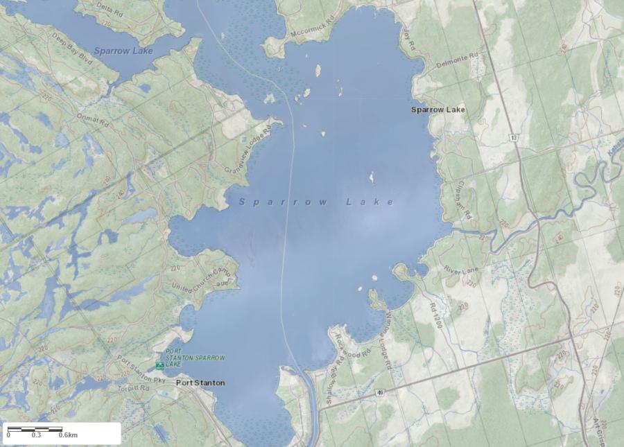
Maps of Sparrow Lake
Topographical Map of Sparrow Lake in Gravenhurst
Legend
 Buildings surrounding Sparrow Lake
 Buildings surrounding Sparrow Lake
 Conservation Area surrounding Sparrow Lake
 Contours of land surrounding Sparrow Lake
 Index Contour
 Rapids
 Spot Height
 Water Falls
 Water Falls/Rapids
 Waterbody Elevation
 Watercourse
 Wetland surrounding Sparrow Lake
 Wooded Area surrounding Sparrow Lake
Zoning Map of Sparrow Lake in Gravenhurst
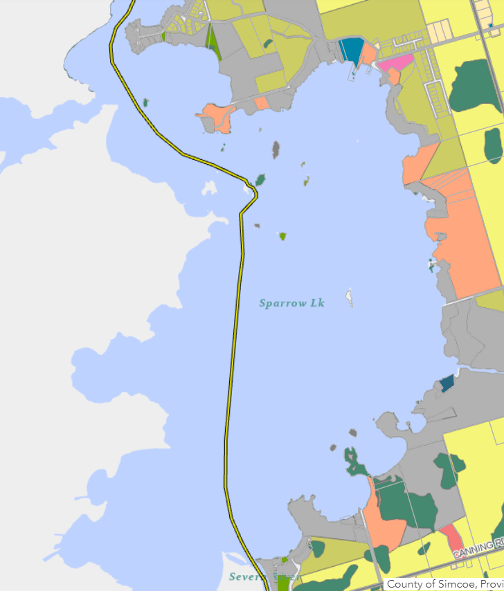
Legend of Gravenhurst Zoning Map - Sparrow Lake
Residential WaterfrontEnvironmentally Protected
Residential 1
Open Space
Rural
Residential Rural
Waterfront Landing
Residential Island
Commercial Recreational
Crown Land Map of Sparrow Lake in Gravenhurst
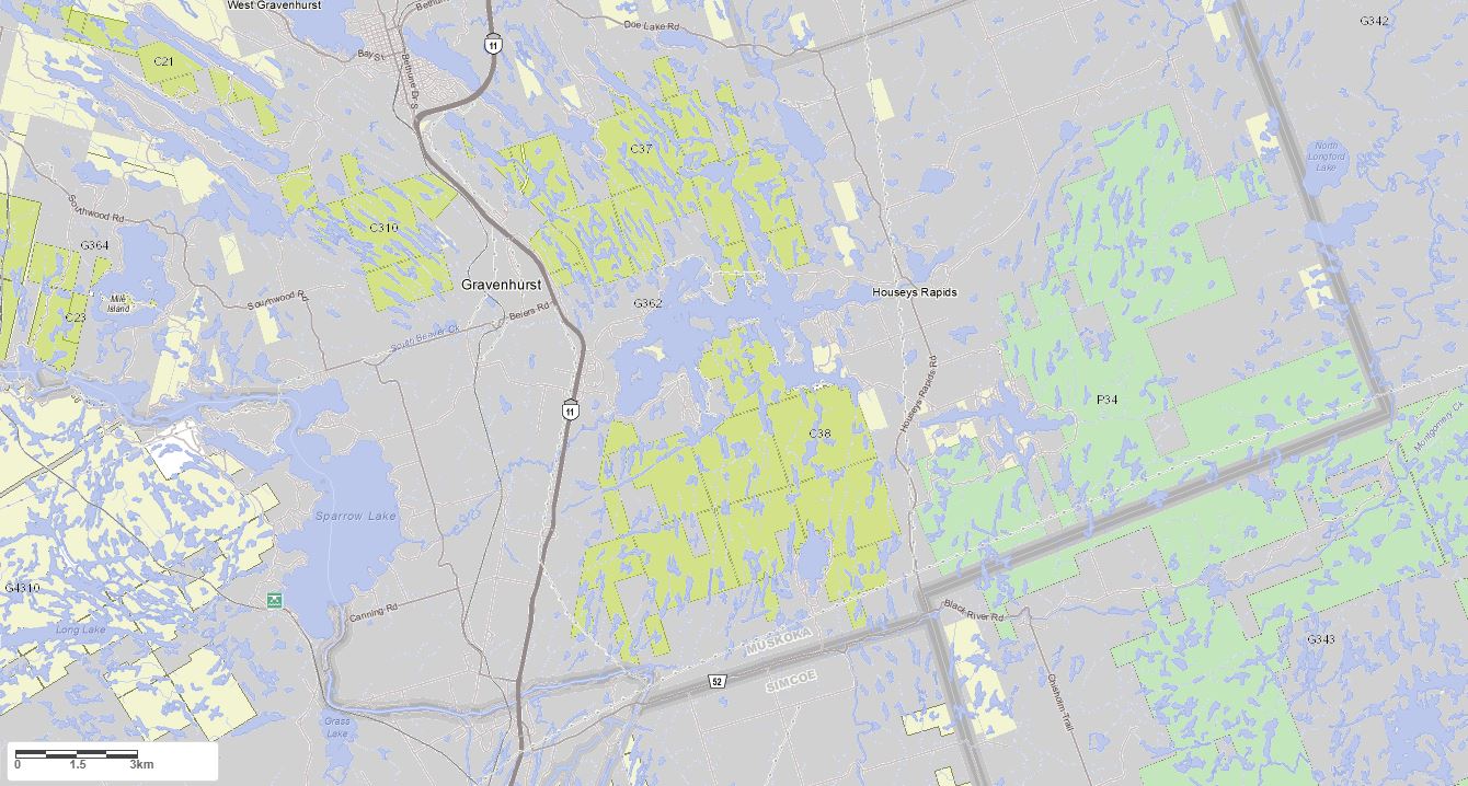
Legend for Crown Land Map
Private Land surrounding Sparrow Lake - (Gravenhurst)Provincial Park surrounding Sparrow Lake - (Gravenhurst)
Crown Land surrounding Sparrow Lake - (Gravenhurst) (General Use)
Conservation Reserve surrounding Sparrow Lake - (Gravenhurst)
Lake Contour Maps showing the depths of Sparrow Lake
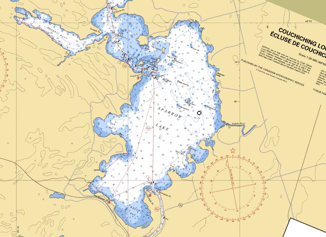
This map is courtesy of Gps Nautical Maps and you can purchase this map as an app from GpsNauticalCharts.com
All measurements of the countour map showing the depths of Sparrow Lake are in feet.
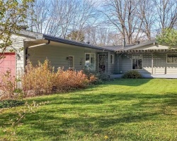
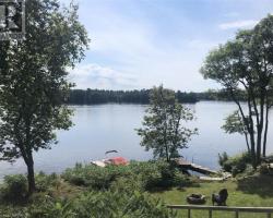
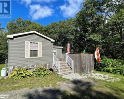
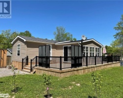
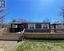
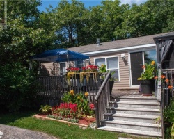
Cottages for Sale on Sparrow Lake
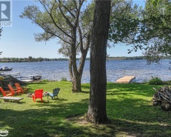
Cottages for Sale close to Sparrow Lake
Lake Videos
This video is courtesy of ecottagefilms.com This video is courtesy of ecottagefilms.com This video is courtesy of ecottagefilms.com This video is courtesy of ecottagefilms.com This video is courtesy of ecottagefilms.com This video is courtesy of ecottagefilms.com This video is courtesy of ecottagefilms.com This video is courtesy of ecottagefilms.com This video is courtesy of ecottagefilms.com Previously listed Cottages on Sparrow Lake
1103 Wiancko Road, Kilworthy, P0E1G0 was previously listed 2024-03-01, mls# 40544806
1025 ROAD 7000, Gravenhurst, P0E1G0 was previously listed 2024-02-14, mls# 40526465
1832 KILWORTHY Road, Gravenhurst, P0E1G0 was previously listed 2023-10-31, mls# 40480462
1063 SHALLOW BAY Road, Gravenhurst, P0E1N0 was previously listed 2023-10-31, mls# 40477018
1677 KILWORTHY Road, Kilworthy, P0E1G0 was previously listed 2023-10-31, mls# 40454158
1139 RIVER Lane, Severn Bridge, P0E1N0 was previously listed 2023-10-31, mls# 40419549
1103 WIANCKO Road, Kilworthy, P0E1G0 was previously listed 2023-10-20, mls# 40483500
1103 WIANCKO Road, Kilworthy, P0E1G0 was previously listed 2023-09-14, mls# 40463818
1434 DEEP BAY Boulevard, Severn, P0E1N0 was previously listed 2023-08-29, mls# 40471858
1099 ROAD 1200 Unit# 2, Gravenhurst, P0E1N0 was previously listed 2022-08-29, mls# 40310210
0 CHANNEL Island, Gravenhurst, P0E1G0 was previously listed 2022-08-26, mls# 40232122
1804 KILWORTHY Road, Gravenhurst, P0E1G0 was previously listed 2022-07-01, mls# 40256215
1099 ROAD 1200 Unit# 3, Gravenhurst, P0E1N0 was previously listed 2022-06-01, mls# 40230027
1711 Delmonte Road, Gravenhurst, P0E1G0 was previously listed 2022-03-31, mls# 40097240
1711 Delmonte Road, Gravenhurst, P0E1G0 was previously listed 2022-03-31, mls# 40096955
1658 Peninsula Point Road, Severn Twp, P0E1N0 was previously listed 2021-12-15, mls# 40174833
3-1099 Road 1200, Gravenhurst, P0E1N0 was previously listed 2021-11-29, mls# 40169098
1021 1100 Road, Gravenhurst, P0E1G0 was previously listed 2021-11-11, mls# 40174624
1176 Grandview Lodge Road, Severn Bridge, P0E1N0 was previously listed 2021-11-04, mls# 40181391
3-1099 Road 1200, Gravenhurst, P0E1N0 was previously listed 2021-09-14, mls# 40140095
1027 Torpitt Road, Severn, P0E1N0 was previously listed 2021-08-28, mls# 40153126
3-1099 Road 1200, Gravenhurst, P0E1N0 was previously listed 2021-07-07, mls# 40121408
1804 Kilworthy Road, Gravenhurst, P0E1G0 was previously listed 2021-06-29, mls# 40126504
1827 Kilworthy Road, Gravenhurst, P0E1G0 was previously listed 2021-06-08, mls# 40110904
1001 Heintzman Gate, Gravenhurst, P0E1G0 was previously listed 2021-06-02, mls# 40115915
1644 Peninsula Point Road, Severn, P0E1G0 was previously listed 2021-06-01, mls# 40116647
1006 Goldfinch Court, Kilworthy, P0E1G0 was previously listed 2021-05-19, mls# 40114429
0 Road 7000 ., Gravenhurst, P0E1G0 was previously listed 2021-01-28, mls# 40052840
1711 Delmonte Road, Gravenhurst, P0E 1G0 was previously listed 2020-12-02, mls# 214198
3840 Sparrow Lake, Washago, P0E1N0 was previously listed 2020-12-01, mls# 30807943
1804 Kilworthy Road, Gravenhurst, P0E1G0 was previously listed 2020-11-09, mls# 40015820
1013 Goldfinch Court, Kilworthy, P0E1G0 was previously listed 2020-10-09, mls# 40028589
1007 Dove Drive, Kilworthy, P0E1G0 was previously listed 2020-09-23, mls# 40022486
1065 Sopher's Landing Road, Kilworthy, P0E1G0 was previously listed 2020-04-04, mls# 251624
Wenona Lodge Road, Gravenhurst, P1P 1R3 was previously listed 2020-01-09, mls# 187703
1003 Valley Drive, Gravenhurst, P0E 1G0 was previously listed 2019-11-02, mls# 214344
1003 Valley Drive, Gravenhurst, P0E 1G0 was previously listed 2019-10-02, mls# 214344
1021 Road 1100 Road, Gravenhurst, P0E 1G0 was previously listed 2019-09-02, mls# 199680
1025 Mccormick Road, Gravenhurst, P0E 1J0 was previously listed 2019-08-06, mls# 201198
Lake Videos
Previously listed Cottages on Sparrow Lake
1103 Wiancko Road, Kilworthy, P0E1G0 was previously listed 2024-03-01, mls# 40544806
1025 ROAD 7000, Gravenhurst, P0E1G0 was previously listed 2024-02-14, mls# 40526465
1832 KILWORTHY Road, Gravenhurst, P0E1G0 was previously listed 2023-10-31, mls# 40480462
1063 SHALLOW BAY Road, Gravenhurst, P0E1N0 was previously listed 2023-10-31, mls# 40477018
1677 KILWORTHY Road, Kilworthy, P0E1G0 was previously listed 2023-10-31, mls# 40454158
1139 RIVER Lane, Severn Bridge, P0E1N0 was previously listed 2023-10-31, mls# 40419549
1103 WIANCKO Road, Kilworthy, P0E1G0 was previously listed 2023-10-20, mls# 40483500
1103 WIANCKO Road, Kilworthy, P0E1G0 was previously listed 2023-09-14, mls# 40463818
1434 DEEP BAY Boulevard, Severn, P0E1N0 was previously listed 2023-08-29, mls# 40471858
1099 ROAD 1200 Unit# 2, Gravenhurst, P0E1N0 was previously listed 2022-08-29, mls# 40310210
0 CHANNEL Island, Gravenhurst, P0E1G0 was previously listed 2022-08-26, mls# 40232122
1804 KILWORTHY Road, Gravenhurst, P0E1G0 was previously listed 2022-07-01, mls# 40256215
1099 ROAD 1200 Unit# 3, Gravenhurst, P0E1N0 was previously listed 2022-06-01, mls# 40230027
1711 Delmonte Road, Gravenhurst, P0E1G0 was previously listed 2022-03-31, mls# 40097240
1711 Delmonte Road, Gravenhurst, P0E1G0 was previously listed 2022-03-31, mls# 40096955
1658 Peninsula Point Road, Severn Twp, P0E1N0 was previously listed 2021-12-15, mls# 40174833
3-1099 Road 1200, Gravenhurst, P0E1N0 was previously listed 2021-11-29, mls# 40169098
1021 1100 Road, Gravenhurst, P0E1G0 was previously listed 2021-11-11, mls# 40174624
1176 Grandview Lodge Road, Severn Bridge, P0E1N0 was previously listed 2021-11-04, mls# 40181391
3-1099 Road 1200, Gravenhurst, P0E1N0 was previously listed 2021-09-14, mls# 40140095
1027 Torpitt Road, Severn, P0E1N0 was previously listed 2021-08-28, mls# 40153126
3-1099 Road 1200, Gravenhurst, P0E1N0 was previously listed 2021-07-07, mls# 40121408
1804 Kilworthy Road, Gravenhurst, P0E1G0 was previously listed 2021-06-29, mls# 40126504
1827 Kilworthy Road, Gravenhurst, P0E1G0 was previously listed 2021-06-08, mls# 40110904
1001 Heintzman Gate, Gravenhurst, P0E1G0 was previously listed 2021-06-02, mls# 40115915
1644 Peninsula Point Road, Severn, P0E1G0 was previously listed 2021-06-01, mls# 40116647
1006 Goldfinch Court, Kilworthy, P0E1G0 was previously listed 2021-05-19, mls# 40114429
0 Road 7000 ., Gravenhurst, P0E1G0 was previously listed 2021-01-28, mls# 40052840
1711 Delmonte Road, Gravenhurst, P0E 1G0 was previously listed 2020-12-02, mls# 214198
3840 Sparrow Lake, Washago, P0E1N0 was previously listed 2020-12-01, mls# 30807943
1804 Kilworthy Road, Gravenhurst, P0E1G0 was previously listed 2020-11-09, mls# 40015820
1013 Goldfinch Court, Kilworthy, P0E1G0 was previously listed 2020-10-09, mls# 40028589
1007 Dove Drive, Kilworthy, P0E1G0 was previously listed 2020-09-23, mls# 40022486
1065 Sopher's Landing Road, Kilworthy, P0E1G0 was previously listed 2020-04-04, mls# 251624
Wenona Lodge Road, Gravenhurst, P1P 1R3 was previously listed 2020-01-09, mls# 187703
1003 Valley Drive, Gravenhurst, P0E 1G0 was previously listed 2019-11-02, mls# 214344
1003 Valley Drive, Gravenhurst, P0E 1G0 was previously listed 2019-10-02, mls# 214344
1021 Road 1100 Road, Gravenhurst, P0E 1G0 was previously listed 2019-09-02, mls# 199680
1025 Mccormick Road, Gravenhurst, P0E 1J0 was previously listed 2019-08-06, mls# 201198