Wood Lake - (Bracebridge)
Wood Lake is located approximately 20 km east of of Bracebridge, north of Hwy 118 E. Wood Lake is situated downstream in its watershed with upstream lakes such as Bird, Bigwind, East and West Buck all flowing through it and into the South Branch of the Muskoka River.
Average traveling time from the GTA to Wood Lake - (Bracebridge) is 2 hours 0 mins
This Lake Median Lake Average Lake | |
Wood Lake is 385 hectares (951 Acres) in size The median size lake in our area is 71 hectares or 175 Acres (average size 398 hectares) | 385 71 398 |
|
Wood Lake has a maximum depth 14 meters (46 ft)
The median depth of lakes in our area is 13.5 m or 44 ft (average depth 18 m) | 14 13.5 18 |
| The median depth of Wood Lake is 5.00 m (16 ft) | 5.00 5.2 7 |
|
Wood Lake Perimeter 13.70 km (8.51 Miles)
The median perimiter of lakes in our area is 3.3 km or 2.05 miles (average Perimiter 3.61 km) | 13.70 3.3 4 |
| Wood Lake Island/s Perimeter 5.80 km (3.6 Miles) | |
|
Wood Lake Altitude 301 m (988 ft)
The median altitude of lakes in our area is 290 m or 951 ft (average Altitude is 289 m) | 301 290 289 |
|
Water Clarity of Wood Lake (median 3.2 m) 3.80 m (12ft)
The median Secchi Depth of lakes in our area is 3.2 m or 10 ft (average Secchi Depth is 3 m) | 3.80 3.2 3 |
| 9 % of Wood Lake shorline is wetland. The median percentage of shoreline which is wetland of lakes in our area is 9 % (average Percentage of shoreline which is wetland 10) % |
Percentage of Shoreline which is wetland 9 9 10 |
|
Wood Lake's phosphorus content in water is 7.20 ug/L
The median Phosphorus content in the water of lakes in our area is 8 ug/l (average Phosphorus content 9 ug/L | 7.20 8 9 |
| Wood Lake's watershed area feeding the Lake (excluding lake) 30.0 km2 (7413 acres) | |
| Lake Trout found in Wood Lake: No | |
| Drainage Basin of Wood Lake South Muskoka River | |
| Wood Lake is in the Township of Oakley | |
| Shoreline Development on Wood Lake is: high; shoreline residential | |
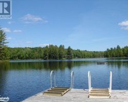
| Public Access to Wood Lake public; boat launch located off Wood L Road 2 Boat Launch | |
| Water Level Management regulated; water level is controlled by MNR-owned and operated dam.Flows and levels are governed by the Muskoka River Water Management Plan. | |
| Major Fish Species in Wood Lake (I 1950’s), (I 1909), (I 1937?c) | |
| Other Fish Species in Wood Lake , , cisco (E), , , (I 1989),golden shiner, bluntnose minnow, northern redbelly dace | |
| Other Species in Wood Lake spiny water flea (I 1995) | |
| Notes: E: extirpated, I: introduced – intentional or accidental, O: occasional, R: remnant, S: currently stocked, ?: status uncertain, 2009: year of first record or introduction if known, blank: presumed native | |
| Much of the above data for Wood Lake is compliments of the Muskoka Water Web maintained by The District Municipality of Muskoka | |
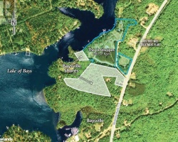
Maps of Wood Lake
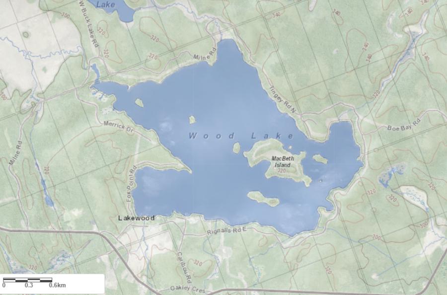
Topographical Map of Wood Lake in Bracebridge
Legend
 Buildings surrounding Wood Lake
 Buildings surrounding Wood Lake
 Conservation Area surrounding Wood Lake
 Contours of land surrounding Wood Lake
 Index Contour
 Rapids
 Spot Height
 Water Falls
 Water Falls/Rapids
 Waterbody Elevation
 Watercourse
 Wetland surrounding Wood Lake
 Wooded Area surrounding Wood Lake
Zoning Map of Wood Lake in Bracebridge

Legend of Bracebridge Zoning Map - Wood Lake
SR1 - Shoreline Residential 1EP1 - Environmentally Protected 1
RU - Rural
RR - Rural Residential
OP1 - Open Space 1
OP2 - Open Space 2
OP3 - Open Space 3
R1 - Residential
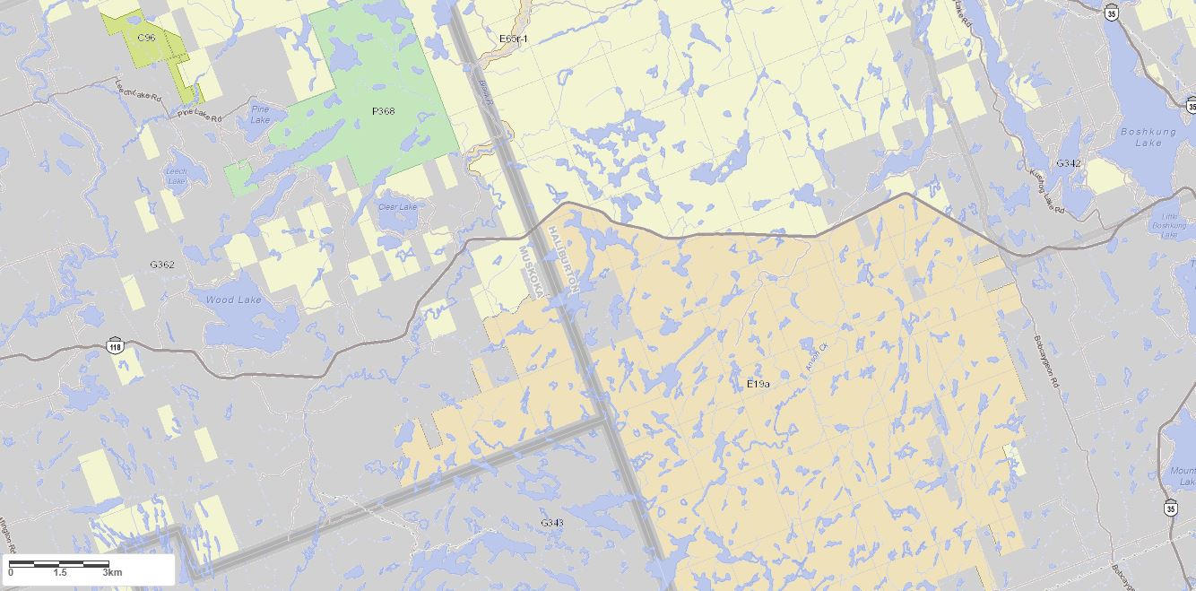
Crown Land Map of Wood Lake in Bracebridge
Legend for Crown Land Map
Private Land surrounding Wood Lake - (Bracebridge)Provincial Park surrounding Wood Lake - (Bracebridge)
Crown Land surrounding Wood Lake - (Bracebridge) (General Use)
Conservation Reserve surrounding Wood Lake - (Bracebridge)
Lake Contour Maps showing the depths of Wood Lake
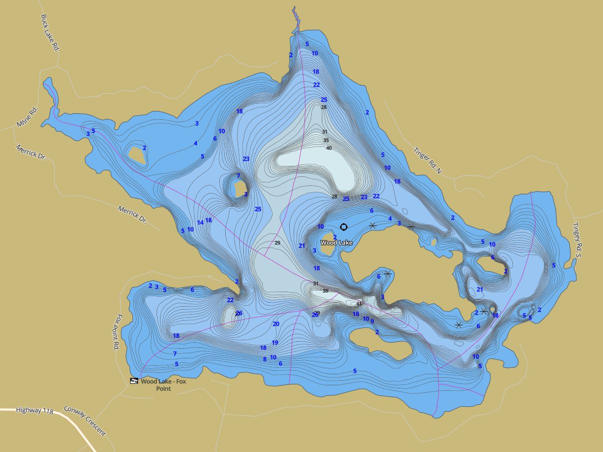
This map is courtesy of Gps Nautical Maps and you can purchase this map as an app from GpsNauticalCharts.com
All measurements of the countour map showing the depths of Wood Lake are in feet.
Snowmobile Trails Surrounding Wood Lake
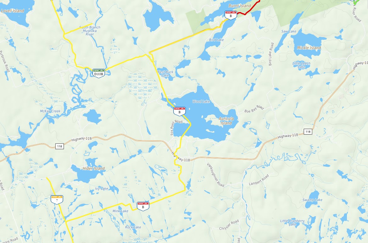
This map is courtesy of Ontario Federation of Snowmobile Club Interactive Trail Map
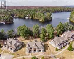
Islands on Wood Lake in Bracebridge, Muskoka
| Official Name | Macbeth Island |
|---|---|
| Perimeter of Macbeth Island | 2.92 km (1.81 miles) |
| Area of Macbeth Island | 25.58 Hectares (63.21 Acres) |
| Properties on Macbeth Island | 59 |
| View on interactive Map | Locate Macbeth Island on Bing Maps |
| Official Name | Auricula Island |
|---|---|
| Perimeter of Auricula Island | 0.52 km (0.32 miles) |
| Area of Auricula Island | 1.43 Hectares (3.53 Acres) |
| Properties on Auricula Island | 1 |
| View on interactive Map | Locate Auricula Island on Bing Maps |
| Official Name | Oak Island |
|---|---|
| Perimeter of Oak Island | 0.40 km (0.25 miles) |
| Area of Oak Island | 1.03 Hectares (2.55 Acres) |
| Properties on Oak Island | 1 |
| View on interactive Map | Locate Oak Island on Bing Maps |
| Official Name | Stuart Island |
|---|---|
| Perimeter of Stuart Island | 1.00 km (0.62 miles) |
| Area of Stuart Island | 4.08 Hectares (10.08 Acres) |
| Properties on Stuart Island | 2 |
| View on interactive Map | Locate Stuart Island on Bing Maps |
| Official Name | Evergreen Island |
|---|---|
| Perimeter of Evergreen Island | 0.32 km (0.2 miles) |
| Area of Evergreen Island | 0.66 Hectares (1.63 Acres) |
| Properties on Evergreen Island | 1 |
| View on interactive Map | Locate Evergreen Island on Bing Maps |
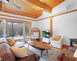
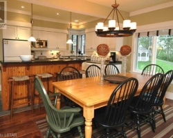
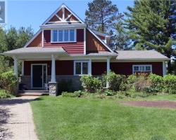
Cottages for Sale on Wood Lake - (Bracebridge)
Sorry no cottages for sale at the moment on Wood Lake (Bracebridge)
Cottages for Sale close to Wood Lake
Lake Videos
This video is courtesy of ecottagefilms.com This video is courtesy of ecottagefilms.com This video is courtesy of ecottagefilms.com This video is courtesy of ecottagefilms.com This video is courtesy of ecottagefilms.com This video is courtesy of ecottagefilms.com This video is courtesy of ecottagefilms.com This video is courtesy of ecottagefilms.com This video is courtesy of ecottagefilms.com This video is courtesy of ecottagefilms.com This video is courtesy of ecottagefilms.com Previously listed Cottages on Wood Lake
1187 RIGNALLS Road E, Bracebridge, P1L1X1 was previously listed 2023-09-16, mls# 40387132
236 MACBETH Island, Bracebridge, P1L1X1 was previously listed 2023-08-19, mls# 40432240
1041 RIGNALLS Road, Bracebridge, P1L1X1 was previously listed 2023-03-13, mls# 40371317
1000 TINGEY Road S, Bracebridge, P1L1X1 was previously listed 2022-11-12, mls# 40285515
244 MACBETH Island, Bracebridge, P1L1X1 was previously listed 2022-08-26, mls# 40297927
1259 RIGNALLS Road E, Bracebridge, P1L1X1 was previously listed 2022-08-13, mls# 40297343
1114 RIGNALLS Road W, Bracebridge, P1L1X1 was previously listed 2022-08-13, mls# 40298278
1181 TINGEY Road N, Bracebridge, P1L1X1 was previously listed 2022-07-01, mls# 40253909
1452 MILNE Road, Bracebridge, P1L1X1 was previously listed 2022-06-01, mls# 40246500
1263 Rignalls Road E, Bracebridge, P1L1X1 was previously listed 2021-08-28, mls# 40157925
8 Macbeth Island, Bracebridge, P1L1X1 was previously listed 2021-08-23, mls# 40156342
140 Macbeth Island, Bracebridge, P1L1X1 was previously listed 2021-08-18, mls# 40150831
1132 Fox Point Road, Bracebridge, P1L1X1 was previously listed 2021-08-12, mls# 40149157
102 Macbeth Island, Bracebridge, P1L1A1 was previously listed 2021-07-30, mls# 40142696
1000 Auricula Island, Bracebridge, P1L1X1 was previously listed 2021-07-30, mls# 40136951
1140 Fox Point Road, Bracebridge, P1L1X3 was previously listed 2021-04-08, mls# 40089378
1105 Rignalls Road E, Bracebridge, P1L1X1 was previously listed 2021-03-25, mls# 40082080
1300 Milne Road, Bracebridge, P1L1X1 was previously listed 2020-11-24, mls# 40024515
1296 Milne Road, Bracebridge, P1L1X1 was previously listed 2020-10-17, mls# 40023059
1140 Fox Point Road, Bracebridge, P1L 1X3 was previously listed 2019-12-27, mls# 213931
284 Macbeth Island, Bracebridge, P1L 1X1 was previously listed 2019-11-02, mls# 220093
1102 Fox Point Road, Bracebridge, P1L 1X1 was previously listed 2019-10-20, mls# 226405
1242 Rignalls Road E #lot C, Bracebridge, P1L 1X1 was previously listed 2019-10-08, mls# 208662
308 & 312 Macbeth Island, Bracebridge, P1L 1X1 was previously listed 2019-09-28, mls# 179709
Lot 44 Macbeth Island, Bracebridge, P1L 1X1 was previously listed 2019-09-26, mls# 223176
45 Macbeth Island, Bracebridge, P1L 1X1 was previously listed 2019-09-26, mls# 223178
1144 Fox Point Road, Bracebridge, P1L 1X1 was previously listed 2019-09-16, mls# 220017
284 Macbeth Island, Bracebridge, P1L 1X1 was previously listed 2019-09-06, mls# 193868
1144 Fox Point Road, Bracebridge, P1L 1X1 was previously listed 2019-08-06, mls# 180175
232 Macbeth Island, Bracebridge, P1L 1X1 was previously listed 2019-08-06, mls# 204558
236 Macbeth Island, Bracebridge, P1L 1X1 was previously listed 2019-08-06, mls# 201067
1296 Milne Road, Bracebridge, P1L 1X1 was previously listed 2019-08-06, mls# 181146
Lake Videos
Previously listed Cottages on Wood Lake
1187 RIGNALLS Road E, Bracebridge, P1L1X1 was previously listed 2023-09-16, mls# 40387132
236 MACBETH Island, Bracebridge, P1L1X1 was previously listed 2023-08-19, mls# 40432240
1041 RIGNALLS Road, Bracebridge, P1L1X1 was previously listed 2023-03-13, mls# 40371317
1000 TINGEY Road S, Bracebridge, P1L1X1 was previously listed 2022-11-12, mls# 40285515
244 MACBETH Island, Bracebridge, P1L1X1 was previously listed 2022-08-26, mls# 40297927
1259 RIGNALLS Road E, Bracebridge, P1L1X1 was previously listed 2022-08-13, mls# 40297343
1114 RIGNALLS Road W, Bracebridge, P1L1X1 was previously listed 2022-08-13, mls# 40298278
1181 TINGEY Road N, Bracebridge, P1L1X1 was previously listed 2022-07-01, mls# 40253909
1452 MILNE Road, Bracebridge, P1L1X1 was previously listed 2022-06-01, mls# 40246500
1263 Rignalls Road E, Bracebridge, P1L1X1 was previously listed 2021-08-28, mls# 40157925
8 Macbeth Island, Bracebridge, P1L1X1 was previously listed 2021-08-23, mls# 40156342
140 Macbeth Island, Bracebridge, P1L1X1 was previously listed 2021-08-18, mls# 40150831
1132 Fox Point Road, Bracebridge, P1L1X1 was previously listed 2021-08-12, mls# 40149157
102 Macbeth Island, Bracebridge, P1L1A1 was previously listed 2021-07-30, mls# 40142696
1000 Auricula Island, Bracebridge, P1L1X1 was previously listed 2021-07-30, mls# 40136951
1140 Fox Point Road, Bracebridge, P1L1X3 was previously listed 2021-04-08, mls# 40089378
1105 Rignalls Road E, Bracebridge, P1L1X1 was previously listed 2021-03-25, mls# 40082080
1300 Milne Road, Bracebridge, P1L1X1 was previously listed 2020-11-24, mls# 40024515
1296 Milne Road, Bracebridge, P1L1X1 was previously listed 2020-10-17, mls# 40023059
1140 Fox Point Road, Bracebridge, P1L 1X3 was previously listed 2019-12-27, mls# 213931
284 Macbeth Island, Bracebridge, P1L 1X1 was previously listed 2019-11-02, mls# 220093
1102 Fox Point Road, Bracebridge, P1L 1X1 was previously listed 2019-10-20, mls# 226405
1242 Rignalls Road E #lot C, Bracebridge, P1L 1X1 was previously listed 2019-10-08, mls# 208662
308 & 312 Macbeth Island, Bracebridge, P1L 1X1 was previously listed 2019-09-28, mls# 179709
Lot 44 Macbeth Island, Bracebridge, P1L 1X1 was previously listed 2019-09-26, mls# 223176
45 Macbeth Island, Bracebridge, P1L 1X1 was previously listed 2019-09-26, mls# 223178
1144 Fox Point Road, Bracebridge, P1L 1X1 was previously listed 2019-09-16, mls# 220017
284 Macbeth Island, Bracebridge, P1L 1X1 was previously listed 2019-09-06, mls# 193868
1144 Fox Point Road, Bracebridge, P1L 1X1 was previously listed 2019-08-06, mls# 180175
232 Macbeth Island, Bracebridge, P1L 1X1 was previously listed 2019-08-06, mls# 204558
236 Macbeth Island, Bracebridge, P1L 1X1 was previously listed 2019-08-06, mls# 201067
1296 Milne Road, Bracebridge, P1L 1X1 was previously listed 2019-08-06, mls# 181146