Ril Lake - (Lake of Bays)
Ril Lake is located in the Township of Lake of Bays, in the District of Muskoka.
The perimeter of the lake is approximately 18.5 km with an average depth of 10 m. The lake is primarily spring fed and supplemented by creeks and seasonal run-off. Ril Lake is located in the Precambrian Shield area of northern Ontario, consisting of underlying granite bedrock overlayed with 1.5 to 6 m of soil, often with rocky granite outcroppings. The north-eastern area of the lake is more developed with lots ranging from 15 to 30 m of waterfront and developed shoreline. The south-western area of the lake is less developed with lots ranging from 120 to 915 m.
Local forest is a mix of deciduous and conifer trees. Local wildlife includes; turtles, deer, moose, beaver, bear, fox, otter, racoon, turkey, and porcupine. A wide range of bird species are known to frequent the lake including; loon, heron, owls, ducks, raven, and woodpeckers. The fish population is made up of mostly small and large-mouth bass.
Average traveling time from the GTA to Ril Lake - (Lake of Bays) is 2 hours 15 mins
This Lake Median Lake Average Lake | |
Ril Lake is 144 hectares (356 Acres) in size The median size lake in our area is 71 hectares or 175 Acres (average size 398 hectares) | 144 71 398 |
|
Ril Lake has a maximum depth 9 meters (30 ft)
The median depth of lakes in our area is 13.5 m or 44 ft (average depth 18 m) | 9 13.5 18 |
| The median depth of Ril Lake is 3.40 m (11 ft) | 3.40 5.2 7 |
|
Ril Lake Perimeter 12.00 km (7.46 Miles)
The median perimiter of lakes in our area is 3.3 km or 2.05 miles (average Perimiter 3.61 km) | 12.00 3.3 4 |
| Ril Lake Island/s Perimeter 0.40 km (0.25 Miles) | |
|
Ril Lake Altitude 366 m (1201 ft)
The median altitude of lakes in our area is 290 m or 951 ft (average Altitude is 289 m) | 366 290 289 |
|
Water Clarity of Ril Lake (median 3.2 m) 2.90 m (10ft)
The median Secchi Depth of lakes in our area is 3.2 m or 10 ft (average Secchi Depth is 3 m) | 2.90 3.2 3 |
| 9 % of Ril Lake shorline is wetland. The median percentage of shoreline which is wetland of lakes in our area is 9 % (average Percentage of shoreline which is wetland 10) % |
Percentage of Shoreline which is wetland 9 9 10 |
|
Ril Lake's phosphorus content in water is 7.00 ug/L
The median Phosphorus content in the water of lakes in our area is 8 ug/l (average Phosphorus content 9 ug/L | 7.00 8 9 |
| Ril Lake's watershed area feeding the Lake (excluding lake) 17.0 km2 (4201 acres) | |
| Lake Trout found in Ril Lake: No | |
| Drainage Basin of Ril Lake South Muskoka River | |
| Ril Lake is in the Township of Ridout | |
| Shoreline Development on Ril Lake is: Intense; shoreline residential | |
| Public Access to Ril Lake Public; North Ril Lake Road Boat Launch | |
| Water Level Management Not regulated | |
| Major Fish Species in Ril Lake (I), (I), (I), (R), | |
| Other Fish Species in Ril Lake , bluntnose minnow | |
| Notes: E: extirpated, I: introduced – intentional or accidental, O: occasional, R: remnant, S: currently stocked, ?: status uncertain, 2009: year of first record or introduction if known, blank: presumed native | |
| Much of the above data for Ril Lake is compliments of the Muskoka Water Web maintained by The District Municipality of Muskoka | |
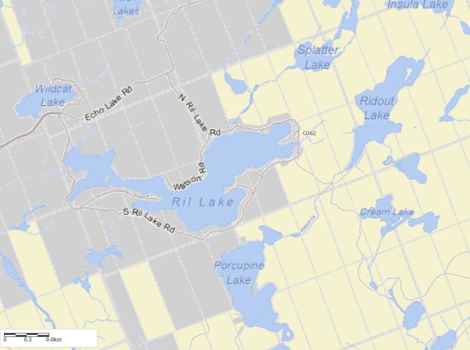
Maps of Ril Lake
Topographical Map of Ril Lake in Lake of Bays

Legend
 Buildings surrounding Ril Lake
 Buildings surrounding Ril Lake
 Conservation Area surrounding Ril Lake
 Contours of land surrounding Ril Lake
 Index Contour
 Rapids
 Spot Height
 Water Falls
 Water Falls/Rapids
 Waterbody Elevation
 Watercourse
 Wetland surrounding Ril Lake
 Wooded Area surrounding Ril Lake
Zoning Map of Ril Lake in Lake of Bays
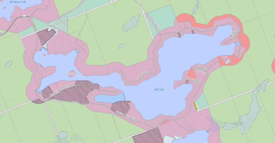
Legend of Lake of Bays Zoning Map - Ril Lake
WR - Waterfront Residential 1RU - Rural
OS - Open Space
CSR - Community Settlement Residential
RL - Rural Limited
WOS - Waterfront Open Space
RR - Rural Residential
Crown Land Map of Ril Lake in Lake of Bays
Legend for Crown Land Map
Private Land surrounding Ril Lake - (Lake of Bays)Provincial Park surrounding Ril Lake - (Lake of Bays)
Crown Land surrounding Ril Lake - (Lake of Bays) (General Use)
Conservation Reserve surrounding Ril Lake - (Lake of Bays)
Lake Contour Maps showing the depths of Ril Lake
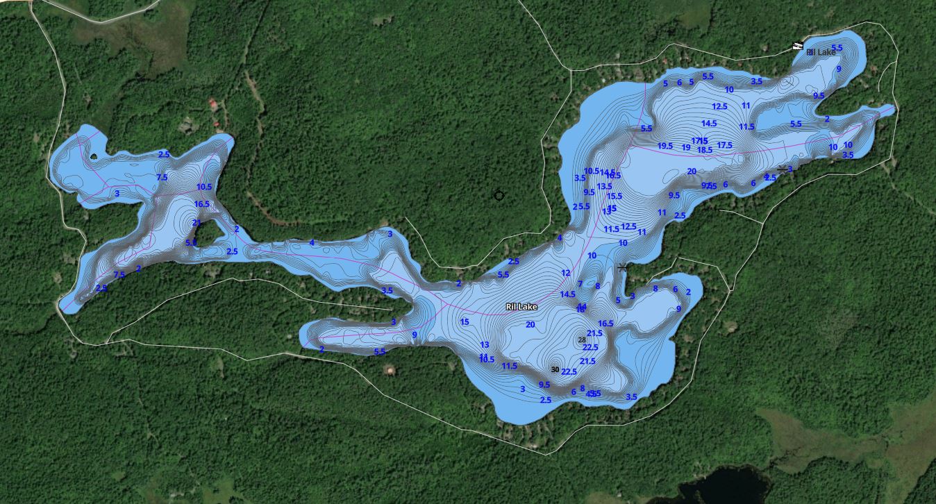
This map is courtesy of Gps Nautical Maps and you can purchase this map as an app from GpsNauticalCharts.com
All measurements of the countour map showing the depths of Ril Lake are in feet.
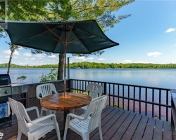
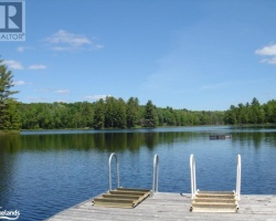
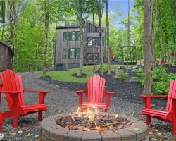
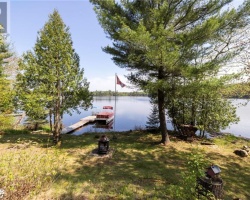
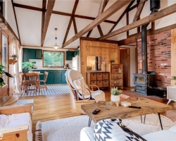
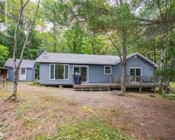
Cottages for Sale on Ril Lake
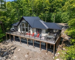
Cottages for Sale close to Ril Lake
Previously listed Cottages on Ril Lake
1351 South Ril Lake Road, Baysville, P0B1A0 was previously listed 2024-04-18, mls# 40572724
1351 S RIL LAKE Road, Baysville, P0B1A0 was previously listed 2023-10-31, mls# 40473512
1053 WATSON Road, Baysville, P0B1A0 was previously listed 2023-10-01, mls# 40420309
1397 S RIL LAKE Road, Baysville, P0B1A0 was previously listed 2023-05-31, mls# 40408542
1033 WATSON Road, Baysville, P0B1A0 was previously listed 2023-04-18, mls# 40387164
1023 SOUTH RIL LAKE Road, Baysville, P0B1A0 was previously listed 2023-03-22, mls# 40375429
1053 WATSON Road, Baysville, P0B1A0 was previously listed 2022-10-31, mls# 40259095
1055 WATSON Road, Baysville, P0B1A0 was previously listed 2022-10-31, mls# 40259100
1123 WATSON RD Road, Baysville, P0B1A0 was previously listed 2022-08-01, mls# 40294506
1005 MCARTHUR POINT Road, Baysville, P0B1A0 was previously listed 2022-08-01, mls# 40269942
1018 JAMES POINT Road, Baysville, P0A1A0 was previously listed 2022-07-27, mls# 40259582
1087 Watson Road, Baysville, P0B1M0 was previously listed 2021-10-07, mls# 40168417
1013 Ril Cove Road, Baysville, P0B1A0 was previously listed 2021-04-13, mls# 40091475
1004 James Point Road, Baysville, P0B1A0 was previously listed 2021-04-09, mls# 40081307
1315 Ril Lake Road S, Baysville, P0B1A0 was previously listed 2021-03-17, mls# 40073000
0 South Ril Lake Road, Baysville, P0B1A0 was previously listed 2021-03-12, mls# 40074953
N/a South Ril Lake Road, Baysville, P0B1A0 was previously listed 2021-02-26, mls# 40065262
1012 James Point Road, Lake Of Bays, P0A 1H0 was previously listed 2020-03-11, mls# 214025
1012 James Point Road, Lake Of Bays, P0A 1H0 was previously listed 2020-03-11, mls# 213328
South Ril Lake Road, Baysville, P0B 1A0 was previously listed 2019-11-02, mls# 181315
1079 Watson Road, Baysville, P0B 1A0 was previously listed 2019-09-30, mls# 209173
1415 Ril Lake Road S, Baysville, P0B 1A0 was previously listed 2019-08-20, mls# 210309