Clear Lake - (Bracebridge)
There another 4 Clear Lake's : Clear Lake in Wood of Muskoka Lakes Clear Lake in Burton of Whitestone Clear Lake in Humphrey of Seguin Clear Lake in Perry of Perry
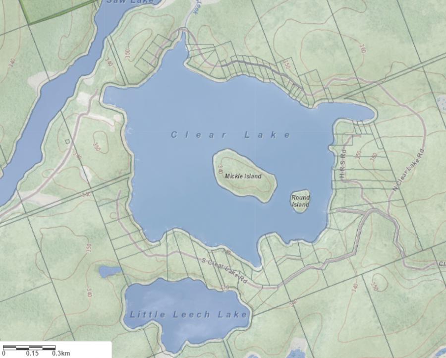
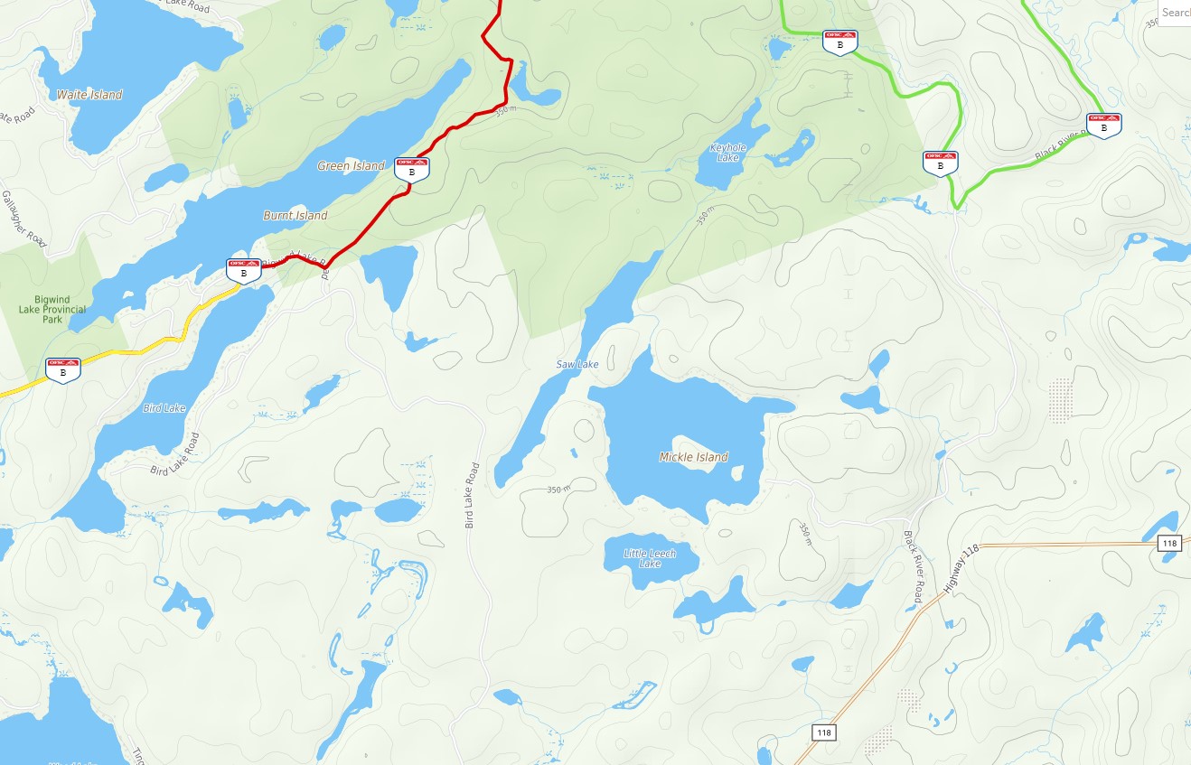
Clear Lake is situated in the geographic township of Oakley in the extreme eastern portion of the Town of Bracebridge. The lake can be accessed via Hwy 118 East to Black River Road and north to Clear Lake Road. Clear Lake flows into the Black River by way of Saw and Keyhole Lakes.
Average traveling time from the GTA to Clear Lake - (Bracebridge) is 2 hours 10 mins
This Lake Median Lake Average Lake | |
Clear Lake is 100 hectares (247 Acres) in size The median size lake in our area is 71 hectares or 175 Acres (average size 398 hectares) | 100 71 398 |
|
Clear Lake has a maximum depth 25 meters (82 ft)
The median depth of lakes in our area is 13.5 m or 44 ft (average depth 18 m) | 25 13.5 18 |
| The median depth of Clear Lake is 9.30 m (31 ft) | 9.30 5.2 7 |
|
Clear Lake Perimeter 5.40 km (3.36 Miles)
The median perimiter of lakes in our area is 3.3 km or 2.05 miles (average Perimiter 3.61 km) | 5.40 3.3 4 |
| Clear Lake Island/s Perimeter 1.50 km (0.93 Miles) | |
|
Clear Lake Altitude 331 m (1086 ft)
The median altitude of lakes in our area is 290 m or 951 ft (average Altitude is 289 m) | 331 290 289 |
|
Water Clarity of Clear Lake (median 3.2 m) 6.40 m (21ft)
The median Secchi Depth of lakes in our area is 3.2 m or 10 ft (average Secchi Depth is 3 m) | 6.40 3.2 3 |
| 2 % of Clear Lake shorline is wetland. The median percentage of shoreline which is wetland of lakes in our area is 9 % (average Percentage of shoreline which is wetland 10) % |
Percentage of Shoreline which is wetland 2 9 10 |
|
Clear Lake's phosphorus content in water is 5.50 ug/L
The median Phosphorus content in the water of lakes in our area is 8 ug/l (average Phosphorus content 9 ug/L | 5.50 8 9 |
| Clear Lake's watershed area feeding the Lake (excluding lake) 1.8 km2 (445 acres) | |
| Lake Trout found in Clear Lake: Yes | |
| Drainage Basin of Clear Lake Upper Black River | |
| Clear Lake is in the Township of Oakley | |
| Shoreline Development on Clear Lake is: moderate; shoreline residential | |
| Public Access to Clear Lake public; boat launch on the south east shore of lake; exit Hwy 118 on to Black River Road Boat Launch | |
| Water Level Management not regulated | |
| Major Fish Species in Clear Lake , round whitefish, (I), (I), | |
| Other Fish Species in Clear Lake , lake chub, , | |
| Other Species in Clear Lake spiny water flea (I 2010) | |
| Number of Cottages on Lake 55 | |
| Notes: E: extirpated, I: introduced – intentional or accidental, O: occasional, R: remnant, S: currently stocked, ?: status uncertain, 2009: year of first record or introduction if known, blank: presumed native | |
| Much of the above data for Clear Lake is compliments of the Muskoka Water Web maintained by The District Municipality of Muskoka | |
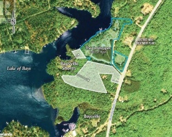
Maps of Clear Lake
Topographical Map of Clear Lake in Bracebridge
Legend
 Buildings surrounding Clear Lake
 Buildings surrounding Clear Lake
 Conservation Area surrounding Clear Lake
 Contours of land surrounding Clear Lake
 Index Contour
 Rapids
 Spot Height
 Water Falls
 Water Falls/Rapids
 Waterbody Elevation
 Watercourse
 Wetland surrounding Clear Lake
 Wooded Area surrounding Clear Lake
Zoning Map of Clear Lake in Bracebridge
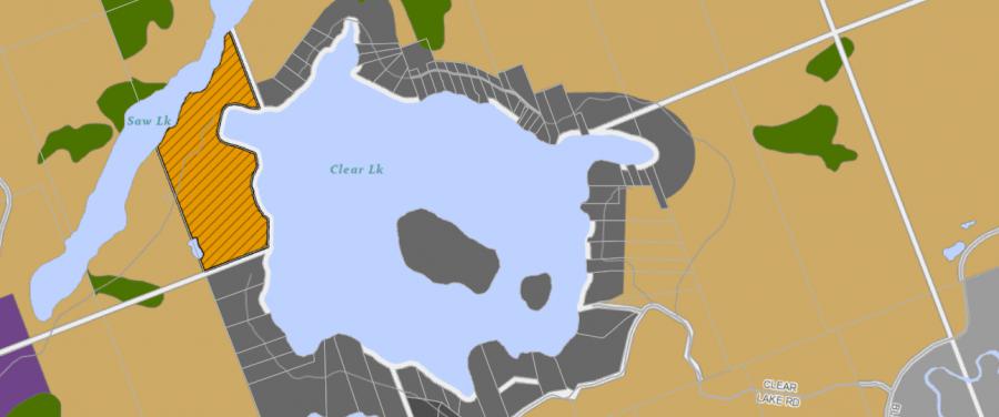
Legend of Bracebridge Zoning Map - Clear Lake
SR1 - Shoreline Residential 1EP1 - Environmentally Protected 1
RU - Rural
RR - Rural Residential
OP1 - Open Space 1
OP2 - Open Space 2
OP3 - Open Space 3
R1 - Residential
Crown Land Map of Clear Lake in Bracebridge
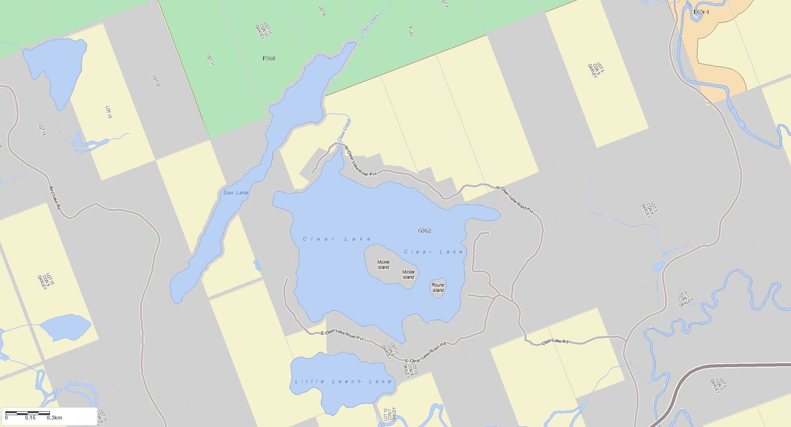
Legend for Crown Land Map
Private Land surrounding Clear Lake - (Bracebridge)Provincial Park surrounding Clear Lake - (Bracebridge)
Crown Land surrounding Clear Lake - (Bracebridge) (General Use)
Conservation Reserve surrounding Clear Lake - (Bracebridge)
Lake Contour Maps showing the depths of Clear Lake
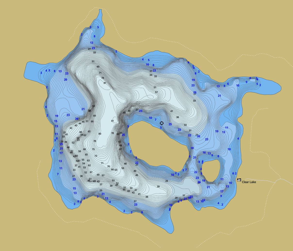
This map is courtesy of Gps Nautical Maps and you can purchase this map as an app from GpsNauticalCharts.com
All measurements of the countour map showing the depths of Clear Lake are in feet.
Snowmobile Trails Surrounding Clear Lake
This map is courtesy of Ontario Federation of Snowmobile Club Interactive Trail Map
Islands on Clear Lake in Bracebridge, Muskoka
| Official Name | Mickle Island |
|---|---|
| Perimeter of Mickle Island | 1.21 km (0.75 miles) |
| Area of Mickle Island | 6.81 Hectares (16.83 Acres) |
| Properties on Mickle Island | 1 |
| View on interactive Map | Locate Mickle Island on Bing Maps |
| Official Name | Round Island |
|---|---|
| Perimeter of Round Island | 0.43 km (0.27 miles) |
| Area of Round Island | 1.07 Hectares (2.64 Acres) |
| Properties on Round Island | 1 |
| View on interactive Map | Locate Round Island on Bing Maps |
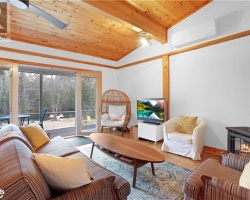
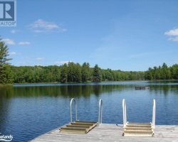
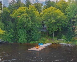
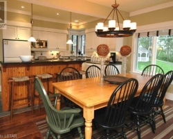
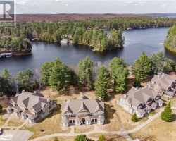
Cottages for Sale on Clear Lake
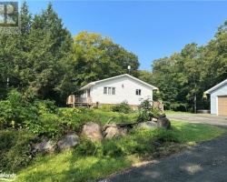
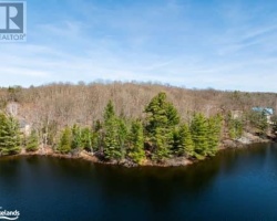
Cottages for Sale close to Clear Lake
Previously listed Cottages on Clear Lake
21 Wee Ge Wa Road, Seguin, P2A0B2 was previously listed 2024-01-03, mls# 40525406
21 WEE GE WA Road, Seguin, P2A0B2 was previously listed 2023-10-31, mls# 40475634
24 ZWAAWASHKWAA MIIKAN, Seguin, P2A0B2 was previously listed 2023-10-31, mls# 40475636
192 10TH Concession, Seguin, P2A2W8 was previously listed 2023-10-31, mls# 40469746
44 Beechwood Drive, Seguin, P2A2W8 was previously listed 2023-10-05, mls# 40495023
21 WEE GE WA Road, Seguin, P2A0B2 was previously listed 2023-09-01, mls# 40429888
1036 HILL Road, Torrance, P0C1M0 was previously listed 2023-08-24, mls# 40457585
1193 NORTH CLEAR LAKE Road, Bracebridge, P1L1X1 was previously listed 2023-08-12, mls# 40463243
1193 NORTH CLEAR LAKE Road, Bracebridge, P1L1X1 was previously listed 2023-08-03, mls# 40422298
LOT 19 CLEAR LAKE Estates, Seguin, P2A0B2 was previously listed 2023-06-01, mls# 40395582
LOT 8 CLEAR LAKE Estates, Seguin, P2A0B2 was previously listed 2023-06-01, mls# 40395130
49B SILVER BIRCH Lane, Emsdale, P0A1J0 was previously listed 2023-05-11, mls# 40387401
1038 HILL Road, Muskoka Lakes, P0C1M0 was previously listed 2023-04-25, mls# 40399227
LOT 8 CLEAR LAKE ESTATES, Seguin, P2A0B2 was previously listed 2023-01-01, mls# 40309684
1038 HILL Road, Muskoka Lakes, P0C1M0 was previously listed 2022-11-26, mls# 40331794
49B SILVER BIRCH Lane, Emsdale, P0A1J0 was previously listed 2022-11-07, mls# 40317564
1038 HILL Road, Muskoka Lakes, P0C1M0 was previously listed 2022-10-01, mls# 40280586
LT 14 CLEAR LAKE ESTATES, Seguin, P2A0B2 was previously listed 2022-09-01, mls# 40259139
47 MAYFLOWER Lane, Emsdale, P0A1J0 was previously listed 2022-08-26, mls# 40285495
70 FAIRVIEW Lane, Perry, P0A1J0 was previously listed 2022-07-01, mls# 40267141
70 FAIRVIEW Lane, Perry, P0A1J0 was previously listed 2022-06-01, mls# 40242467
LT 20 CLEAR LAKE ESTATES, Parry Sound, P2A0B2 was previously listed 2022-04-10, mls# 40230138
20 KOLKKA Road, Seguin, P2A2W8 was previously listed 2022-03-16, mls# 40221112
Lt 7 Clear Lake Estates, Parry Sound, P2A0B2 was previously listed 2022-03-05, mls# 40192638
1104 Clear Lake Road, Torrance, P0C1M0 was previously listed 2022-03-02, mls# 40213452
Lt 15 Clear Lake Estates, Parry Sound, P2A0B2 was previously listed 2022-02-24, mls# 40192639
Lt 2 Clear Lake Estates, Parry Sound, P2A0B2 was previously listed 2021-12-25, mls# 40192637
Lot 6 Clear Lake Estates, Parry Sound, P2A0B2 was previously listed 2021-11-01, mls# 40133634
Lot 19 Clear Lake Estates, Parry Sound, P2A0B2 was previously listed 2021-11-01, mls# 40133548
Lot 20 Clear Lake Estates, Parry Sound, P2A0B2 was previously listed 2021-11-01, mls# 40133578
Lot 7 Clear Lake Estates, Parry Sound, P2A0B2 was previously listed 2021-11-01, mls# 40133646
Lot 9 Clear Lake Estates, Parry Sound, P2A0B2 was previously listed 2021-11-01, mls# 40133652
Lot 8 Clear Lake Estates, Parry Sound, P2A0B2 was previously listed 2021-11-01, mls# 40133695
Lot 11 Clear Lake Estates, Parry Sound, P2A0B2 was previously listed 2021-11-01, mls# 40133657
Lot 16 Clear Lake Estates, Seguin, P2A0B2 was previously listed 2021-11-01, mls# 40122001
Lot 18 Clear Lake Estates, Parry Sound, P2A0B2 was previously listed 2021-11-01, mls# 40123016
Lot 17 Clear Lake Estates, Seguin, P2A0B2 was previously listed 2021-11-01, mls# 40123015
Lot 4 Clear Lake Estates, Parry Sound, P2A0B2 was previously listed 2021-11-01, mls# 40133628
Lot 2 Clear Lake Estates, Parry Sound, P2A0B2 was previously listed 2021-11-01, mls# 40133603
Lot 15 Clear Lake Estates, Seguin, P2A0B2 was previously listed 2021-11-01, mls# 40103405
1117 North Clear Lake Road, Bracebridge, P1L1X1 was previously listed 2021-10-21, mls# 40175556
191 10th Concession Road, Seguin, P2A2W8 was previously listed 2021-10-14, mls# 40145625
65 Whispering Wind Lane, Emsdale, P0A1J0 was previously listed 2021-10-10, mls# 40173106
Lot 3 Clear Lake Estates, Parry Sound, P2A0B2 was previously listed 2021-09-17, mls# 40133620
Lot 1 Clear Lake Estates, Parry Sound, P2A0B2 was previously listed 2021-08-28, mls# 40133591
Lot 5 Clear Lake Estates, Parry Sound, P2A0B2 was previously listed 2021-08-13, mls# 40133631
1267 Clear Lake Road, Minden, K0M2L1 was previously listed 2021-07-17, mls# 40139922
Lt 22 592 Highway, Emsdale, P0A1J0 was previously listed 2021-07-09, mls# 40126846
1027 Melody Hill Road, Torrance, P0C1M0 was previously listed 2021-06-18, mls# 40124949
1078 Woodpecker Trail, Minden, K0M2K0 was previously listed 2021-06-11, mls# 40124337
Lot 12 Clear Lake Estates, Seguin, P2A0B2 was previously listed 2021-05-30, mls# 40089032
Lot 13 Clear Lake Estates, Seguin, P2A0B2 was previously listed 2021-05-15, mls# 40103396
Lot 14 Clear Lake Estates, Seguin, P2A0B2 was previously listed 2021-05-15, mls# 40103403
1212 Woodpecker Trail, Minden, K0M2K0 was previously listed 2021-05-07, mls# 40104463
554 Homeland Drive, Emsdale, P0A1J0 was previously listed 2021-04-21, mls# 40093522
556 Homeland Drive, Emsdale, P0A1J0 was previously listed 2021-04-21, mls# 40093591
35 Silver Birch Lane, Perry, P0A1J0 was previously listed 2021-03-27, mls# 40069737
Lt 22 592 Highway, Emsdale, P0A1J0 was previously listed 2021-01-07, mls# 40040160
47 Mayflower Lane, Emsdale, P0A1R0 was previously listed 2020-07-01, mls# 252865
1094 South Clear Lake Road, Bracebridge, P1L1X1 was previously listed 2020-06-23, mls# 256091
Lot 9 Fairview Lane, Emsdale, P0A1J0 was previously listed 2020-06-01, mls# 247502
68 Bay Lake Road, Emsdale, P0A 1J0 was previously listed 2020-01-09, mls# 206527
68 Bay Lake Road, Emsdale, P0A 1J0 was previously listed 2020-01-09, mls# 206149
1111 North Clear Lake Road, Bracebridge, P1L 1X1 was previously listed 2020-01-09, mls# 206070
1111 North Clear Lake Road, Bracebridge, P1L 1X1 was previously listed 2020-01-09, mls# 203691
1094 South Clear Lake Road, Bracebridge, P1L 1X1 was previously listed 2019-12-27, mls# 181708
1369 Clear Lake Road, Minden, K0M 2K0 was previously listed 2019-10-24, mls# 207452
35 Silver Birch Lane, Perry, P0A 1J0 was previously listed 2019-10-18, mls# 214593
1343 Clear Lake Road, Minden Hills, K0M 2L1 was previously listed 2019-08-28, mls# 199998
Willowridge Road, Seguin, P0C 1J0 was previously listed 2019-08-06, mls# 198766