Lamorie Lake - (Gravenhurst)
Average traveling time from the GTA to Lamorie Lake - (Gravenhurst) is 1 hour 52 mins
This Lake Median Lake Average Lake | |
Lamorie Lake is 11 hectares (27 Acres) in size The median size lake in our area is 71 hectares or 175 Acres (average size 398 hectares) | 11 71 398 |
|
Lamorie Lake has a maximum depth 4 meters (13 ft)
The median depth of lakes in our area is 13.5 m or 44 ft (average depth 18 m) | 4 13.5 18 |
| The median depth of Lamorie Lake is 2.40 m (8 ft) | 2.40 5.2 7 |
|
Lamorie Lake Altitude 229 m (751 ft)
The median altitude of lakes in our area is 290 m or 951 ft (average Altitude is 289 m) | 229 290 289 |
|
Water Clarity of Lamorie Lake (median 3.2 m) 2.00 m (7ft)
The median Secchi Depth of lakes in our area is 3.2 m or 10 ft (average Secchi Depth is 3 m) | 2.00 3.2 3 |
| Drainage Basin of Lamorie Lake Gibson River | |
| Lamorie Lake's percentage of shoreline which is Crown Land 50 % | |
| Lamorie Lake is in the Township of Wood | |
| Local Name of Lamorie Lake is Unnamed Lake | |
| Shoreline Development on Lamorie Lake is: low; shoreline residential | |
| Public Access to Lamorie Lake public; via Crown land from Haleway Drive | |
| Water Level Management not regulated | |
| Major Fish Species in Lamorie Lake , | |
| Other Fish Species in Lamorie Lake | |
| Notes: E: extirpated, I: introduced – intentional or accidental, O: occasional, R: remnant, S: currently stocked, ?: status uncertain, 2009: year of first record or introduction if known, blank: presumed native | |
| Much of the above data for Lamorie Lake is compliments of the Muskoka Water Web maintained by The District Municipality of Muskoka | |
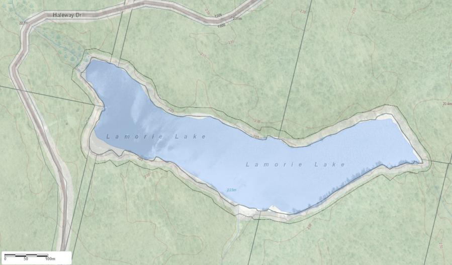
Maps of Lamorie Lake
Topographical Map of Lamorie Lake in Gravenhurst
Legend
 Buildings surrounding Lamorie Lake
 Buildings surrounding Lamorie Lake
 Conservation Area surrounding Lamorie Lake
 Contours of land surrounding Lamorie Lake
 Index Contour
 Rapids
 Spot Height
 Water Falls
 Water Falls/Rapids
 Waterbody Elevation
 Watercourse
 Wetland surrounding Lamorie Lake
 Wooded Area surrounding Lamorie Lake
Zoning Map of Lamorie Lake in Gravenhurst
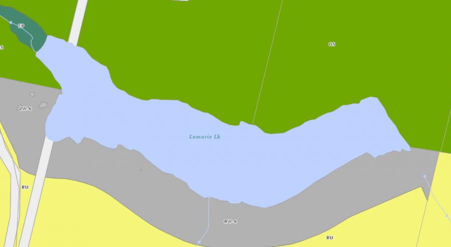
Legend of Gravenhurst Zoning Map - Lamorie Lake
Residential WaterfrontEnvironmentally Protected
Residential 1
Open Space
Rural
Residential Rural
Waterfront Landing
Residential Island
Commercial Recreational
Cottages for Sale on Lamorie Lake - (Gravenhurst)
Sorry no cottages for sale at the moment on Lamorie Lake (Gravenhurst)
Cottages for Sale close to Lamorie Lake
Previously listed Cottages on Lamorie Lake
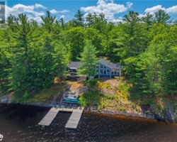
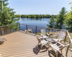
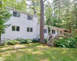
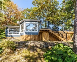
2924 SOUTHWOOD Road, Gravenhurst, P0E1G0 was previously listed 2022-09-21, mls# 40310420
Previously listed Cottages on Lamorie Lake
2924 SOUTHWOOD Road, Gravenhurst, P0E1G0 was previously listed 2022-09-21, mls# 40310420