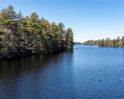
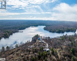
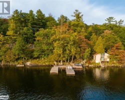
Bass Lake - (Muskoka Lakes)
There is another Bass Lake in the township of Ryde in Gravenhurst
Bass Lake is located in the geographical township of Medora within the Township of Muskoka Lakes. The lake is situated west of the village of Glen Orchard, south of Muskoka Rd 169. Bass Lake flows north into the main basin of Lake Joseph.
Average traveling time from the GTA to Bass Lake - (Muskoka Lakes) is 1 hour 59 mins
This Lake Median Lake Average Lake | |
Bass Lake is 98 hectares (242 Acres) in size The median size lake in our area is 71 hectares or 175 Acres (average size 398 hectares) | 98 71 398 |
|
Bass Lake has a maximum depth 12 meters (39 ft)
The median depth of lakes in our area is 13.5 m or 44 ft (average depth 18 m) | 12 13.5 18 |
|
Bass Lake Perimeter 9.30 km (5.78 Miles)
The median perimiter of lakes in our area is 3.3 km or 2.05 miles (average Perimiter 3.61 km) | 9.30 3.3 4 |
|
Bass Lake Altitude 229 m (751 ft)
The median altitude of lakes in our area is 290 m or 951 ft (average Altitude is 289 m) | 229 290 289 |
|
Water Clarity of Bass Lake (median 3.2 m) 3.60 m (12ft)
The median Secchi Depth of lakes in our area is 3.2 m or 10 ft (average Secchi Depth is 3 m) | 3.60 3.2 3 |
| 4 % of Bass Lake shorline is wetland. The median percentage of shoreline which is wetland of lakes in our area is 9 % (average Percentage of shoreline which is wetland 10) % |
Percentage of Shoreline which is wetland 4 9 10 |
|
Bass Lake's phosphorus content in water is 6.80 ug/L
The median Phosphorus content in the water of lakes in our area is 8 ug/l (average Phosphorus content 9 ug/L | 6.80 8 9 |
| Bass Lake's watershed area feeding the Lake (excluding lake) 5.3 km2 (1310 acres) | |
| Lake Trout found in Bass Lake: No | |
| Drainage Basin of Bass Lake Muskoka River | |
| Bass Lake is in the Township of Medora | |
| Shoreline Development on Bass Lake is: high; shoreline residential | |
| Public Access to Bass Lake private; launch at marina off Hwy 169 Boat Launch | |
| Water Level Management not regulated | |
| Major Fish Species in Bass Lake , (I), (I), (I), | |
| Other Fish Species in Bass Lake , | |
| Notes: E: extirpated, I: introduced – intentional or accidental, O: occasional, R: remnant, S: currently stocked, ?: status uncertain, 2009: year of first record or introduction if known, blank: presumed native | |
| Much of the above data for Bass Lake is compliments of the Muskoka Water Web maintained by The District Municipality of Muskoka | |
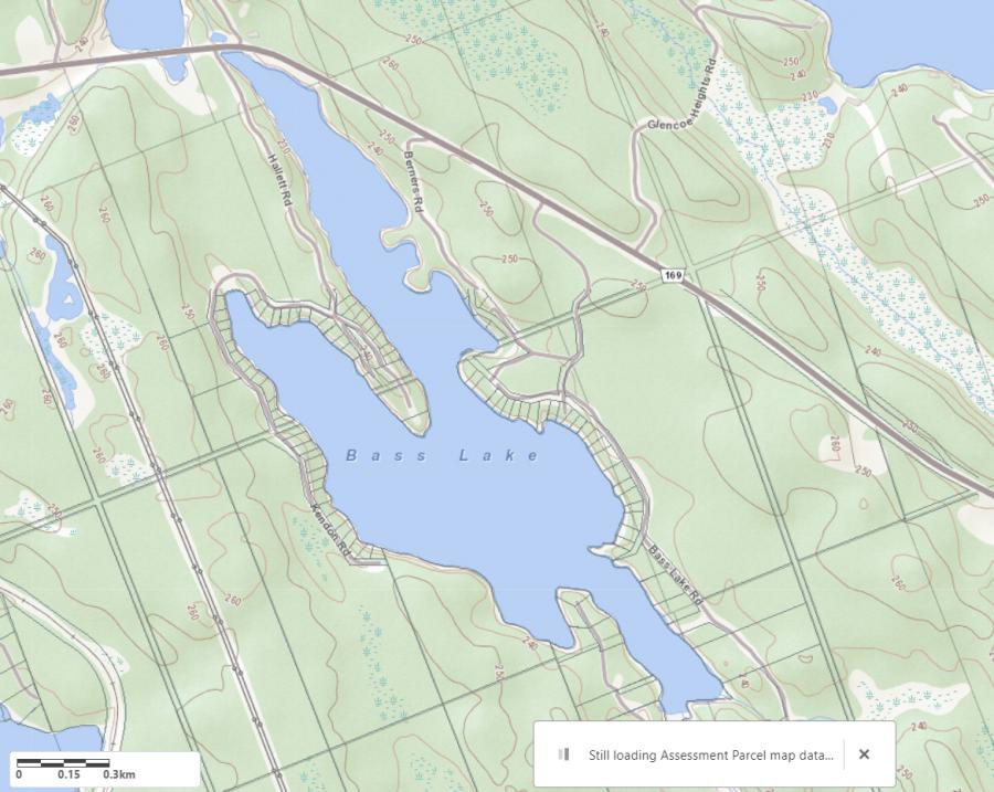
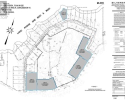
Maps of Bass Lake
Topographical Map of Bass Lake in Muskoka Lakes
Legend
 Buildings surrounding Bass Lake
 Buildings surrounding Bass Lake
 Conservation Area surrounding Bass Lake
 Contours of land surrounding Bass Lake
 Index Contour
 Rapids
 Spot Height
 Water Falls
 Water Falls/Rapids
 Waterbody Elevation
 Watercourse
 Wetland surrounding Bass Lake
 Wooded Area surrounding Bass Lake
Zoning Map of Bass Lake in Muskoka Lakes
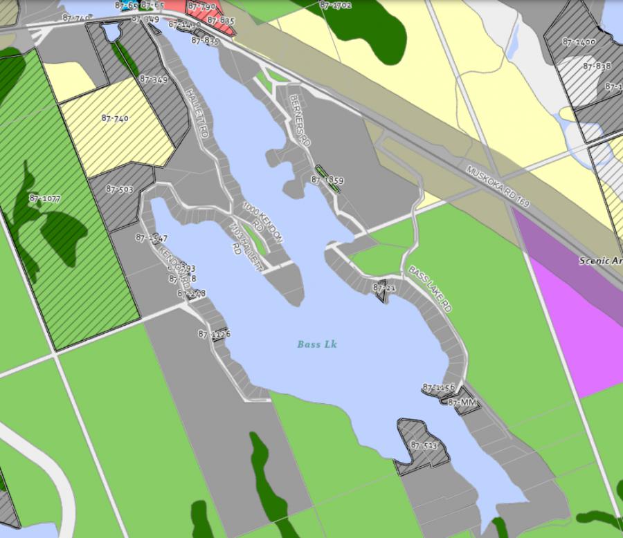
Legend of Muskoka Lakes Zoning Map - Bass Lake
Waterfront ResidentialEnvironmentally Protected
Community Residential
Open Space
Rural
Residential Rural
Waterfront Landing
Waterfront Commercial
Waterbody Open Space
Crown Land Map of Bass Lake in Muskoka Lakes
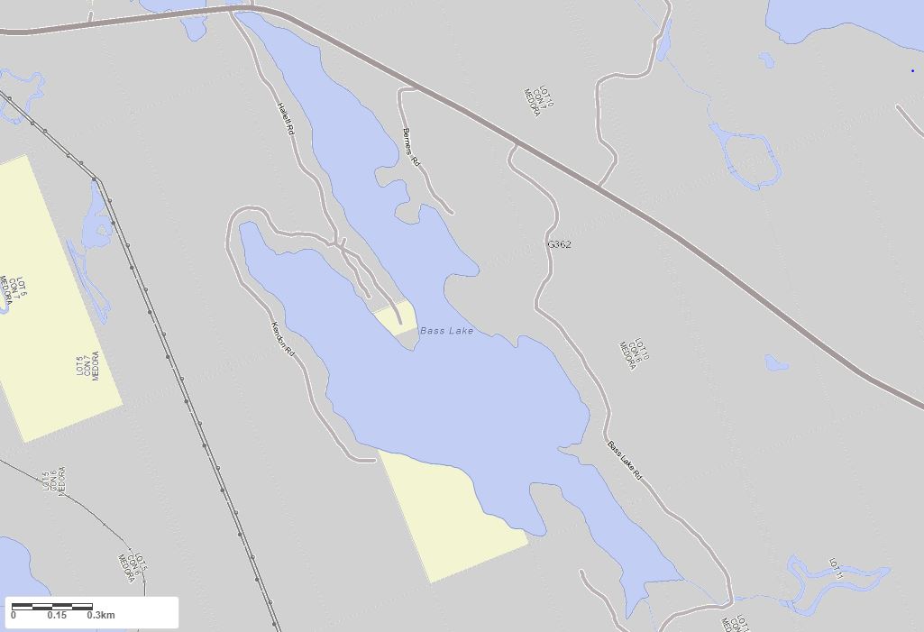
Legend for Crown Land Map
Private Land surrounding Bass Lake - (Muskoka Lakes)Provincial Park surrounding Bass Lake - (Muskoka Lakes)
Crown Land surrounding Bass Lake - (Muskoka Lakes) (General Use)
Conservation Reserve surrounding Bass Lake - (Muskoka Lakes)
Lake Contour Maps showing the depths of Bass Lake
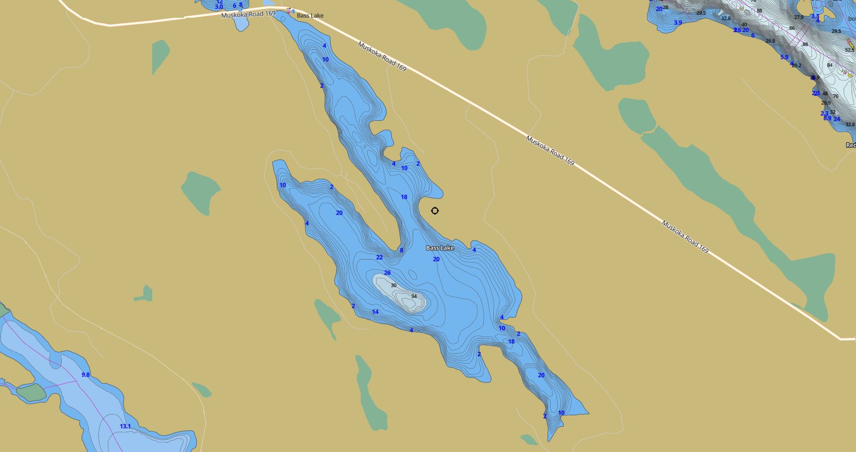
This map is courtesy of Gps Nautical Maps and you can purchase this map as an app from GpsNauticalCharts.com
All measurements of the countour map showing the depths of Bass Lake are in feet.
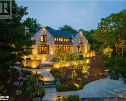
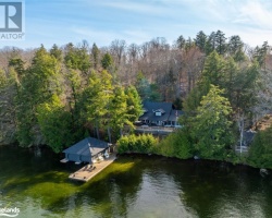
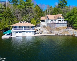
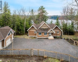
Cottages for Sale on Bass Lake
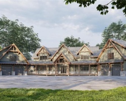
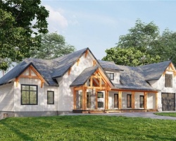
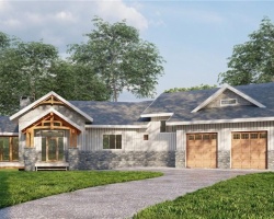
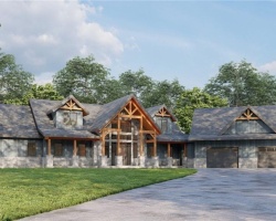
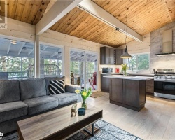
Cottages for Sale close to Bass Lake
Lake Videos
This video is courtesy of ecottagefilms.com This video is courtesy of ecottagefilms.com This video is courtesy of ecottagefilms.com This video is courtesy of ecottagefilms.com Previously listed Cottages on Bass Lake
1138 Bass Lake Road Unit# 2, Port Carling, P0B1J0 was previously listed 2024-02-17, mls# 40542509
79 GREENWOOD AVENUE Avenue, Coldwater, L0K1E0 was previously listed 2023-10-31, mls# 40500456
1000 KENDON Road Unit# 11, Port Carling, P0C1H0 was previously listed 2023-10-21, mls# 40470426
79 GREENWOOD AVENUE Avenue, Coldwater, L0K1E0 was previously listed 2023-10-18, mls# 40476394
1138 BASS LAKE Road Unit# 2, Port Carling, P0B1J0 was previously listed 2023-08-03, mls# 40443669
22 FIRE ROUTE 408 A, Bobcaygeon, K0M1A0 was previously listed 2023-06-01, mls# 40188959
1137 KENDON Road, MacTier, P0C1H0 was previously listed 2023-05-16, mls# 40406803
1138 BASS LAKE Road Unit# 2, MacTier, P0C1H0 was previously listed 2023-03-18, mls# 40377400
1138 BASS LAKE Road Unit# 2, MacTier, P0C1H0 was previously listed 2023-01-27, mls# 40328698
1085 HALLETT'S Road, MacTier, P0C1H0 was previously listed 2022-12-15, mls# 40344787
22 FIRE ROUTE 408 A, Bobcaygeon, K0M1A0 was previously listed 2022-12-03, mls# 40341264
1138 BASS LAKE Road Unit# 2, MacTier, P0C1H0 was previously listed 2022-09-26, mls# 40313230
1039 HALLETT'S Road, MacTier, P0C1H0 was previously listed 2022-09-01, mls# 40309814
1149 KENDON Road, MacTier, P0C1H0 was previously listed 2022-08-26, mls# 40241176
1049 KENDON Road, Port Carling, P0B1J0 was previously listed 2022-07-27, mls# 40290200
22 Fire Route 408 A, Bobcaygeon, K0M1A0 was previously listed 2022-02-13, mls# 40188959
1149 Kendon Road, Muskoka Lakes, P0C1H0 was previously listed 2021-05-19, mls# 40110144
1074 Cooks Road, Gravenhurst, P1P1R3 was previously listed 2021-03-27, mls# 40079898
1067 Thomas Road W, Gravenhurst, P1P1R3 was previously listed 2020-09-25, mls# 248713
35 Birch Road, Coldwater, L0K1E0 was previously listed 2020-05-13, mls# 251780
1078 Bass Lake Road, Mactier, P0C 1H0 was previously listed 2020-01-09, mls# 206180
1067 Thomas Road W, Gravenhurst, P1P 1R3 was previously listed 2019-11-02, mls# 214849
2553 13 Line N, Oro-medonte, L0K 1E0 was previously listed 2019-10-08, mls# 221158
1027 Thomas Road, Gravenhurst, P1P 1R3 was previously listed 2019-10-02, mls# 191119
1061 Hallett's Road, Mactier, P0C 1H0 was previously listed 2019-09-28, mls# 220936
Lake Videos
Previously listed Cottages on Bass Lake
1138 Bass Lake Road Unit# 2, Port Carling, P0B1J0 was previously listed 2024-02-17, mls# 40542509
79 GREENWOOD AVENUE Avenue, Coldwater, L0K1E0 was previously listed 2023-10-31, mls# 40500456
1000 KENDON Road Unit# 11, Port Carling, P0C1H0 was previously listed 2023-10-21, mls# 40470426
79 GREENWOOD AVENUE Avenue, Coldwater, L0K1E0 was previously listed 2023-10-18, mls# 40476394
1138 BASS LAKE Road Unit# 2, Port Carling, P0B1J0 was previously listed 2023-08-03, mls# 40443669
22 FIRE ROUTE 408 A, Bobcaygeon, K0M1A0 was previously listed 2023-06-01, mls# 40188959
1137 KENDON Road, MacTier, P0C1H0 was previously listed 2023-05-16, mls# 40406803
1138 BASS LAKE Road Unit# 2, MacTier, P0C1H0 was previously listed 2023-03-18, mls# 40377400
1138 BASS LAKE Road Unit# 2, MacTier, P0C1H0 was previously listed 2023-01-27, mls# 40328698
1085 HALLETT'S Road, MacTier, P0C1H0 was previously listed 2022-12-15, mls# 40344787
22 FIRE ROUTE 408 A, Bobcaygeon, K0M1A0 was previously listed 2022-12-03, mls# 40341264
1138 BASS LAKE Road Unit# 2, MacTier, P0C1H0 was previously listed 2022-09-26, mls# 40313230
1039 HALLETT'S Road, MacTier, P0C1H0 was previously listed 2022-09-01, mls# 40309814
1149 KENDON Road, MacTier, P0C1H0 was previously listed 2022-08-26, mls# 40241176
1049 KENDON Road, Port Carling, P0B1J0 was previously listed 2022-07-27, mls# 40290200
22 Fire Route 408 A, Bobcaygeon, K0M1A0 was previously listed 2022-02-13, mls# 40188959
1149 Kendon Road, Muskoka Lakes, P0C1H0 was previously listed 2021-05-19, mls# 40110144
1074 Cooks Road, Gravenhurst, P1P1R3 was previously listed 2021-03-27, mls# 40079898
1067 Thomas Road W, Gravenhurst, P1P1R3 was previously listed 2020-09-25, mls# 248713
35 Birch Road, Coldwater, L0K1E0 was previously listed 2020-05-13, mls# 251780
1078 Bass Lake Road, Mactier, P0C 1H0 was previously listed 2020-01-09, mls# 206180
1067 Thomas Road W, Gravenhurst, P1P 1R3 was previously listed 2019-11-02, mls# 214849
2553 13 Line N, Oro-medonte, L0K 1E0 was previously listed 2019-10-08, mls# 221158
1027 Thomas Road, Gravenhurst, P1P 1R3 was previously listed 2019-10-02, mls# 191119
1061 Hallett's Road, Mactier, P0C 1H0 was previously listed 2019-09-28, mls# 220936