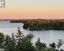
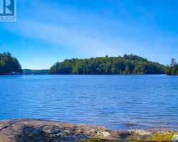
Bruce Lake - (Muskoka Lakes)
Bruce Lake is situated in the geographic township of Medora within the Township of Muskoka Lakes. Access can be gained by traveling north on Muskoka Rd 7 from the Village of Port Sandfield. Bruce Lake flows southwest into the Joseph River by way of the Bruce Lake Marsh.
Average traveling time from the GTA to Bruce Lake - (Muskoka Lakes) is 2 hours 14 mins
This Lake Median Lake Average Lake | |
Bruce Lake is 91 hectares (225 Acres) in size The median size lake in our area is 71 hectares or 175 Acres (average size 398 hectares) | 91 71 398 |
|
Bruce Lake has a maximum depth 6 meters (20 ft)
The median depth of lakes in our area is 13.5 m or 44 ft (average depth 18 m) | 6 13.5 18 |
| The median depth of Bruce Lake is 3.40 m (11 ft) | 3.40 5.2 7 |
|
Bruce Lake Perimeter 6.20 km (3.85 Miles)
The median perimiter of lakes in our area is 3.3 km or 2.05 miles (average Perimiter 3.61 km) | 6.20 3.3 4 |
| Bruce Lake Island/s Perimeter 0.40 km (0.25 Miles) | |
|
Bruce Lake Altitude 238 m (781 ft)
The median altitude of lakes in our area is 290 m or 951 ft (average Altitude is 289 m) | 238 290 289 |
|
Water Clarity of Bruce Lake (median 3.2 m) 4.30 m (14ft)
The median Secchi Depth of lakes in our area is 3.2 m or 10 ft (average Secchi Depth is 3 m) | 4.30 3.2 3 |
| 7 % of Bruce Lake shorline is wetland. The median percentage of shoreline which is wetland of lakes in our area is 9 % (average Percentage of shoreline which is wetland 10) % |
Percentage of Shoreline which is wetland 7 9 10 |
|
Bruce Lake's phosphorus content in water is 9.70 ug/L
The median Phosphorus content in the water of lakes in our area is 8 ug/l (average Phosphorus content 9 ug/L | 9.70 8 9 |
| Bruce Lake's watershed area feeding the Lake (excluding lake) 3.1 km2 (766 acres) | |
| Lake Trout found in Bruce Lake: No | |
| Drainage Basin of Bruce Lake Lake Rosseau | |
| Bruce Lake's percentage of shoreline which is Crown Land 5 % | |
| Bruce Lake is in the Township of Medora | |
| Shoreline Development on Bruce Lake is: moderate; shoreline residential | |
| Public Access to Bruce Lake public; road allowance at western end | |
| Water Level Management not regulated | |
| Major Fish Species in Bruce Lake (I), (I 2002) | |
| Other Fish Species in Bruce Lake , , common shiner, | |
| Notes: E: extirpated, I: introduced – intentional or accidental, O: occasional, R: remnant, S: currently stocked, ?: status uncertain, 2009: year of first record or introduction if known, blank: presumed native | |
| Much of the above data for Bruce Lake is compliments of the Muskoka Water Web maintained by The District Municipality of Muskoka | |
Maps of Bruce Lake
Topographical Map of Bruce Lake in Muskoka Lakes
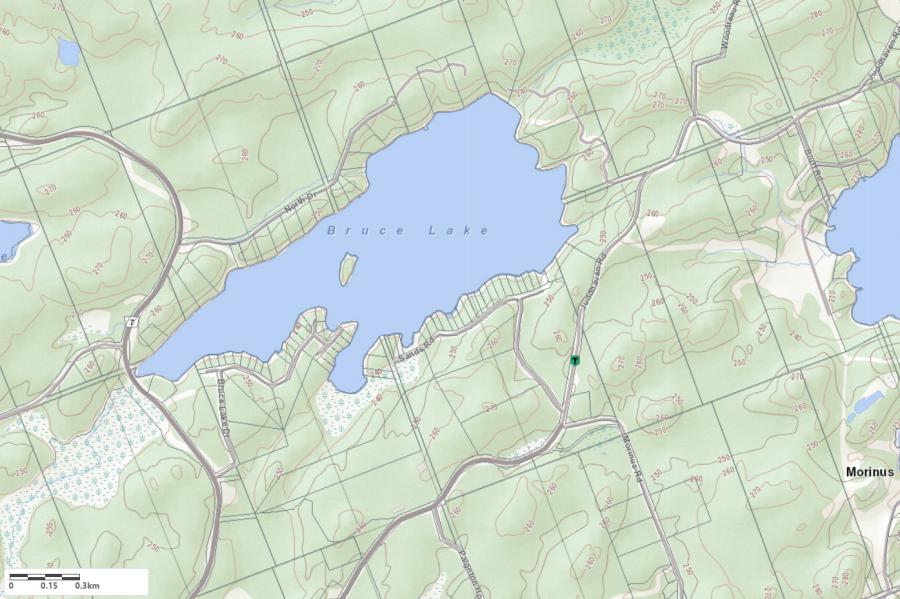
Legend
 Buildings surrounding Bruce Lake
 Buildings surrounding Bruce Lake
 Conservation Area surrounding Bruce Lake
 Contours of land surrounding Bruce Lake
 Index Contour
 Rapids
 Spot Height
 Water Falls
 Water Falls/Rapids
 Waterbody Elevation
 Watercourse
 Wetland surrounding Bruce Lake
 Wooded Area surrounding Bruce Lake
Zoning Map of Bruce Lake in Muskoka Lakes
Legend of Muskoka Lakes Zoning Map - Bruce Lake
Waterfront ResidentialEnvironmentally Protected
Community Residential
Open Space
Rural
Residential Rural
Waterfront Landing
Waterfront Commercial
Waterbody Open Space
Crown Land Map of Bruce Lake in Muskoka Lakes
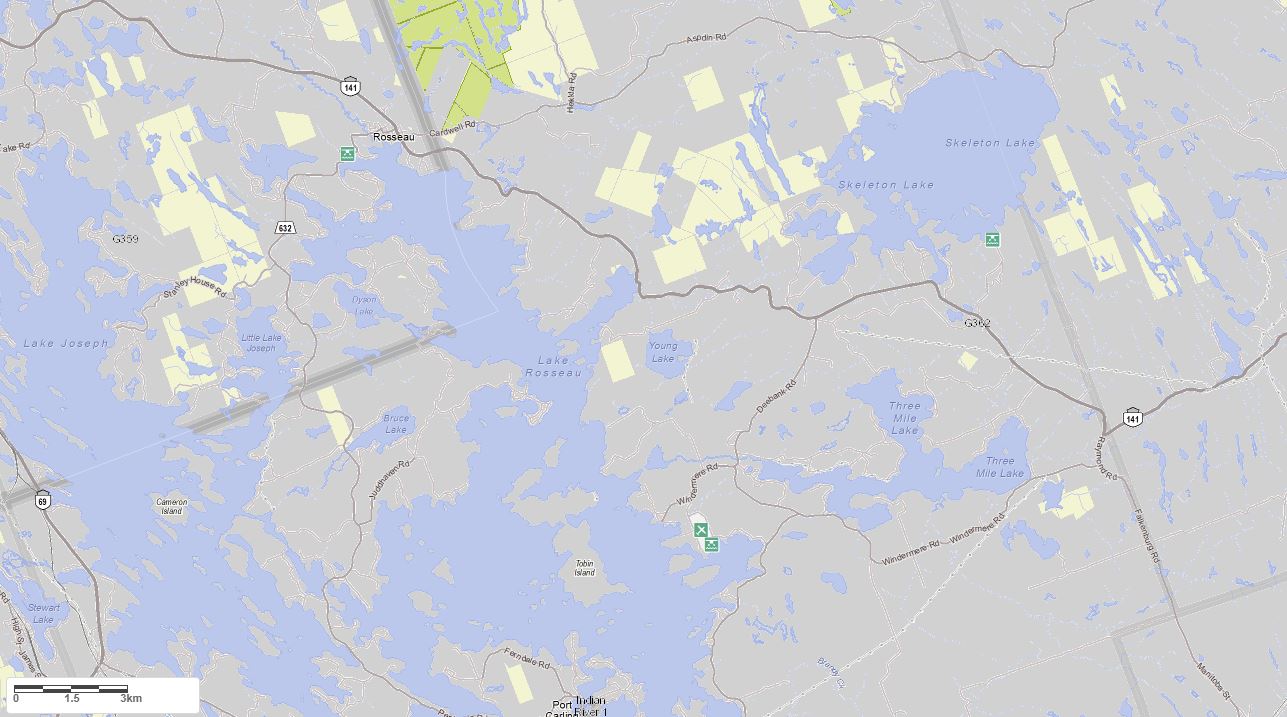
Legend for Crown Land Map
Private Land surrounding Bruce Lake - (Muskoka Lakes)Provincial Park surrounding Bruce Lake - (Muskoka Lakes)
Crown Land surrounding Bruce Lake - (Muskoka Lakes) (General Use)
Conservation Reserve surrounding Bruce Lake - (Muskoka Lakes)
Lake Contour Maps showing the depths of Bruce Lake

This map is courtesy of Gps Nautical Maps and you can purchase this map as an app from GpsNauticalCharts.com
All measurements of the countour map showing the depths of Bruce Lake are in feet.
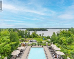
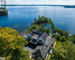
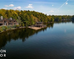
Cottages for Sale on Bruce Lake
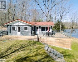
Cottages for Sale close to Bruce Lake
Previously listed Cottages on Bruce Lake
1059 BRUCE LAKE Drive, Minett, P0B1G0 was previously listed 2022-10-06, mls# 40329560
1125 SANDS Road Unit# 3, Muskoka Lakes, P0B1G0 was previously listed 2022-07-27, mls# 40279154
1118 North Drive Unit# 4, Muskoka Lakes, P0B1J0 was previously listed 2021-09-22, mls# 40146025
1053 Bruce Lake Drive Unit# 5, Minett, P0B1J0 was previously listed 2021-07-29, mls# 40143008
1059 Bruce Lake Drive, Minett, P0B1G0 was previously listed 2021-06-20, mls# 40123749
1063 Bruce Lake Drive, Port Carling, P0B1J0 was previously listed 2021-04-14, mls# 40093262
0 North Drive, Muskoka Lakes, P0B1J0 was previously listed 2020-12-07, mls# 40049119
1125 Sands Road Unit# 3, Muskoka Lakes, P0B1G0 was previously listed 2020-11-15, mls# 40026640
1060 Sands Road, Muskoka Lakes, P0B1J0 was previously listed 2020-10-17, mls# 40027973
1060 Sands Road, Muskoka Lakes, P0B1J0 was previously listed 2020-10-02, mls# 40027973
1053 Bruce Lake Drive #1, Minett, P0B 1J0 was previously listed 2019-12-27, mls# 210404