Portage Lake - (Seguin)
There is another Portage Lake in the township of McDougall in McDougall
This Lake Median Lake Average Lake | |
Portage Lake is 98 hectares (242 Acres) in size The median size lake in our area is 71 hectares or 175 Acres (average size 398 hectares) | 98 71 398 |
|
Portage Lake has a maximum depth 26 meters (85 ft)
The median depth of lakes in our area is 13.5 m or 44 ft (average depth 18 m) | 26 13.5 18 |
| The median depth of Portage Lake is 12.00 m (39 ft) | 12.00 5.2 7 |
|
Portage Lake Perimeter 7.10 km (4.41 Miles)
The median perimiter of lakes in our area is 3.3 km or 2.05 miles (average Perimiter 3.61 km) | 7.10 3.3 4 |
| Portage Lake Island/s Perimeter 0.70 km (0.43 Miles) | |
|
Portage Lake Altitude 244 m (801 ft)
The median altitude of lakes in our area is 290 m or 951 ft (average Altitude is 289 m) | 244 290 289 |
| Portage Lake's watershed area feeding the Lake (excluding lake) 5.8 km2 (1433 acres) | |
| Drainage Basin of Portage Lake Lake Joseph | |
| Portage Lake's percentage of shoreline which is Crown Land 1 % | |
| Portage Lake is in the Township of Humphrey | |
| Shoreline Development on Portage Lake is: moderate; shoreline residential | |
| Public Access to Portage Lake water access from Lake Joseph | |
| Water Level Management Regulated indirectly by MNR owned and operated dam on Lake Rosseau at Port Carling. Flows and levels are regulated by the Muskoka River Water Management Plan | |
| Major Fish Species in Portage Lake , (I?), (I?), , , (I), cisco (), lake whitefish (R) | |
| Other Fish Species in Portage Lake , , (I), | |
| Other Species in Portage Lake spiny water flea (I 2006) | |
| Notes: E: extirpated, I: introduced – intentional or accidental, O: occasional, R: remnant, S: currently stocked, ?: status uncertain, 2009: year of first record or introduction if known, blank: presumed native | |
| Much of the above data for Portage Lake is compliments of the Muskoka Water Web maintained by The District Municipality of Muskoka | |
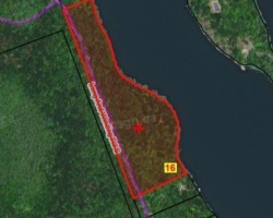
Maps of Portage Lake
Topographical Map of Portage Lake in Seguin
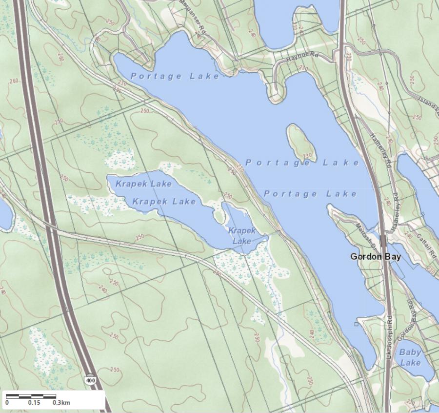
Legend
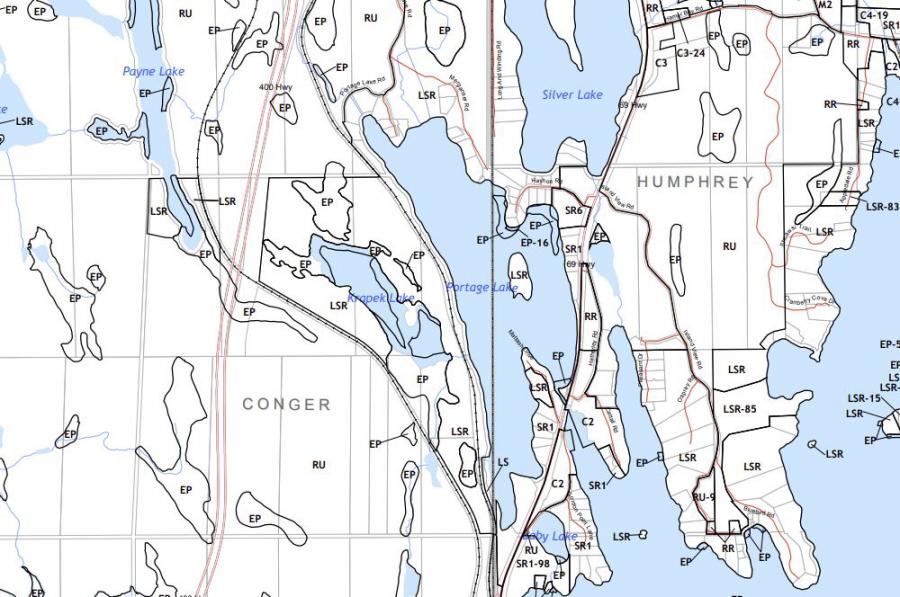
 Buildings surrounding Portage Lake
 Buildings surrounding Portage Lake
 Conservation Area surrounding Portage Lake
 Contours of land surrounding Portage Lake
 Index Contour
 Rapids
 Spot Height
 Water Falls
 Water Falls/Rapids
 Waterbody Elevation
 Watercourse
 Wetland surrounding Portage Lake
 Wooded Area surrounding Portage Lake
Zoning Map of Portage Lake in Seguin
Lake Contour Maps showing the depths of Portage Lake
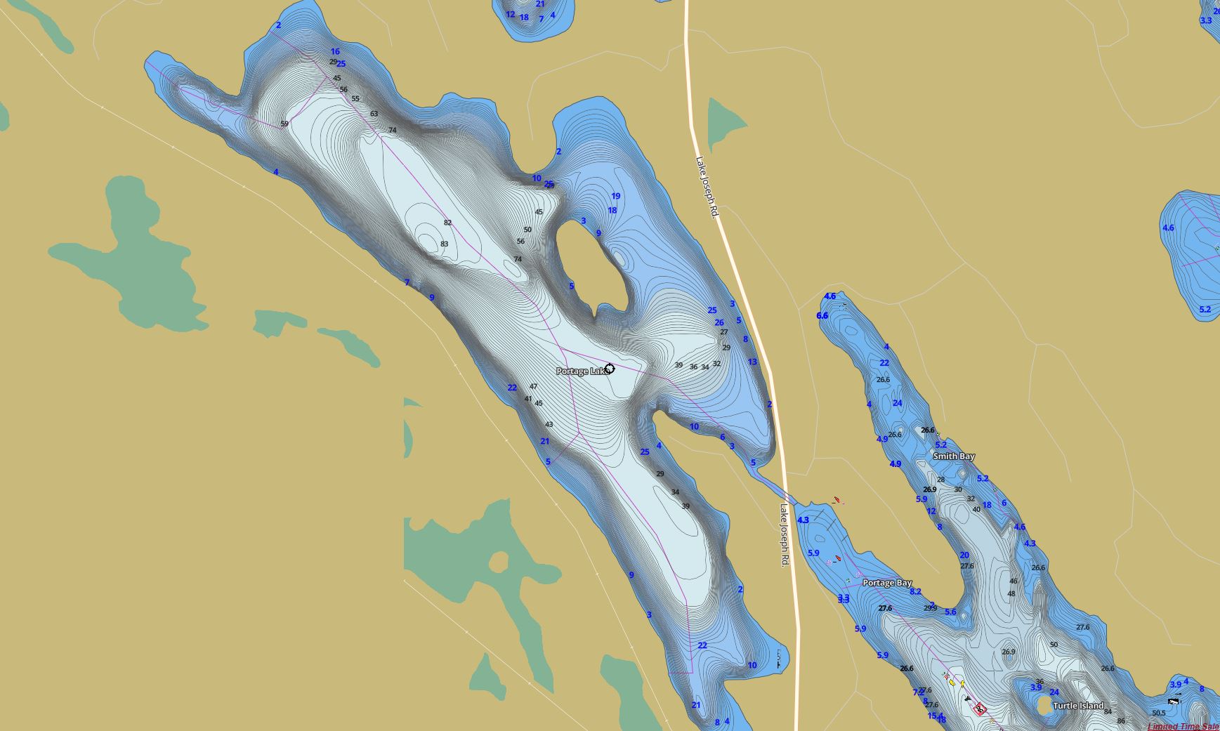
This map is courtesy of Gps Nautical Maps and you can purchase this map as an app from GpsNauticalCharts.com
All measurements of the countour map showing the depths of Portage Lake are in feet.
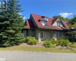
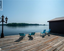
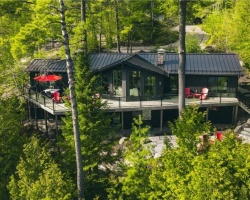
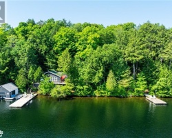
Cottages for Sale on Portage Lake
Cottages for Sale close to Portage Lake
Previously listed Cottages on Portage Lake
34 Lake Forest Drive, McDougall, P2A2W9 was previously listed 2024-03-28, mls# 40563004
14 Georgian Pines Drive, McDougall, P2A2W9 was previously listed 2024-03-16, mls# 40555148
1052 Portage Road, Haliburton, K0M1S0 was previously listed 2023-12-06, mls# 40519987
1047 DUDLEY Road, Haliburton, K0M1S0 was previously listed 2023-10-31, mls# 40505077
1447 KENNAWAY Road, Haliburton, K0M1S0 was previously listed 2023-10-31, mls# 40485825
1052 PORTAGE Road, Haliburton, K0M1S0 was previously listed 2023-10-31, mls# 40472008
10 STEAM WHISTLE Lane, McDougall, P2A2W9 was previously listed 2022-11-26, mls# 40335801
1397 TRILLIUM Trail, Haliburton, K0M1S0 was previously listed 2022-10-25, mls# 40335814
15 MEADOWCREST Drive, McDougall, P2A2W9 was previously listed 2022-07-01, mls# 40202197
LT 4 PORTAGE Lake, McDougall, P2A2W9 was previously listed 2022-05-01, mls# 40217076
LT 6 PORTAGE Lake, McDougall, P2A2W9 was previously listed 2022-04-19, mls# 40217569
Lt 5 Portage Lake, McDougall, P2A2W9 was previously listed 2022-03-11, mls# 40217326
50 Lake Forest Drive, Nobel, P2A2W9 was previously listed 2021-11-03, mls# 40173303
1 Meadowcrest Drive, McDougall, P2A2W9 was previously listed 2021-10-22, mls# 40117996
50 Lake Forest Drive, Nobel, P2A2W9 was previously listed 2021-10-02, mls# 40156332
0 Portage Lake, Seguin, P0C1H0 was previously listed 2021-08-01, mls# 40112326
34 Lake Forest Drive, Parry Sound, P2A2W9 was previously listed 2021-07-15, mls# 40136657
1447 Kennaway Road, Haliburton, K0M1S0 was previously listed 2021-07-14, mls# 40132696
1705 Highway 69, Seguin, P2A2W8 was previously listed 2021-06-11, mls# 40120559
1 Steamwhistle Lane, McDougall, P2A2W9 was previously listed 2021-05-09, mls# 40103309
1046 Portage Road, Haliburton, K0M1S0 was previously listed 2020-09-19, mls# 40007570