Burnt Lake - (Archipelago)
This Lake Median Lake Average Lake | |
Burnt Lake is 22 hectares (54 Acres) in size The median size lake in our area is 71 hectares or 175 Acres (average size 398 hectares) | 22 71 398 |
|
Burnt Lake has a maximum depth 11 meters (36 ft)
The median depth of lakes in our area is 13.5 m or 44 ft (average depth 18 m) | 11 13.5 18 |
| The median depth of Burnt Lake is 4.80 m (16 ft) | 4.80 5.2 7 |
|
Burnt Lake Perimeter 5.20 km (3.23 Miles)
The median perimiter of lakes in our area is 3.3 km or 2.05 miles (average Perimiter 3.61 km) | 5.20 3.3 4 |
|
Burnt Lake Altitude 225 m (738 ft)
The median altitude of lakes in our area is 290 m or 951 ft (average Altitude is 289 m) | 225 290 289 |
|
Water Clarity of Burnt Lake (median 3.2 m) 6.80 m (22ft)
The median Secchi Depth of lakes in our area is 3.2 m or 10 ft (average Secchi Depth is 3 m) | 6.80 3.2 3 |
| Burnt Lake's watershed area feeding the Lake (excluding lake) 3.8 km2 (939 acres) | |
| Drainage Basin of Burnt Lake Moon River | |
| Burnt Lake's percentage of shoreline which is Crown Land 50 % | |
| Burnt Lake is in the Township of Conger | |
| Shoreline Development on Burnt Lake is: Low; shoreline residential | |
| Public Access to Burnt Lake Private; may be accessible via road allowance at Sawmill Lane | |
| Water Level Management not regulated | |
| Major Fish Species in Burnt Lake Largemouth Bass, Smallmouth Bass | |
| Other Fish Species in Burnt Lake Pumpkinseed | |
| Notes: E: extirpated, I: introduced – intentional or accidental, O: occasional, R: remnant, S: currently stocked, ?: status uncertain, 2009: year of first record or introduction if known, blank: presumed native | |
| Much of the above data for Burnt Lake is compliments of the Muskoka Water Web maintained by The District Municipality of Muskoka | |
Maps of Burnt Lake
Topographical Map of Burnt Lake in Archipelago
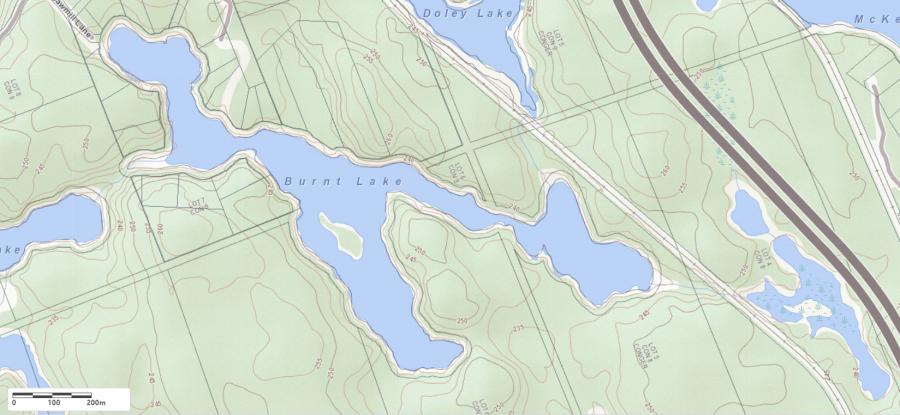
Legend
 Buildings surrounding Burnt Lake
 Buildings surrounding Burnt Lake
 Conservation Area surrounding Burnt Lake
 Contours of land surrounding Burnt Lake
 Index Contour
 Rapids
 Spot Height
 Water Falls
 Water Falls/Rapids
 Waterbody Elevation
 Watercourse
 Wetland surrounding Burnt Lake
 Wooded Area surrounding Burnt Lake
Lake Contour Maps showing the depths of Burnt Lake
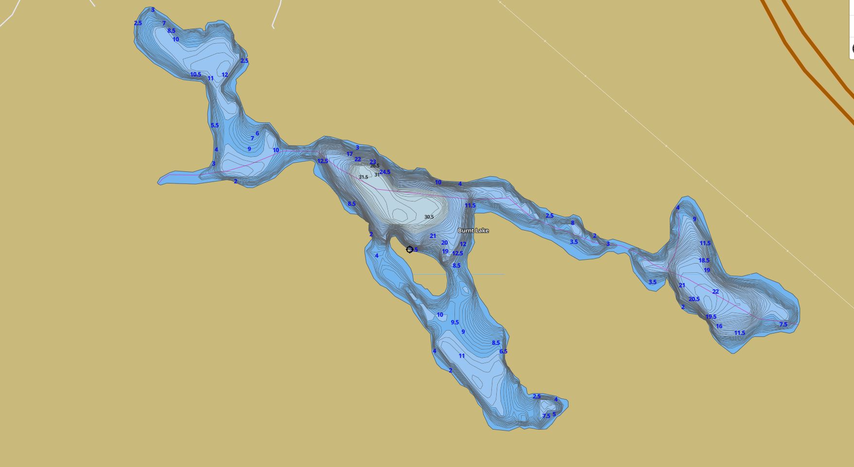
This map is courtesy of Gps Nautical Maps and you can purchase this map as an app from GpsNauticalCharts.com
All measurements of the countour map showing the depths of Burnt Lake are in feet.
Cottages for Sale on Burnt Lake - (Archipelago)
Sorry no cottages for sale at the moment on Burnt Lake (Archipelago)
Cottages for Sale close to Burnt Lake
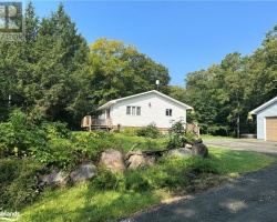
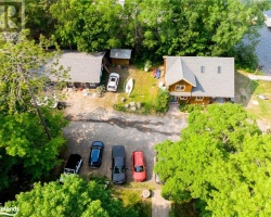
Previously listed Cottages on Burnt Lake
4428 County Road 121 Road, Kinmount, K0M2A0 was previously listed 2023-10-31, mls# 40499211
87 SUPERIOR Road, Fenelon Falls, K0M1N0 was previously listed 2023-10-31, mls# 40461781
50 RIVER BEND Drive, Burnt River, K0M1C0 was previously listed 2023-09-03, mls# 40462859
53 BLACK BEAR Drive, Fenelon Falls, K0M1N0 was previously listed 2023-08-19, mls# 40430660
87 SUPERIOR Road, Fenelon Falls, K0M1N0 was previously listed 2023-08-03, mls# 40411208
0 SOMERVILLE 11TH Concession, Burnt River, K0M1C0 was previously listed 2023-04-08, mls# 40386225
0 SOMERVILLE 11TH Concession, Burnt River, K0M1C0 was previously listed 2022-12-01, mls# 40308031
12 HARMONIOUS Drive, Kawartha Lakes, K0M1N0 was previously listed 2022-08-30, mls# 40308971
0 LAWSON BAY Road, Seguin, P2A2W8 was previously listed 2022-08-01, mls# 40267032
16 AUSTIN Drive, Burnt River, K0M1C0 was previously listed 2022-05-01, mls# 40220644
71 BROOK Road, Fenelon Falls, K0M1N0 was previously listed 2022-04-13, mls# 40227294
26 Evans Drive, Fenelon Falls, K0M1N0 was previously listed 2021-11-22, mls# 40153610
50 River Bend Drive, Burnt River, K0M1C0 was previously listed 2021-10-05, mls# 40163551
95 Cedarplank Road, Fenelon Falls, K0M1N0 was previously listed 2021-08-04, mls# 40147833
32 Basswood Drive, Burnt River, K0M1C0 was previously listed 2021-05-11, mls# 40078726
28 Harmonious Drive, Fenelon Falls, K0M1N0 was previously listed 2021-02-17, mls# 40062914
1041 Nystedt Lane, Minden Hills, K0M2K0 was previously listed 2020-10-10, mls# 40027591
316 Moorings Drive, Fenelon Falls, K0M1N0 was previously listed 2020-09-26, mls# 276418
91 Cedarplank Road, Fenelon Falls, K0M1N0 was previously listed 2020-09-24, mls# 40011906
Matthews Garcia Road, Seguin, P2A2W9 was previously listed 2020-09-04, mls# 232041