Montgomery Lake - (Huntsville)
Montgomery Lake is a small, picturesque lake located in the Huntsville area of Ontario, Canada. It covers an area of approximately 33 hectares (81 acres) and has a maximum depth of 13 meters (43 feet). The lake is part of a chain of four lakes that includes Mary Lake, Lake Vernon, and Fairy Lake.
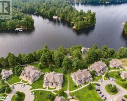
The shoreline of Montgomery Lake is mostly undeveloped, with only a few cottages and homes located along its shores. The lake is surrounded by forests and rocky outcrops, providing visitors with stunning natural scenery and wildlife viewing opportunities. Montgomery Lake is a popular destination for recreational activities such as swimming, fishing, and boating. The lake is home to a variety of fish species, including smallmouth bass, lake trout, and yellow perch.
There are several public access points and boat launches located around the lake, providing easy access for visitors who wish to explore the lake by boat. The lake is also located close to the town of Huntsville, where visitors can find a range of amenities, including restaurants, shops, and accommodations.
Overall, Montgomery Lake is a beautiful and peaceful destination that offers a variety of outdoor activities and natural beauty for visitors to enjoy. With its clear waters, beautiful surroundings, and tranquil atmosphere, it is a great place to relax and unwind in the heart of Ontario's Muskoka region.
Average traveling time from the GTA to Montgomery Lake - (Huntsville) is 2 hours 15 mins
This Lake Median Lake Average Lake | |
Montgomery Lake is 14 hectares (35 Acres) in size The median size lake in our area is 71 hectares or 175 Acres (average size 398 hectares) | 14 71 398 |
|
Montgomery Lake has a maximum depth 12 meters (39 ft)
The median depth of lakes in our area is 13.5 m or 44 ft (average depth 18 m) | 12 13.5 18 |
| The median depth of Montgomery Lake is 6.00 m (20 ft) | 6.00 5.2 7 |
|
Montgomery Lake Perimeter 1.80 km (1.12 Miles)
The median perimiter of lakes in our area is 3.3 km or 2.05 miles (average Perimiter 3.61 km) | 1.80 3.3 4 |
|
Montgomery Lake Altitude 320 m (1050 ft)
The median altitude of lakes in our area is 290 m or 951 ft (average Altitude is 289 m) | 320 290 289 |
|
Water Clarity of Montgomery Lake (median 3.2 m) 5.00 m (16ft)
The median Secchi Depth of lakes in our area is 3.2 m or 10 ft (average Secchi Depth is 3 m) | 5.00 3.2 3 |
| Montgomery Lake's watershed area feeding the Lake (excluding lake) 1.2 km2 (297 acres) | |
| Montgomery Lake is in the Township of Brunel | |
| Shoreline Development on Montgomery Lake is: low; shoreline residential | |
| Public Access to Montgomery Lake private | |
| Water Level Management not regulated | |
| Major Fish Species in Montgomery Lake (I) | |
| Other Fish Species in Montgomery Lake , , , creek chub | |
| Notes: E: extirpated, I: introduced – intentional or accidental, O: occasional, R: remnant, S: currently stocked, ?: status uncertain, 2009: year of first record or introduction if known, blank: presumed native | |
| Much of the above data for Montgomery Lake is compliments of the Muskoka Water Web maintained by The District Municipality of Muskoka | |
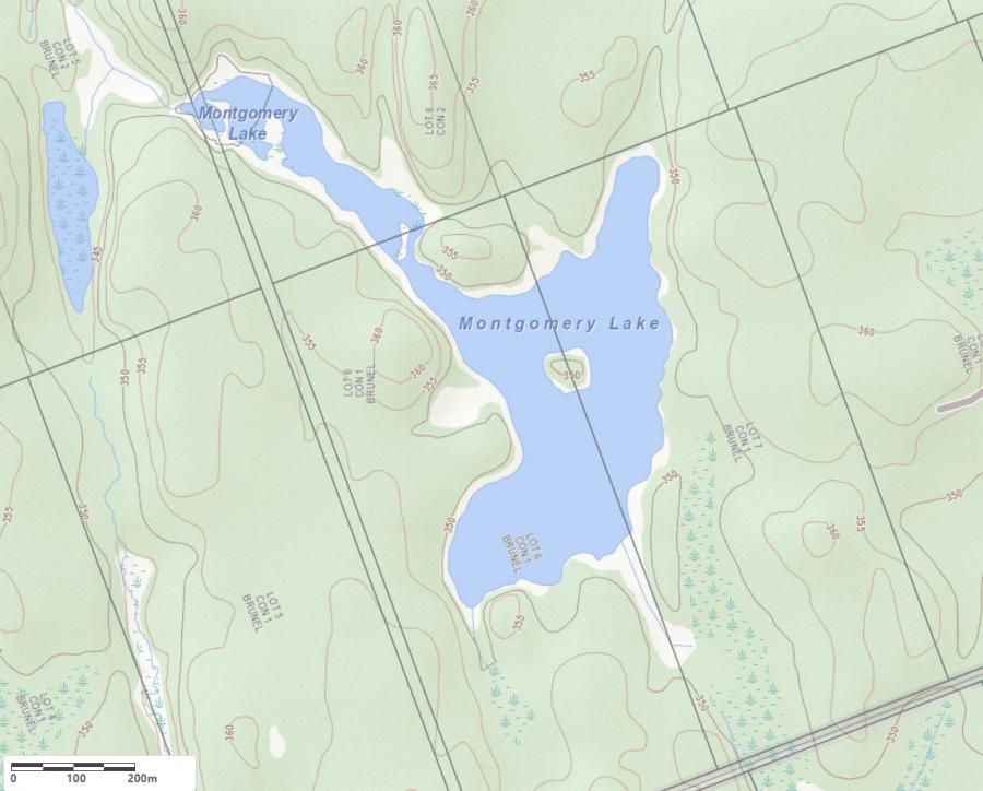
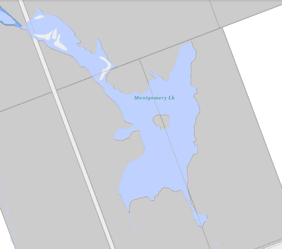
Maps of Montgomery Lake
Topographical Map of Montgomery Lake in Huntsville
Legend
 Buildings surrounding Montgomery Lake
 Buildings surrounding Montgomery Lake
 Conservation Area surrounding Montgomery Lake
 Contours of land surrounding Montgomery Lake
 Index Contour
 Rapids
 Spot Height
 Water Falls
 Water Falls/Rapids
 Waterbody Elevation
 Watercourse
 Wetland surrounding Montgomery Lake
 Wooded Area surrounding Montgomery Lake
Zoning Map of Montgomery Lake in Huntsville
Legend of Huntsville Zoning Map - Montgomery Lake
SR1 - Shoreroad Residential 1SR2 - Shoreroad Residential 2
SR3 - Shoreroad Residential 3
SR3 - Shoreroad Residential 4
NR - Natural Resource
NR1 - Natural Resource Floodway
NR2 - Natural Resource Floodfrindge
C - Conservation
CS4 - Marina
O1 - Open Space 1
O2 - Open Space 2
RR - Rural Residential
RU1 - Rural 1
RU2 - Rural 2
Crown Land Map of Montgomery Lake in Huntsville
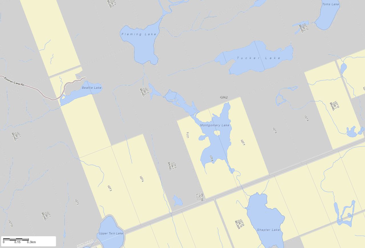
Legend for Crown Land Map
Private Land surrounding Montgomery Lake - (Huntsville)Provincial Park surrounding Montgomery Lake - (Huntsville)
Crown Land surrounding Montgomery Lake - (Huntsville) (General Use)
Conservation Reserve surrounding Montgomery Lake - (Huntsville)
Cottages for Sale on Montgomery Lake - (Huntsville)
Sorry no cottages for sale at the moment on Montgomery Lake (Huntsville)