Gilleach Lake - (Bracebridge)
Gilleach Lake is located in the geographic township of Macaulay on the eastern boundry of the Town of Bracebridge. Gilleach Lake is known as a headwater lake, meaning that it has no upstream lakes, and it flows via Sage Creek to the North Branch of the Muskoka River.
Average traveling time from the GTA to Gilleach Lake - (Bracebridge) is 2 hours 7 mins
This Lake Median Lake Average Lake | |
Gilleach Lake is 38 hectares (94 Acres) in size The median size lake in our area is 71 hectares or 175 Acres (average size 398 hectares) | 38 71 398 |
|
Gilleach Lake has a maximum depth 18 meters (59 ft)
The median depth of lakes in our area is 13.5 m or 44 ft (average depth 18 m) | 18 13.5 18 |
|
Gilleach Lake Altitude 320 m (1050 ft)
The median altitude of lakes in our area is 290 m or 951 ft (average Altitude is 289 m) | 320 290 289 |
|
Water Clarity of Gilleach Lake (median 3.2 m) 3.00 m (10ft)
The median Secchi Depth of lakes in our area is 3.2 m or 10 ft (average Secchi Depth is 3 m) | 3.00 3.2 3 |
| 10 % of Gilleach Lake shorline is wetland. The median percentage of shoreline which is wetland of lakes in our area is 9 % (average Percentage of shoreline which is wetland 10) % |
Percentage of Shoreline which is wetland 10 9 10 |
|
Gilleach Lake's phosphorus content in water is 9.70 ug/L
The median Phosphorus content in the water of lakes in our area is 8 ug/l (average Phosphorus content 9 ug/L | 9.70 8 9 |
| Gilleach Lake's watershed area feeding the Lake (excluding lake) 1.0 km2 (247 acres) | |
| Lake Trout found in Gilleach Lake: No | |
| Drainage Basin of Gilleach Lake North Muskoka River | |
| Gilleach Lake is in the Township of Macaulay | |
| Local Name of Gilleach Lake is Loon Lake | |
| Shoreline Development on Gilleach Lake is: low; commercial, shoreline residential | |
| Public Access to Gilleach Lake unknown | |
| Water Level Management not regulated | |
| Major Fish Species in Gilleach Lake (I1946) | |
| Other Fish Species in Gilleach Lake , , , golden shiner | |
| Notes: E: extirpated, I: introduced – intentional or accidental, O: occasional, R: remnant, S: currently stocked, ?: status uncertain, 2009: year of first record or introduction if known, blank: presumed native | |
| Much of the above data for Gilleach Lake is compliments of the Muskoka Water Web maintained by The District Municipality of Muskoka | |
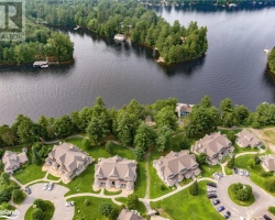
Maps of Gilleach Lake
Topographical Map of Gilleach Lake in Bracebridge
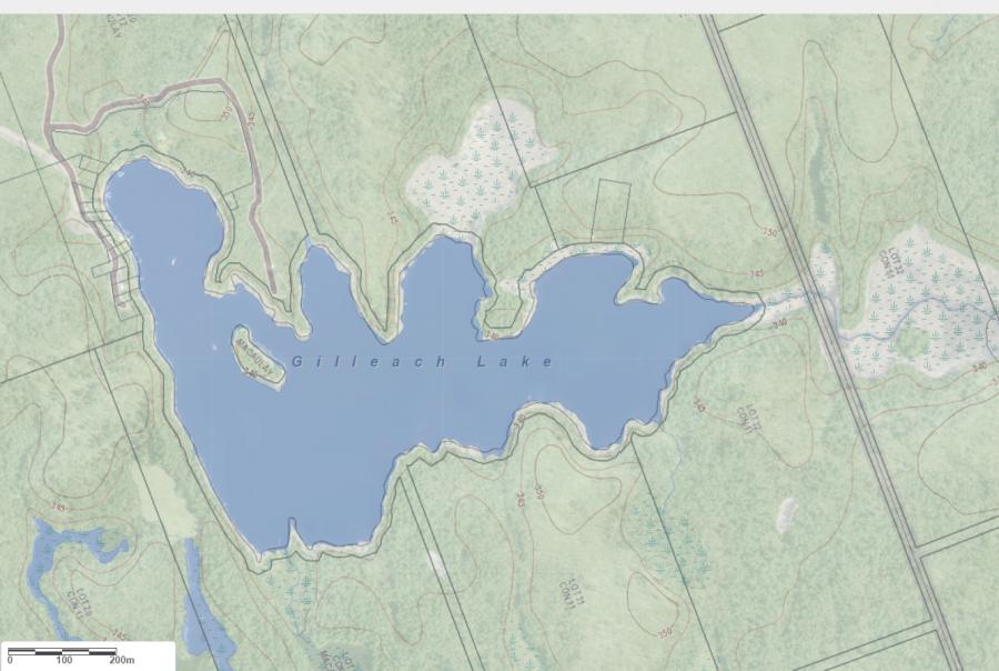
Legend
 Buildings surrounding Gilleach Lake
 Buildings surrounding Gilleach Lake
 Conservation Area surrounding Gilleach Lake
 Contours of land surrounding Gilleach Lake
 Index Contour
 Rapids
 Spot Height
 Water Falls
 Water Falls/Rapids
 Waterbody Elevation
 Watercourse
 Wetland surrounding Gilleach Lake
 Wooded Area surrounding Gilleach Lake
Zoning Map of Gilleach Lake in Bracebridge
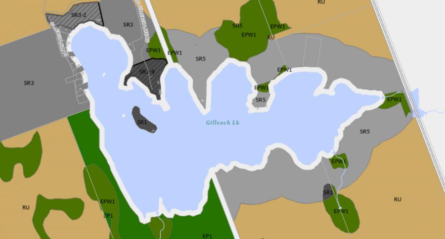
Legend of Bracebridge Zoning Map - Gilleach Lake
SR1 - Shoreline Residential 1EP1 - Environmentally Protected 1
RU - Rural
RR - Rural Residential
OP1 - Open Space 1
OP2 - Open Space 2
OP3 - Open Space 3
R1 - Residential
Crown Land Map of Gilleach Lake in Bracebridge
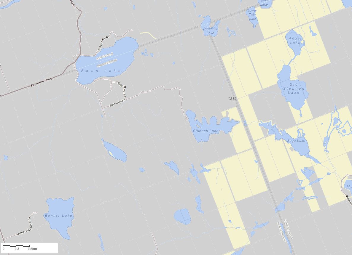
Legend for Crown Land Map
Private Land surrounding Gilleach Lake - (Bracebridge)Provincial Park surrounding Gilleach Lake - (Bracebridge)
Crown Land surrounding Gilleach Lake - (Bracebridge) (General Use)
Conservation Reserve surrounding Gilleach Lake - (Bracebridge)
Islands on Gilleach Lake in Bracebridge, Muskoka
| Official Name | Macaulay |
|---|---|
| Perimeter of Macaulay | 0.40 km (0.25 miles) |
| Area of Macaulay | 0.54 Hectares (1.33 Acres) |
| Properties on Macaulay | 1 |
| View on interactive Map | Locate Macaulay on Bing Maps |
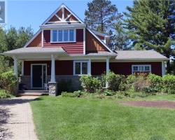
Cottages for Sale on Gilleach Lake - (Bracebridge)
Sorry no cottages for sale at the moment on Gilleach Lake (Bracebridge)
Cottages for Sale close to Gilleach Lake
Previously listed Cottages on Gilleach Lake
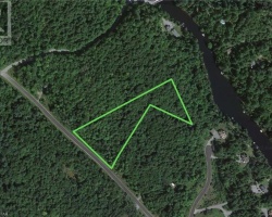
1117 Gilleach Lake Road, Port Sydney, P0B1L0 was previously listed 2021-07-15, mls# 40137671

Previously listed Cottages on Gilleach Lake
1117 Gilleach Lake Road, Port Sydney, P0B1L0 was previously listed 2021-07-15, mls# 40137671