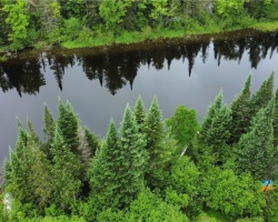
Bear Lake - (McMurrich)
There is another Bear Lake in the township of Livingstone in Algonquin Highlands
Average traveling time from the GTA to Bear Lake - (McMurrich) is 2 hours 47 min
This Lake Median Lake Average Lake | |
Bear Lake is 325 hectares (803 Acres) in size The median size lake in our area is 71 hectares or 175 Acres (average size 398 hectares) | 325 71 398 |
|
Bear Lake has a maximum depth 7 meters (23 ft)
The median depth of lakes in our area is 13.5 m or 44 ft (average depth 18 m) | 7 13.5 18 |
| The median depth of Bear Lake is 2.30 m (8 ft) | 2.30 5.2 7 |
|
Bear Lake Perimeter 14.20 km (8.82 Miles)
The median perimiter of lakes in our area is 3.3 km or 2.05 miles (average Perimiter 3.61 km) | 14.20 3.3 4 |
| Bear Lake Island/s Perimeter 0.80 km (0.5 Miles) | |
|
Bear Lake Altitude 315 m (1033 ft)
The median altitude of lakes in our area is 290 m or 951 ft (average Altitude is 289 m) | 315 290 289 |
|
Water Clarity of Bear Lake (median 3.2 m) 2.30 m (8ft)
The median Secchi Depth of lakes in our area is 3.2 m or 10 ft (average Secchi Depth is 3 m) | 2.30 3.2 3 |
| Bear Lake's watershed area feeding the Lake (excluding lake) 26.7 km2 (6598 acres) | |
| Bear Lake's percentage of shoreline which is Crown Land 10 % | |
| Bear Lake is in the Township of Monteith | |
| Local Name of Bear Lake is Bear Lake | |
| Shoreline Development on Bear Lake is: High; shoreline residential | |
| Public Access to Bear Lake public: Beach Street off Highway 518 Boat Launch | |
| Water Level Management not regulated | |
| Major Fish Species in Bear Lake (I), (I), (I), , | |
| Other Fish Species in Bear Lake , , Iowa darter, , johnny darter, golden shiner , | |
| Notes: E: extirpated, I: introduced – intentional or accidental, O: occasional, R: remnant, S: currently stocked, ?: status uncertain, 2009: year of first record or introduction if known, blank: presumed native | |
| Much of the above data for Bear Lake is compliments of the Muskoka Water Web maintained by The District Municipality of Muskoka | |
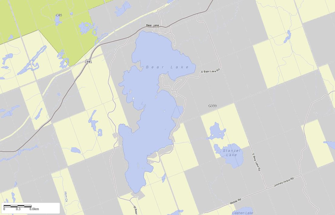
Maps of Bear Lake
Topographical Map of Bear Lake in McMurrich

Legend
 Buildings surrounding Bear Lake
 Buildings surrounding Bear Lake
 Conservation Area surrounding Bear Lake
 Contours of land surrounding Bear Lake
 Index Contour
 Rapids
 Spot Height
 Water Falls
 Water Falls/Rapids
 Waterbody Elevation
 Watercourse
 Wetland surrounding Bear Lake
 Wooded Area surrounding Bear Lake
Crown Land Map of Bear Lake in McMurrich
Legend for Crown Land Map
Private Land surrounding Bear Lake - (McMurrich)Provincial Park surrounding Bear Lake - (McMurrich)
Crown Land surrounding Bear Lake - (McMurrich) (General Use)
Conservation Reserve surrounding Bear Lake - (McMurrich)
Lake Contour Maps showing the depths of Bear Lake
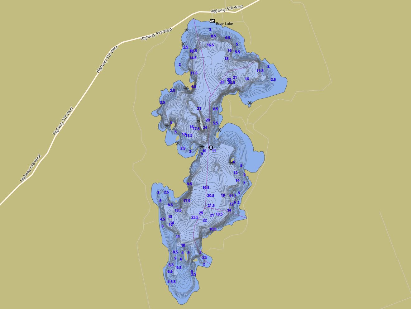
This map is courtesy of Gps Nautical Maps and you can purchase this map as an app from GpsNauticalCharts.com
All measurements of the countour map showing the depths of Bear Lake are in feet.
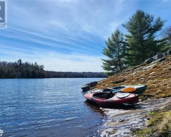
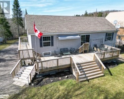
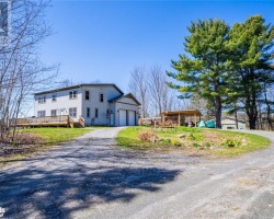
Cottages for Sale on Bear Lake
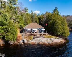
Cottages for Sale close to Bear Lake
Previously listed Cottages on Bear Lake
753 WEST BEAR LAKE Road, Sprucedale, P0A1P0 was previously listed 2024-02-12, mls# 40539923
20 BREEZY POINT Road, Sprucedale, P0A1Y0 was previously listed 2023-10-23, mls# 40458200
753 WEST BEAR LAKE Road, Sprucedale, P0A1P0 was previously listed 2023-10-20, mls# 40460972
753 WEST BEAR LAKE Road, Sprucedale, P0A1P0 was previously listed 2023-08-03, mls# 40440717
555 WEST BEAR LAKE RD Road, Sprucedale, P0A1R0 was previously listed 2023-04-26, mls# 40403475
2442 BEAR LAKE Road, Dorset, P0A1E0 was previously listed 2022-12-14, mls# 40334579
1131 BEAR Lake, Dorset, P0A1E0 was previously listed 2022-06-01, mls# 40262818
80 Sanborn Drive, Sprucedale, P0A1Y0 was previously listed 2021-11-25, mls# 40185961
45 Redam Road, Sprucedale, P0A1Y0 was previously listed 2021-11-09, mls# 40183135
11165 Bear Lake - Wao, Dorset, P0A1E0 was previously listed 2021-08-26, mls# 40155350
N/a (10715) Bear Lake, Dorset, P0A1E0 was previously listed 2021-07-29, mls# 40101857
0 West Bear Lake Road, Sprucedale, P0A1Y0 was previously listed 2021-06-30, mls# 40131440
10705 Bear Lake, Dorset, P0A1E0 was previously listed 2021-06-22, mls# 40101847
1010 Cottontail Lane, Dorset, P0A1E0 was previously listed 2021-06-11, mls# 40122489
764 East Bear Lake Road, Sprucedale, P0A1Y0 was previously listed 2021-06-02, mls# 40104501
0 Madill Road, Gooderham, K0M1R0 was previously listed 2021-04-10, mls# 40093247
Sanborn Drive S, Sprucedale, P0A1Y0 was previously listed 2020-11-24, mls# 234848
2395 Bear Lake Road, Dorset, P0A 1E0 was previously listed 2020-08-23, mls# 224477
653 East Bear Lake Road, Sprucedale, P0A1Y0 was previously listed 2020-03-14, mls# 243907
75 Bayside Drive, Sprucedale, P0A 1Y0 was previously listed 2019-11-02, mls# 214349
81 Bayside Drive, Sprucedale, P0A 1Y0 was previously listed 2019-08-20, mls# 211571