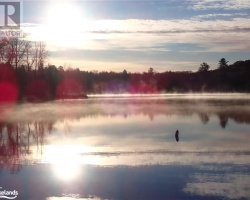
Axe Lake - (McMurrich)
Average traveling time from the GTA to Axe Lake - (McMurrich) is 2 hours 52 mins
This Lake Median Lake Average Lake | |
Axe Lake is 265 hectares (655 Acres) in size The median size lake in our area is 71 hectares or 175 Acres (average size 398 hectares) | 265 71 398 |
|
Axe Lake has a maximum depth 13 meters (43 ft)
The median depth of lakes in our area is 13.5 m or 44 ft (average depth 18 m) | 13 13.5 18 |
|
Axe Lake Altitude 323 m (1060 ft)
The median altitude of lakes in our area is 290 m or 951 ft (average Altitude is 289 m) | 323 290 289 |
|
Water Clarity of Axe Lake (median 3.2 m) 1.20 m (4ft)
The median Secchi Depth of lakes in our area is 3.2 m or 10 ft (average Secchi Depth is 3 m) | 1.20 3.2 3 |
| Axe Lake's watershed area feeding the Lake (excluding lake) 33.0 km2 (8154 acres) | |
| Drainage Basin of Axe Lake North Muskoka River | |
| Axe Lake's percentage of shoreline which is Crown Land 25 % | |
| Axe Lake is in the Township of Stisted | |
| Shoreline Development on Axe Lake is: low; recreation camp | |
| Public Access to Axe Lake by water via Axe Creek from Rome Road | |
| Water Level Management not regulated | |
| Major Fish Species in Axe Lake (I), (I) | |
| Other Fish Species in Axe Lake , , , cisco, Iowa darter, blacknose shiner | |
| Notes: E: extirpated, I: introduced – intentional or accidental, O: occasional, R: remnant, S: currently stocked, ?: status uncertain, 2009: year of first record or introduction if known, blank: presumed native | |
| Much of the above data for Axe Lake is compliments of the Muskoka Water Web maintained by The District Municipality of Muskoka | |
Maps of Axe Lake
Topographical Map of Axe Lake in McMurrich
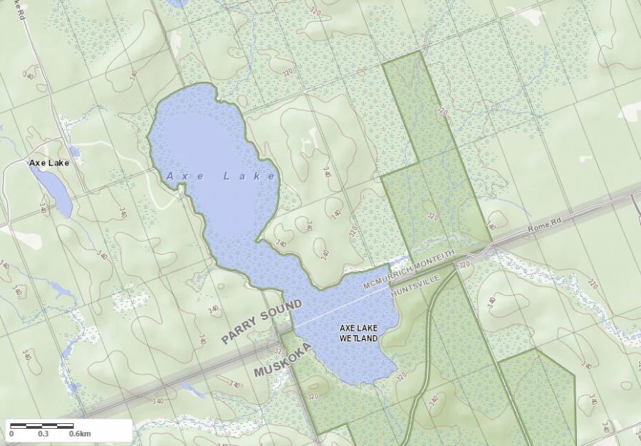
Legend
 Buildings surrounding Axe Lake
 Buildings surrounding Axe Lake
 Conservation Area surrounding Axe Lake
 Contours of land surrounding Axe Lake
 Index Contour
 Rapids
 Spot Height
 Water Falls
 Water Falls/Rapids
 Waterbody Elevation
 Watercourse
 Wetland surrounding Axe Lake
 Wooded Area surrounding Axe Lake
Crown Land Map of Axe Lake in McMurrich
Legend for Crown Land Map
Private Land surrounding Axe Lake - (McMurrich)Provincial Park surrounding Axe Lake - (McMurrich)
Crown Land surrounding Axe Lake - (McMurrich) (General Use)
Conservation Reserve surrounding Axe Lake - (McMurrich)
Cottages for Sale on Axe Lake - (McMurrich)
Sorry no cottages for sale at the moment on Axe Lake (McMurrich)
Cottages for Sale close to Axe Lake
Previously listed Cottages on Axe Lake
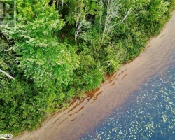
0 AXE LAKE Road, Sprucedale, P0A1Y0 was previously listed 2023-01-01, mls# 40288141
0 AXE LAKE Road, Sprucedale, P0A1Y0 was previously listed 2023-01-01, mls# 40288136
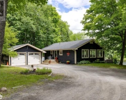
2411 Axe Lake Road, Sprucedale, P0A1Y0 was previously listed 2021-11-16, mls# 40142291
2411 Axe Lake Road, Sprucedale, P0A1Y0 was previously listed 2021-11-16, mls# 40142350
2411 Axe Lake Road, Sprucedale, P0A1Y0 was previously listed 2021-11-14, mls# 40142819
2411 Axe Lake Road, Sprucedale, P0A1Y0 was previously listed 2021-11-14, mls# 40142835
2411 Axe Lake Road, Sprucedale, P0A1Y0 was previously listed 2021-10-31, mls# 40141388
Previously listed Cottages on Axe Lake
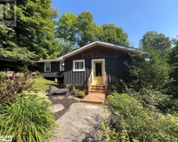
0 AXE LAKE Road, Sprucedale, P0A1Y0 was previously listed 2023-01-01, mls# 40288141
0 AXE LAKE Road, Sprucedale, P0A1Y0 was previously listed 2023-01-01, mls# 40288136
2411 Axe Lake Road, Sprucedale, P0A1Y0 was previously listed 2021-11-16, mls# 40142291
2411 Axe Lake Road, Sprucedale, P0A1Y0 was previously listed 2021-11-16, mls# 40142350
2411 Axe Lake Road, Sprucedale, P0A1Y0 was previously listed 2021-11-14, mls# 40142819
2411 Axe Lake Road, Sprucedale, P0A1Y0 was previously listed 2021-11-14, mls# 40142835
2411 Axe Lake Road, Sprucedale, P0A1Y0 was previously listed 2021-10-31, mls# 40141388