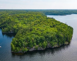
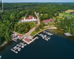
Barnes Lake - (Muskoka Lakes)
Average traveling time from the GTA to Barnes Lake - (Muskoka Lakes) is 2 hours 15 mins
This Lake Median Lake Average Lake | |
Barnes Lake is 67 hectares (166 Acres) in size The median size lake in our area is 71 hectares or 175 Acres (average size 398 hectares) | 67 71 398 |
|
Barnes Lake has a maximum depth 7 meters (23 ft)
The median depth of lakes in our area is 13.5 m or 44 ft (average depth 18 m) | 7 13.5 18 |
|
Barnes Lake Altitude 312 m (1024 ft)
The median altitude of lakes in our area is 290 m or 951 ft (average Altitude is 289 m) | 312 290 289 |
|
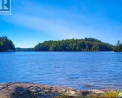
Water Clarity of Barnes Lake (median 3.2 m) 3.60 m (12ft)
The median Secchi Depth of lakes in our area is 3.2 m or 10 ft (average Secchi Depth is 3 m) | 3.60 3.2 3 |
| Barnes Lake's watershed area feeding the Lake (excluding lake) 2.6 km2 (642 acres) | |
| Drainage Basin of Barnes Lake Skeleton River | |
| Barnes Lake's percentage of shoreline which is Crown Land 95 % | |
| Barnes Lake is in the Township of Cardwell | |
| Local Name of Barnes Lake is Big Long Lake | |
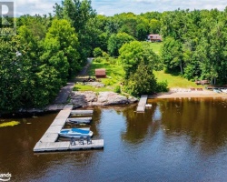
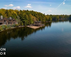
| Shoreline Development on Barnes Lake is: very low; recreation camp | |
| Public Access to Barnes Lake unknown; may be accessible by a trail from Fish Hatchery Road, but beginning of trail may be on private land | |
| Water Level Management not regulated | |
| Major Fish Species in Barnes Lake largemouth Bass (I 2017), (?), | |
| Notes: E: extirpated, I: introduced – intentional or accidental, O: occasional, R: remnant, S: currently stocked, ?: status uncertain, 2009: year of first record or introduction if known, blank: presumed native | |
| Much of the above data for Barnes Lake is compliments of the Muskoka Water Web maintained by The District Municipality of Muskoka | |
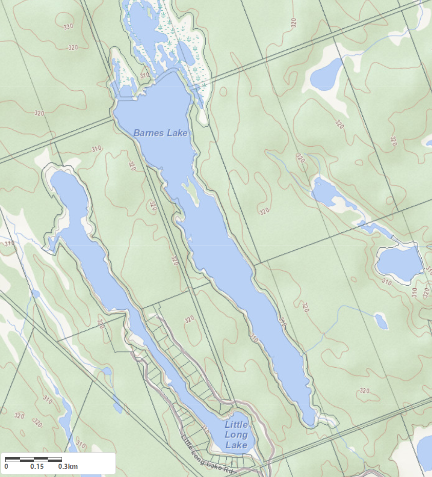
Maps of Barnes Lake
Topographical Map of Barnes Lake in Muskoka Lakes
Legend
 Buildings surrounding Barnes Lake
 Buildings surrounding Barnes Lake
 Conservation Area surrounding Barnes Lake
 Contours of land surrounding Barnes Lake
 Index Contour
 Rapids
 Spot Height
 Water Falls
 Water Falls/Rapids
 Waterbody Elevation
 Watercourse
 Wetland surrounding Barnes Lake
 Wooded Area surrounding Barnes Lake
Zoning Map of Barnes Lake in Muskoka Lakes
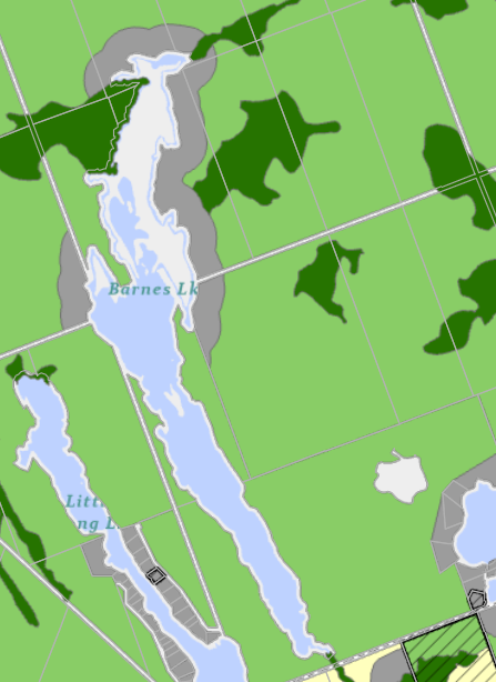
Legend of Muskoka Lakes Zoning Map - Barnes Lake
Waterfront ResidentialEnvironmentally Protected
Community Residential
Open Space
Rural
Residential Rural
Waterfront Landing
Waterfront Commercial
Waterbody Open Space
Crown Land Map of Barnes Lake in Muskoka Lakes
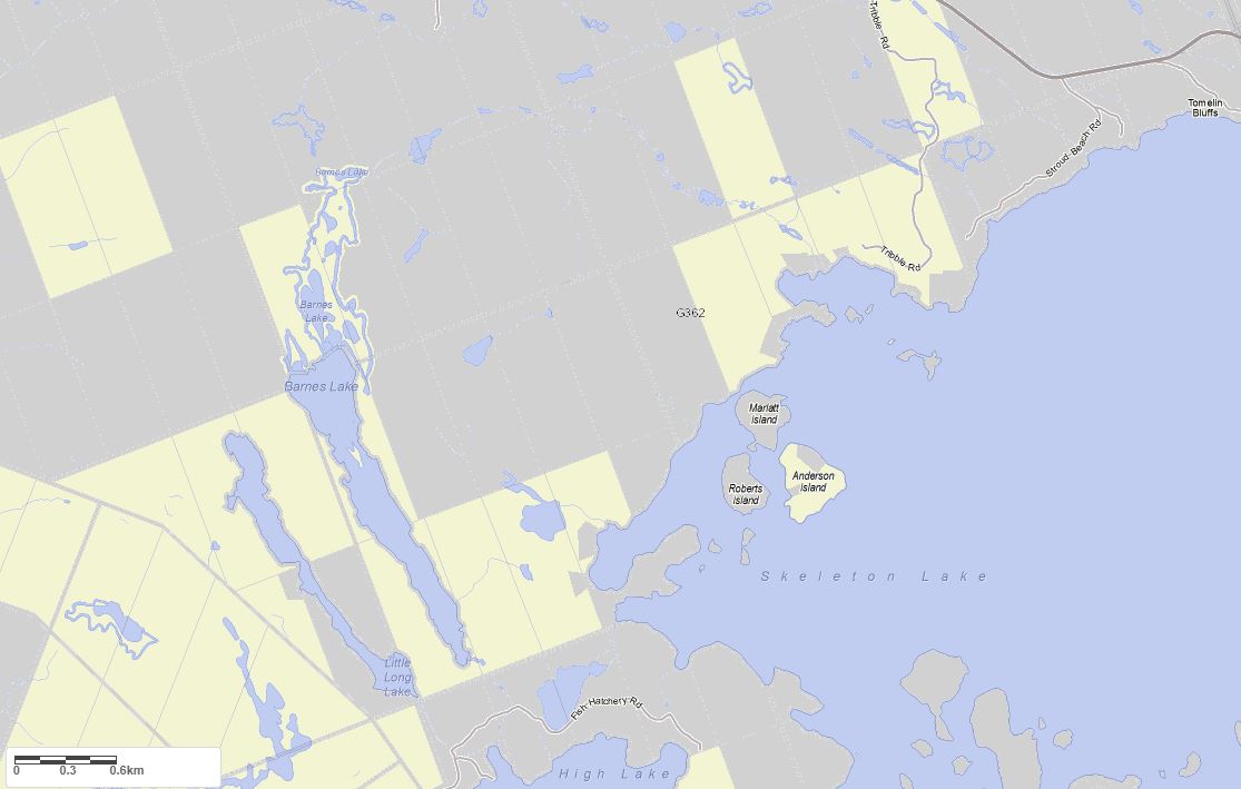
Legend for Crown Land Map
Private Land surrounding Barnes Lake - (Muskoka Lakes)Provincial Park surrounding Barnes Lake - (Muskoka Lakes)
Crown Land surrounding Barnes Lake - (Muskoka Lakes) (General Use)
Conservation Reserve surrounding Barnes Lake - (Muskoka Lakes)
Cottages for Sale on Barnes Lake - (Muskoka Lakes)
Sorry no cottages for sale at the moment on Barnes Lake (Muskoka Lakes)