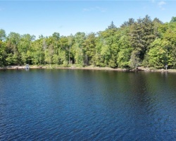
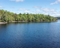
Ainslie Lake - (Whitestone)
Average traveling time from the GTA to Ainslie Lake - (Whitestone) is 2 hours 46 mins
This Lake Median Lake Average Lake | |
Ainslie Lake is 10 hectares (25 Acres) in size The median size lake in our area is 71 hectares or 175 Acres (average size 398 hectares) | 10 71 398 |
|
Ainslie Lake has a maximum depth 4 meters (13 ft)
The median depth of lakes in our area is 13.5 m or 44 ft (average depth 18 m) | 4 13.5 18 |
| The median depth of Ainslie Lake is 1.00 m (3 ft) | 1.00 5.2 7 |
|
Ainslie Lake Perimeter 1.60 km (0.99 Miles)
The median perimiter of lakes in our area is 3.3 km or 2.05 miles (average Perimiter 3.61 km) | 1.60 3.3 4 |
|
Ainslie Lake Altitude 245 m (804 ft)
The median altitude of lakes in our area is 290 m or 951 ft (average Altitude is 289 m) | 245 290 289 |
|
Water Clarity of Ainslie Lake (median 3.2 m) 1.80 m (6ft)
The median Secchi Depth of lakes in our area is 3.2 m or 10 ft (average Secchi Depth is 3 m) | 1.80 3.2 3 |
| Ainslie Lake's watershed area feeding the Lake (excluding lake) 1.9 km2 (469 acres) | |
| Drainage Basin of Ainslie Lake Magnetawan River | |
| Ainslie Lake is in the Township of McKenzie | |
| Shoreline Development on Ainslie Lake is: low; shoreline residential | |
| Public Access to Ainslie Lake unknown | |
| Water Level Management not regulated | |
| Major Fish Species in Ainslie Lake , , | |
| Other Fish Species in Ainslie Lake | |
| Notes: E: extirpated, I: introduced – intentional or accidental, O: occasional, R: remnant, S: currently stocked, ?: status uncertain, 2009: year of first record or introduction if known, blank: presumed native | |
| Much of the above data for Ainslie Lake is compliments of the Muskoka Water Web maintained by The District Municipality of Muskoka | |
Maps of Ainslie Lake
Topographical Map of Ainslie Lake in Whitestone
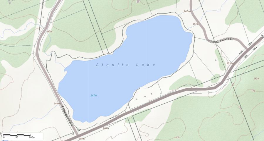
Legend
 Buildings surrounding Ainslie Lake
 Buildings surrounding Ainslie Lake
 Conservation Area surrounding Ainslie Lake
 Contours of land surrounding Ainslie Lake
 Index Contour
 Rapids
 Spot Height
 Water Falls
 Water Falls/Rapids
 Waterbody Elevation
 Watercourse
 Wetland surrounding Ainslie Lake
 Wooded Area surrounding Ainslie Lake
Crown Land Map of Ainslie Lake in Whitestone
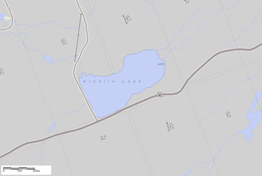
Legend for Crown Land Map
Private Land surrounding Ainslie Lake - (Whitestone)Provincial Park surrounding Ainslie Lake - (Whitestone)
Crown Land surrounding Ainslie Lake - (Whitestone) (General Use)
Conservation Reserve surrounding Ainslie Lake - (Whitestone)
Cottages for Sale on Ainslie Lake - (Whitestone)
Sorry no cottages for sale at the moment on Ainslie Lake (Whitestone)
Cottages for Sale close to Ainslie Lake
Previously listed Cottages on Ainslie Lake
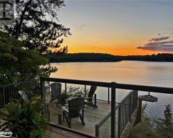
50 AINSLIE LAKE Drive, Whitestone, P0A1G0 was previously listed 2023-03-05, mls# 40356467
50 AINSLIE LAKE Drive, Whitestone, P0A1G0 was previously listed 2022-12-01, mls# 40329079
50 AINSLIE LAKE Drive, Whitestone, P0A1G0 was previously listed 2022-09-27, mls# 40303105
50 AINSLIE LAKE Drive, Whitestone, P0A1G0 was previously listed 2022-08-01, mls# 40295720
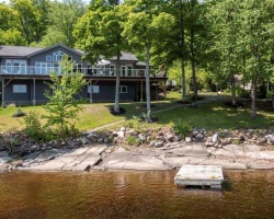
66 Ainslie Lake Drive, Parry Sound, P0A1G0 was previously listed 2021-03-03, mls# 40066416
0 Ainslie Lake Drive, Whitestone, P0A1G0 was previously listed 2021-02-13, mls# 40055458
0 Ainslie Lake Drive, Whitestone, P0A1G0 was previously listed 2021-01-01, mls# 40031814
Previously listed Cottages on Ainslie Lake
50 AINSLIE LAKE Drive, Whitestone, P0A1G0 was previously listed 2023-03-05, mls# 40356467
50 AINSLIE LAKE Drive, Whitestone, P0A1G0 was previously listed 2022-12-01, mls# 40329079
50 AINSLIE LAKE Drive, Whitestone, P0A1G0 was previously listed 2022-09-27, mls# 40303105
50 AINSLIE LAKE Drive, Whitestone, P0A1G0 was previously listed 2022-08-01, mls# 40295720
66 Ainslie Lake Drive, Parry Sound, P0A1G0 was previously listed 2021-03-03, mls# 40066416
0 Ainslie Lake Drive, Whitestone, P0A1G0 was previously listed 2021-02-13, mls# 40055458
0 Ainslie Lake Drive, Whitestone, P0A1G0 was previously listed 2021-01-01, mls# 40031814