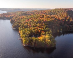
Longline Lake - (Lake of Bays)
Average traveling time from the GTA to Longline Lake - (Lake of Bays) is 2 hours 12 mins
This Lake Median Lake Average Lake | |
Longline Lake is 27 hectares (67 Acres) in size The median size lake in our area is 71 hectares or 175 Acres (average size 398 hectares) | 27 71 398 |
|
Longline Lake has a maximum depth 17 meters (56 ft)
The median depth of lakes in our area is 13.5 m or 44 ft (average depth 18 m) | 17 13.5 18 |
| The median depth of Longline Lake is 7.00 m (23 ft) | 7.00 5.2 7 |
|
Longline Lake Perimeter 4.00 km (2.49 Miles)
The median perimiter of lakes in our area is 3.3 km or 2.05 miles (average Perimiter 3.61 km) | 4.00 3.3 4 |
|
Longline Lake Altitude 335 m (1099 ft)
The median altitude of lakes in our area is 290 m or 951 ft (average Altitude is 289 m) | 335 290 289 |
|
Water Clarity of Longline Lake (median 3.2 m) 6.50 m (21ft)
The median Secchi Depth of lakes in our area is 3.2 m or 10 ft (average Secchi Depth is 3 m) | 6.50 3.2 3 |
|
Longline Lake's phosphorus content in water is 6.80 ug/L
The median Phosphorus content in the water of lakes in our area is 8 ug/l (average Phosphorus content 9 ug/L | 6.80 8 9 |
| Longline Lake's watershed area feeding the Lake (excluding lake) 1.0 km2 (247 acres) | |
| Lake Trout found in Longline Lake: No | |
| Drainage Basin of Longline Lake Lake of Bays | |
| Longline Lake is in the Township of Ridout | |
| Shoreline Development on Longline Lake is: moderate; commercial, shoreline residential | |
| Public Access to Longline Lake public; unopened road allowance off Longline Lake Road; canoe/small boat | |
| Water Level Management not regulated | |
| Major Fish Species in Longline Lake (I), , (R), (R?), splake (S) | |
| Other Fish Species in Longline Lake , , , pearl dace, creek chub | |
| Notes: E: extirpated, I: introduced – intentional or accidental, O: occasional, R: remnant, S: currently stocked, ?: status uncertain, 2009: year of first record or introduction if known, blank: presumed native | |
| Much of the above data for Longline Lake is compliments of the Muskoka Water Web maintained by The District Municipality of Muskoka | |
Maps of Longline Lake
Topographical Map of Longline Lake in Lake of Bays
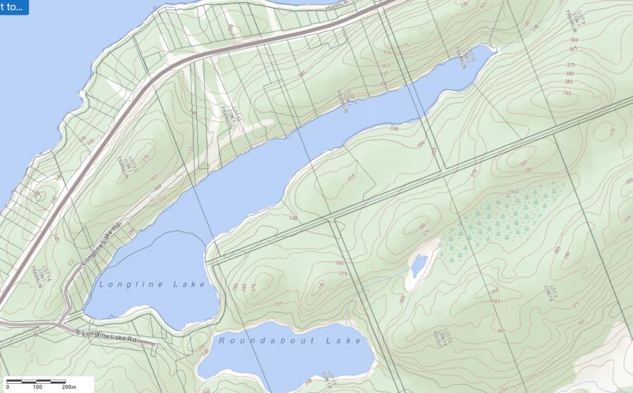
Legend
 Buildings surrounding Longline Lake
 Buildings surrounding Longline Lake
 Conservation Area surrounding Longline Lake
 Contours of land surrounding Longline Lake
 Index Contour
 Rapids
 Spot Height
 Water Falls
 Water Falls/Rapids
 Waterbody Elevation
 Watercourse
 Wetland surrounding Longline Lake
 Wooded Area surrounding Longline Lake
Zoning Map of Longline Lake in Lake of Bays
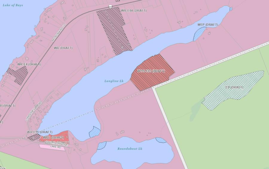
Legend of Lake of Bays Zoning Map - Longline Lake
WR - Waterfront Residential 1RU - Rural
OS - Open Space
CSR - Community Settlement Residential
RL - Rural Limited
WOS - Waterfront Open Space
RR - Rural Residential
Crown Land Map of Longline Lake in Lake of Bays
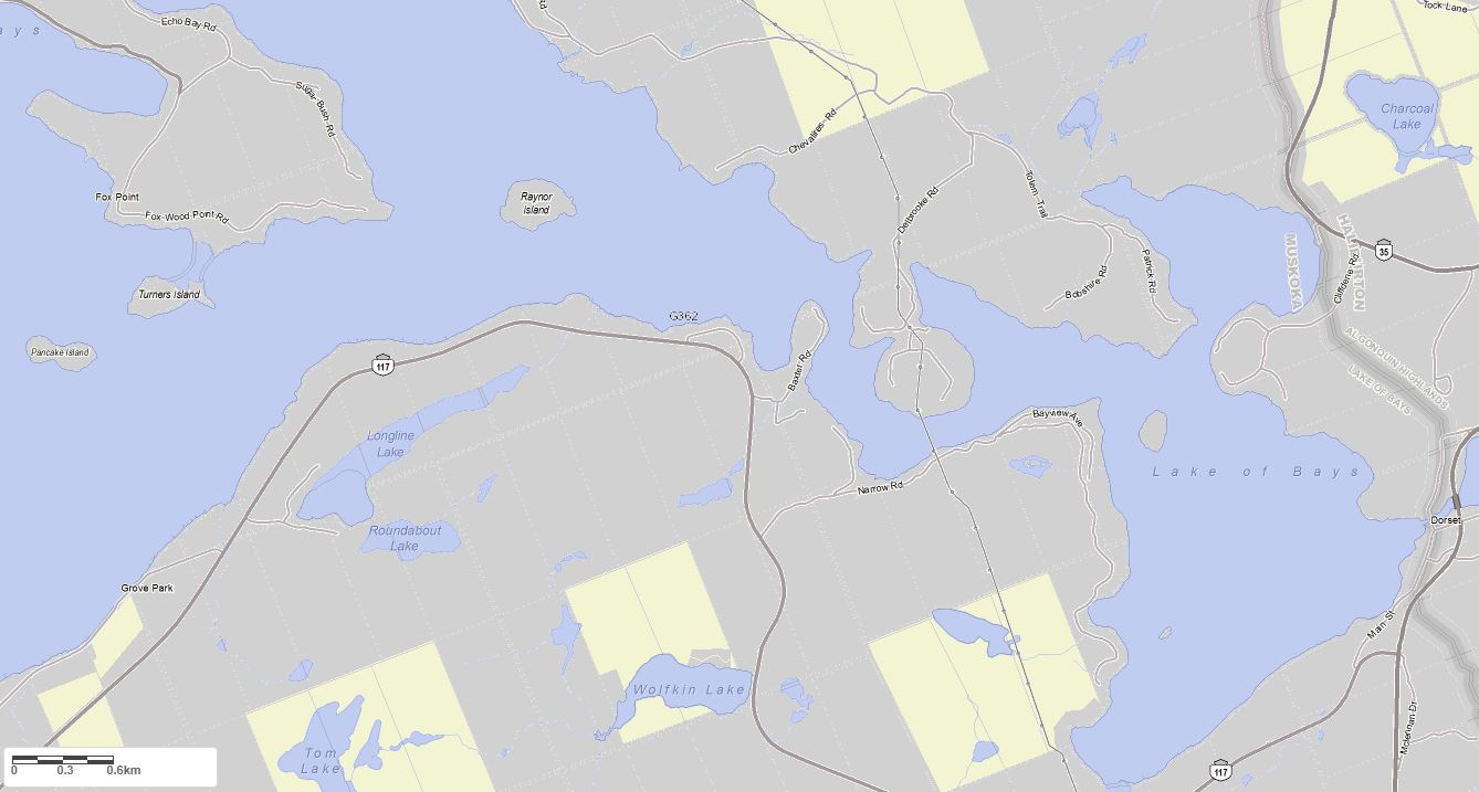
Legend for Crown Land Map
Private Land surrounding Longline Lake - (Lake of Bays)Provincial Park surrounding Longline Lake - (Lake of Bays)
Crown Land surrounding Longline Lake - (Lake of Bays) (General Use)
Conservation Reserve surrounding Longline Lake - (Lake of Bays)
Lake Contour Maps showing the depths of Longline Lake
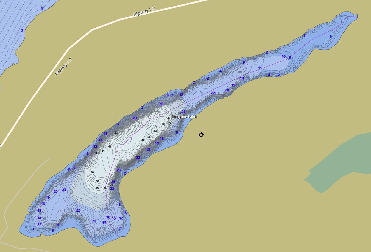
This map is courtesy of Gps Nautical Maps and you can purchase this map as an app from GpsNauticalCharts.com
All measurements of the countour map showing the depths of Longline Lake are in feet.
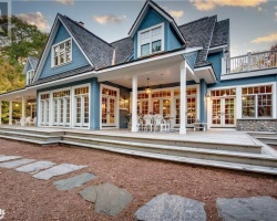
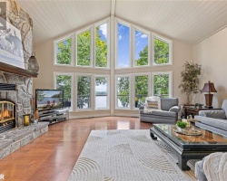
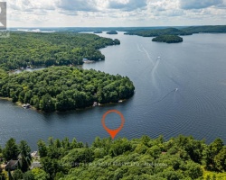
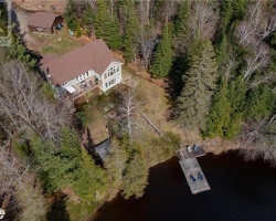
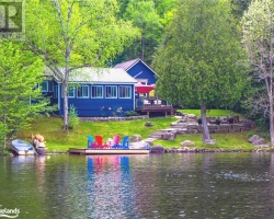
Cottages for Sale on Longline Lake
Cottages for Sale close to Longline Lake
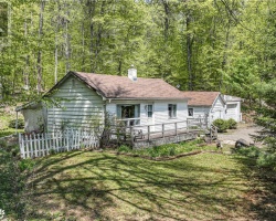
Previously listed Cottages on Longline Lake
1041 LONG LINE LAKE Road, Baysville, P0B1A0 was previously listed 2023-10-03, mls# 40469603
1034 LONG LINE LAKE Road, Baysville, P0B1A0 was previously listed 2023-03-05, mls# 40359954
1034 LONG LINE LAKE Road, Baysville, P0B1A0 was previously listed 2022-12-23, mls# 40336396
1034 LONG LINE LAKE Road, Baysville, P0B1A0 was previously listed 2022-10-05, mls# 40321986
1046 LONG LINE LAKE Road, Dorset, P0A1E0 was previously listed 2022-08-13, mls# 40300500
1046 LONG LINE LAKE Road, Dorset, P0A1E0 was previously listed 2022-08-13, mls# 40301609
Muskoka Road 117 Highway, Dorset, P0A 1E0 was previously listed 2020-02-26, mls# 238423
Muskoka Road 117 Highway, Dorset, P0A 1E0 was previously listed 2019-12-27, mls# 170122
1048 Longline Lake Road, Baysville, P0A 1A0 was previously listed 2019-12-27, mls# 217709