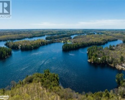
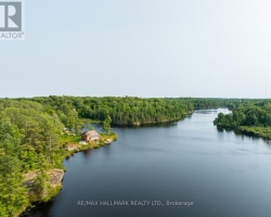
Long Lake - (McDougall)
There another 4 Long Lake's : Long Lake in Wood of Muskoka Lakes Long Lake in Draper of Bracebridge Long Lake in Foley of Seguin Long Lake in Proudfoot of Kearney
This Lake Median Lake Average Lake | |
Long Lake is 24 hectares (59 Acres) in size The median size lake in our area is 71 hectares or 175 Acres (average size 398 hectares) | 24 71 398 |
|
Long Lake has a maximum depth 10 meters (33 ft)
The median depth of lakes in our area is 13.5 m or 44 ft (average depth 18 m) | 10 13.5 18 |
| The median depth of Long Lake is 4.00 m (13 ft) | 4.00 5.2 7 |
|
Long Lake Perimeter 4.50 km (2.8 Miles)
The median perimiter of lakes in our area is 3.3 km or 2.05 miles (average Perimiter 3.61 km) | 4.50 3.3 4 |
|
Long Lake Altitude 250 m (820 ft)
The median altitude of lakes in our area is 290 m or 951 ft (average Altitude is 289 m) | 250 290 289 |
|
Water Clarity of Long Lake (median 3.2 m) 2.80 m (9ft)
The median Secchi Depth of lakes in our area is 3.2 m or 10 ft (average Secchi Depth is 3 m) | 2.80 3.2 3 |
| Long Lake's watershed area feeding the Lake (excluding lake) 3.3 km2 (815 acres) | |
| Drainage Basin of Long Lake Seguin River | |
| Long Lake is in the Township of Ferguson | |
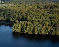
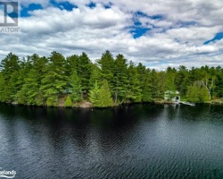
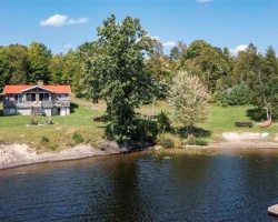
| Shoreline Development on Long Lake is: Low; Shoreline residential | |
| Public Access to Long Lake Private | |
| Water Level Management Not regulated | |
| Major Fish Species in Long Lake Largemouth Bass | |
| Other Fish Species in Long Lake White Sucker, Yellow Perch | |
| Notes: E: extirpated, I: introduced – intentional or accidental, O: occasional, R: remnant, S: currently stocked, ?: status uncertain, 2009: year of first record or introduction if known, blank: presumed native | |
| Much of the above data for Long Lake is compliments of the Muskoka Water Web maintained by The District Municipality of Muskoka | |
Maps of Long Lake
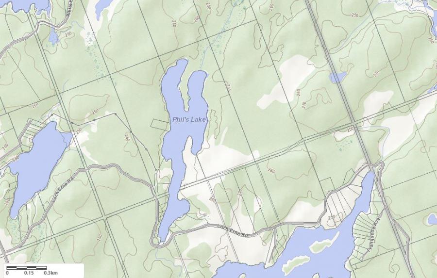
Topographical Map of Long Lake in McDougall
Legend
 Buildings surrounding Long Lake
 Buildings surrounding Long Lake
 Conservation Area surrounding Long Lake
 Contours of land surrounding Long Lake
 Index Contour
 Rapids
 Spot Height
 Water Falls
 Water Falls/Rapids
 Waterbody Elevation
 Watercourse
 Wetland surrounding Long Lake
 Wooded Area surrounding Long Lake
Zoning Map of Long Lake in McDougall
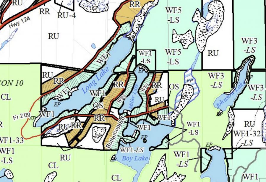
Crown Land Map of Long Lake in McDougall
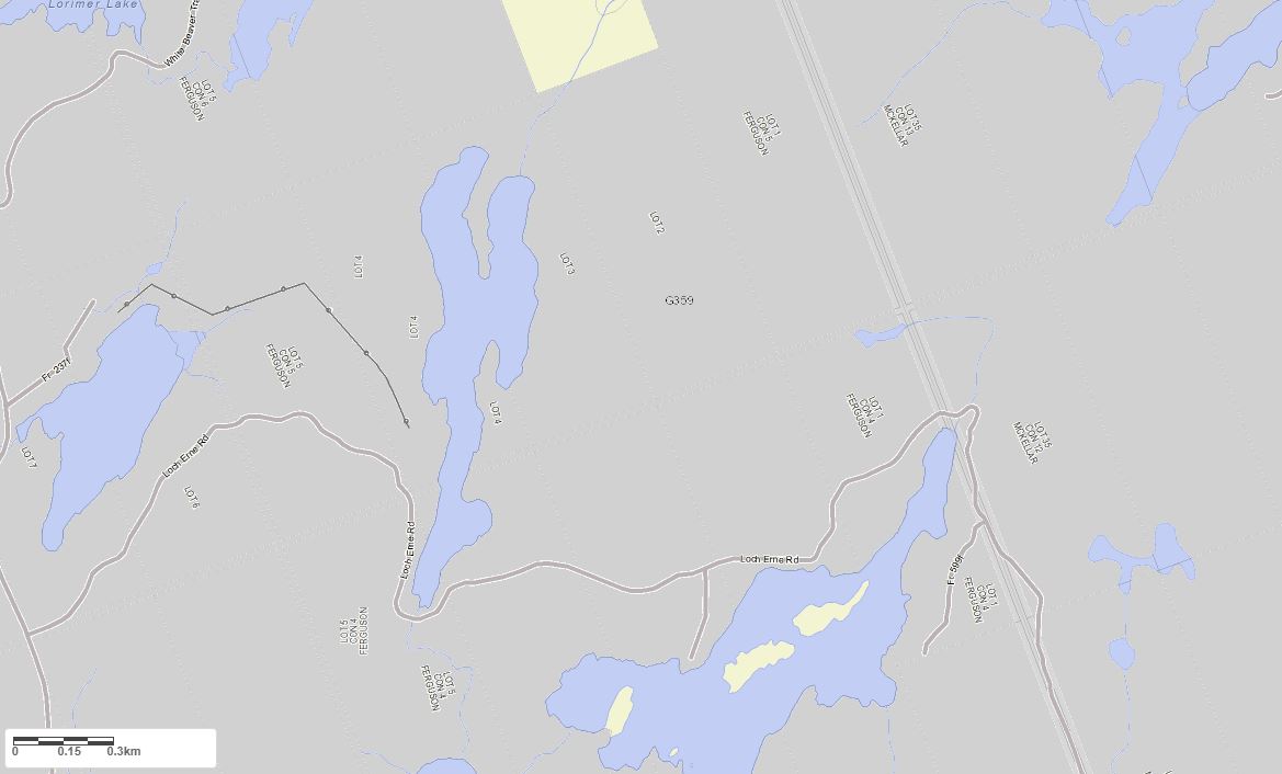
Legend for Crown Land Map
Private Land surrounding Long Lake - (McDougall)Provincial Park surrounding Long Lake - (McDougall)
Crown Land surrounding Long Lake - (McDougall) (General Use)
Conservation Reserve surrounding Long Lake - (McDougall)
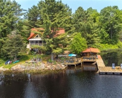
Cottages for Sale on Long Lake
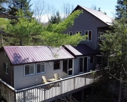
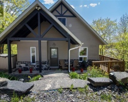
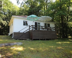
Cottages for Sale close to Long Lake
Previously listed Cottages on Long Lake
1299 Precipice Road, Haliburton, K0M1S0 was previously listed 2024-06-06, mls# 40601648
36 Beaver Trail, McDougall, P2A2W7 was previously listed 2024-04-24, mls# 40576783
1066 Windsor Drive, Bala, P0C1A0 was previously listed 2024-04-22, mls# 40575628
1299 Precipice Road, Haliburton, K0M1S0 was previously listed 2024-03-19, mls# 40554184
84 PINEWOOD Road, McDougall, P2A2W7 was previously listed 2024-02-09, mls# 40537707
1066 WINDSOR Drive, Bala, P0C1A0 was previously listed 2023-10-31, mls# 40417226
84 PINEWOOD Road, McDougall, P2A2W7 was previously listed 2023-10-31, mls# 40477047
2797 MUSKOKA ROAD 169, Muskoka Lakes, P0B1J0 was previously listed 2023-09-02, mls# 40466537
1039 MINK Road, Haliburton, K0M1S0 was previously listed 2023-04-16, mls# 40387473
1039 MINK Road, Haliburton, K0M1S0 was previously listed 2022-12-16, mls# 40323510
12 PINEWOOD Road, McDougall, P2A2W8 was previously listed 2022-11-02, mls# 40321137
1028 WINDSOR Drive, Bala, P0C1A0 was previously listed 2022-11-01, mls# 40273921
1299 PRECIPICE Road, Haliburton, K0M1S0 was previously listed 2022-10-21, mls# 40323404
1299 PRECIPICE Road, Haliburton, K0M1S0 was previously listed 2022-09-15, mls# 40298737
1154 LONG LAKE Road, Haliburton, K0M1S0 was previously listed 2022-09-04, mls# 40291863
2873 MUSKOKA DISTRICT ROAD 169, Bala, P0C1A0 was previously listed 2022-07-01, mls# 40272726
1377 OWL BAY Trail, Haliburton, K0M1S0 was previously listed 2022-07-01, mls# 40240791
1063 MINK Road, Haliburton, K0M1S0 was previously listed 2022-07-01, mls# 40266173
1053 MINK Road, Haliburton, K0M1S0 was previously listed 2022-03-18, mls# 40218542
341 Haskett's Drive, Port Severn, L0K1S0 was previously listed 2021-11-04, mls# 40183293
341 Haskett's Drive, Port Severn, L0K1S0 was previously listed 2021-10-31, mls# 40154175
1223 Precipice Road, Haliburton, K0M1S0 was previously listed 2021-10-27, mls# 40172235
1113 Precipice Road, Haliburton, K0M1S0 was previously listed 2021-09-11, mls# 40160111
3011 District Road #169 Unit# 1,2,3, Bala, P0C1A0 was previously listed 2021-08-04, mls# 40127053
1299 Precipice Road, Haliburton, K0M1S0 was previously listed 2021-07-23, mls# 40143945
0 Miskwabi Lake Road, Haliburton, K0M1S0 was previously listed 2021-07-20, mls# 40130025
1132 Pavilion Lane, Haliburton, K0M1S0 was previously listed 2021-05-12, mls# 40105202
1082 Windsor Drive, Bala, P0B1J0 was previously listed 2021-05-08, mls# 40101018
1045 Precipice Road, Haliburton, K0M1S0 was previously listed 2021-05-06, mls# 40106408
1071 Mink Road, Haliburton, K0M1S0 was previously listed 2021-04-28, mls# 40098582
2921 Muskoka Road 169 Road, Bala, P0C1M0 was previously listed 2021-04-22, mls# 40090217
2795 Muskoka Road 169 Road, Bala, P1P1R2 was previously listed 2021-04-20, mls# 40092786
1088 Long Lake Rd Private, Bala, P0C1M0 was previously listed 2021-04-09, mls# 40089137
2931 Muskoka District Road 169 ., Bala, P0C1A0 was previously listed 2020-12-01, mls# 40022678
2825 Muskoka Rd 169 Highway, Bala, P0C1A0 was previously listed 2020-11-03, mls# 40037246
2931 Muskoka District Road 169 ., Bala, P0C1A0 was previously listed 2020-10-22, mls# 40022678
. Long Lake Wao ., Dudley, K0M1S0 was previously listed 2020-10-21, mls# 258549
- Precipice Road, Haliburton, K0M1S0 was previously listed 2020-10-16, mls# 40024645
1060 Long Lake Road, Bala, P0C1A0 was previously listed 2020-10-14, mls# 40029850
1021 Bluffs Break Court, Haliburton, K0M1S0 was previously listed 2020-10-14, mls# 40016374
1041 Odessa Trail, Haliburton, K0M1S0 was previously listed 2020-10-03, mls# 270393
1033 Serendipity Trail, Haliburton, K0M1S0 was previously listed 2020-09-26, mls# 40021921
1171 Precipice Road, Haliburton, K0M1S0 was previously listed 2020-08-08, mls# 245979
Precipice Road, Haliburton, K0M 1S0 was previously listed 2020-07-25, mls# 220767
78 Pinewood Road, McDougall, P2A2W7 was previously listed 2020-07-16, mls# 251684
1041 Odessa Trail, Haliburton, K0M1S0 was previously listed 2020-07-02, mls# 245433
1057 Mink Road, Haliburton, K0M1S0 was previously listed 2020-02-26, mls# 239456
1100 Mink Road, Haliburton, K0M 1S0 was previously listed 2019-12-27, mls# 221367
Precipice Road, Haliburton, K0M 1S0 was previously listed 2019-12-27, mls# 180456
1339 Precipice Road, Haliburton, K0M 1S0 was previously listed 2019-12-27, mls# 216984
Precipice Road, Haliburton, K0M 1S0 was previously listed 2019-12-27, mls# 217321
1039 Mink Road, Haliburton, K0M 1S0 was previously listed 2019-11-04, mls# 216999
1041 Odessa Trail, Haliburton, K0M 1S0 was previously listed 2019-11-02, mls# 180104
1041 Odessa Trail, Haliburton, K0M 1S0 was previously listed 2019-11-02, mls# 200240
1053 Mink Road, Haliburton, K0M 1S0 was previously listed 2019-10-30, mls# 214331
1145 Mink Road, Haliburton, K0M 1S0 was previously listed 2019-10-20, mls# 207336
1377 Owl Bay Trail, Haliburton, K0M 1S0 was previously listed 2019-10-16, mls# 200041
520 Boundary Road, Perry, P0A 1J0 was previously listed 2019-09-14, mls# 194276
520 Boundary Road, Perry, P0A 1J0 was previously listed 2019-09-14, mls# 194277
1144 Long Lake Road, Haliburton, K0M 1S0 was previously listed 2019-09-12, mls# 213009
1053 Mink Road, Haliburton, K0M 1S0 was previously listed 2019-08-08, mls# 198876
Precipice Road, Haliburton, K0M 1S0 was previously listed 2019-08-06, mls# 169312
1339 Precipice Road, Haliburton, K0M 1S0 was previously listed 2019-08-06, mls# 169291