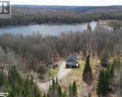
Head Lake - (Haliburton)
Head Lake is located in the transition zone between the limestone belt to the south and the Precambrian country to the north. As a result, it has a great variety of waterfront types, ranging from flat, level and landscaped lots to smooth, rugged granite shoreline. The northern half of the lake has many Precambrian shoals, which makes it a very favourable lake for fishing and kayaking. It tends to be a quieter lake than others in the region.
Average traveling time from the GTA to Head Lake - (Haliburton) is 2 hours 20 mins
This Lake Median Lake Average Lake | |
Head Lake is 964 hectares (2382 Acres) in size The median size lake in our area is 71 hectares or 175 Acres (average size 398 hectares) | 964 71 398 |
|
Head Lake has a maximum depth 9 meters (30 ft)
The median depth of lakes in our area is 13.5 m or 44 ft (average depth 18 m) | 9 13.5 18 |
|
Head Lake Altitude 268 m (879 ft)
The median altitude of lakes in our area is 290 m or 951 ft (average Altitude is 289 m) | 268 290 289 |
| Public Access to Head Lake Boat Launch | |
| Major Fish Species in Head Lake Walleye, Muskellunge, Black Crappie, Largemouth Bass, Smallmouth Bass, Yellow Perch | |
| Notes: E: extirpated, I: introduced – intentional or accidental, O: occasional, R: remnant, S: currently stocked, ?: status uncertain, 2009: year of first record or introduction if known, blank: presumed native | |
| Much of the above data for Head Lake is compliments of the Muskoka Water Web maintained by The District Municipality of Muskoka | |
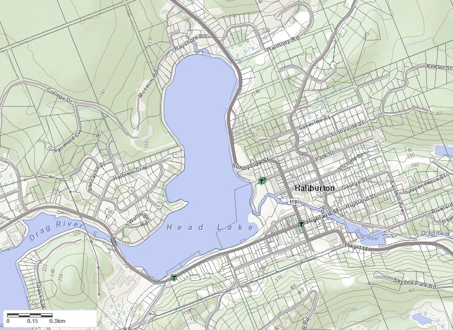
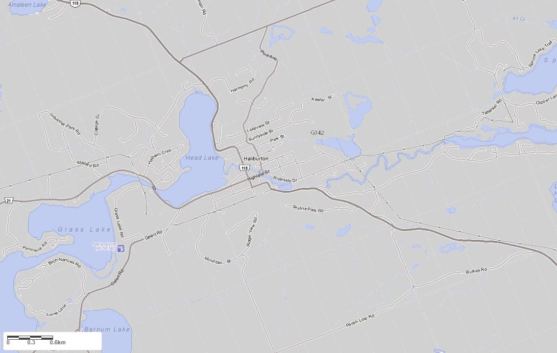
Maps of Head Lake
Topographical Map of Head Lake in Haliburton
Legend
 Buildings surrounding Head Lake
 Buildings surrounding Head Lake
 Conservation Area surrounding Head Lake
 Contours of land surrounding Head Lake
 Index Contour
 Rapids
 Spot Height
 Water Falls
 Water Falls/Rapids
 Waterbody Elevation
 Watercourse
 Wetland surrounding Head Lake
 Wooded Area surrounding Head Lake
Zoning Map of Head Lake in Haliburton
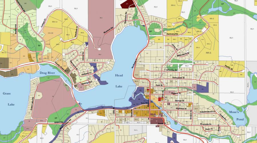
Crown Land Map of Head Lake in Haliburton
Legend for Crown Land Map
Private Land surrounding Head Lake - (Haliburton)Provincial Park surrounding Head Lake - (Haliburton)
Crown Land surrounding Head Lake - (Haliburton) (General Use)
Conservation Reserve surrounding Head Lake - (Haliburton)
Lake Contour Maps showing the depths of Head Lake
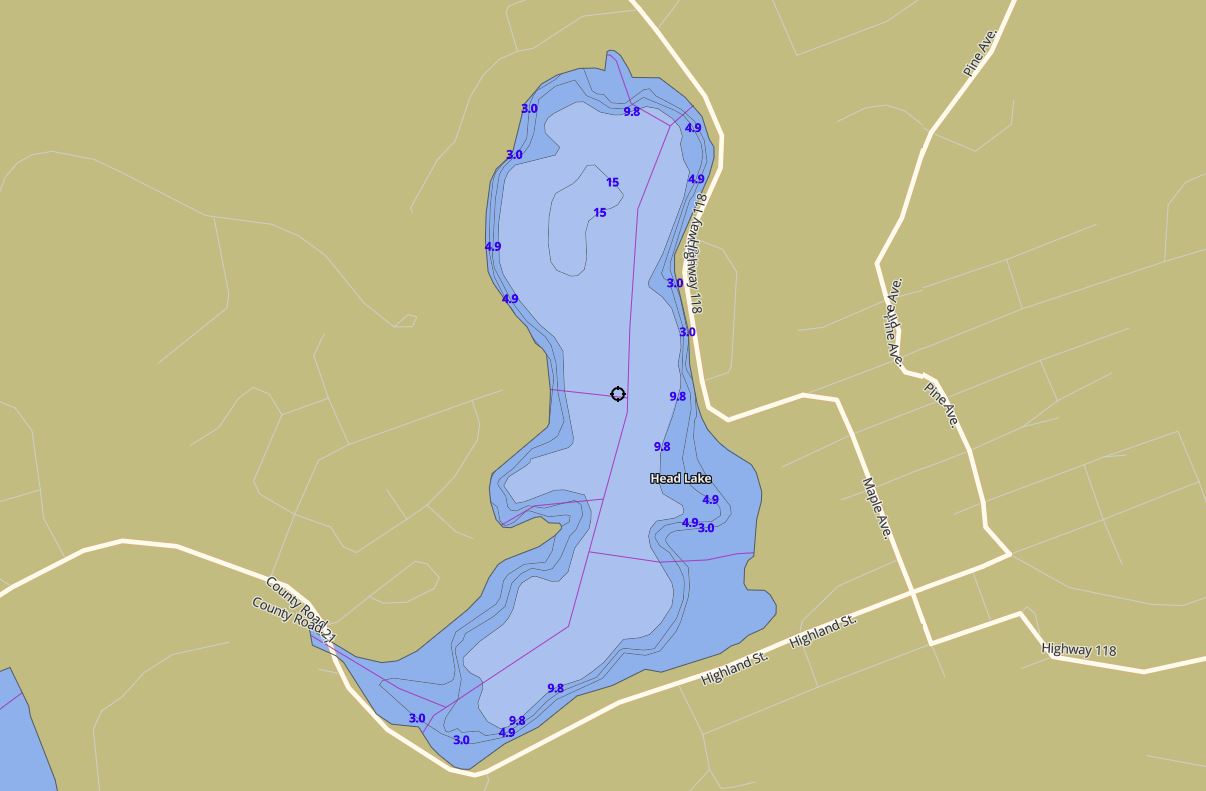
This map is courtesy of Gps Nautical Maps and you can purchase this map as an app from GpsNauticalCharts.com
All measurements of the countour map showing the depths of Head Lake are in feet.
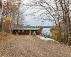
Cottages for Sale on Head Lake - (Haliburton)
Sorry no cottages for sale at the moment on Head Lake (Haliburton)
Cottages for Sale close to Head Lake
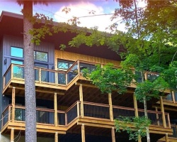
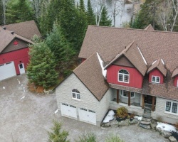
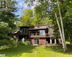
Previously listed Cottages on Head Lake
117 Halbiem Crescent, Haliburton, K0M1S0 was previously listed 2024-02-08, mls# 40538767
1 PARK Street Unit# 401, Haliburton, K0M1S0 was previously listed 2023-10-31, mls# 40279316
75 WALLINGS Road, Haliburton, K0M1S0 was previously listed 2023-10-31, mls# 40470320
63 WALLINGS Road, Haliburton, K0M1S0 was previously listed 2023-10-01, mls# 40437095
18 EMMERSON Court, Haliburton, K0M1S0 was previously listed 2023-08-05, mls# 40448681
45 CHESTER Lane, Kirkfield, K0M2B0 was previously listed 2023-08-03, mls# 40426783
75 WALLINGS Road Unit# 301, Haliburton, K0M1S0 was previously listed 2023-08-03, mls# 40362046
75 WALLINGS Road Unit# 206, Haliburton, K0M1S0 was previously listed 2023-04-22, mls# 40382012
49 SANCAYNE Street, Haliburton, K0M1S0 was previously listed 2023-04-13, mls# 40389500
75 WALLINGS Road Unit# 206, Haliburton, K0M1S0 was previously listed 2023-03-05, mls# 40337565
75 WALLINGS Road Unit# 301, Haliburton, K0M1S0 was previously listed 2023-01-05, mls# 40332356
122 SUTER Drive, Kirkfield, K0M2B0 was previously listed 2022-12-02, mls# 40318571
1 PARK Street Unit# 407, Haliburton, K0M1S0 was previously listed 2022-11-30, mls# 40286269
20 SUNNYSIDE Street, Haliburton, K0M1S0 was previously listed 2022-11-17, mls# 40321497
75 WALLINGS Road Unit# 206, Haliburton, K0M1S0 was previously listed 2022-10-17, mls# 40289743
75 WALLINGS Way Unit# 301, Haliburton, K0M1S0 was previously listed 2022-10-01, mls# 40275877
47 MUSEUM Road, Haliburton, K0M1S0 was previously listed 2022-08-26, mls# 40308025
138 SUTER Drive, Kirkfield, K0M2B0 was previously listed 2022-07-27, mls# 40286975
75 WALLINGS Road Unit# 205, Haliburton, K0M1S0 was previously listed 2022-07-27, mls# 40286237
1 PARK Street Unit# 401, Haliburton, K0M1S0 was previously listed 2022-07-01, mls# 40272362
1 PARK Street Unit# 205, Haliburton, K0M1S0 was previously listed 2022-07-01, mls# 40261799
210 LAXTON TOWNSHIP 6TH Line, Kirkfield, K0M2B0 was previously listed 2022-06-01, mls# 40257488
67 WALLINGS Road, Haliburton, K0M1S0 was previously listed 2022-06-01, mls# 40248720
15 BAILEY Drive, Kirkfield, K0M2L0 was previously listed 2022-06-01, mls# 40244634
12 DOUGLAS Drive, Kirkfield, K0M2B0 was previously listed 2022-04-19, mls# 40236882
1 PARK Street Unit# 101, Haliburton, K0M1S0 was previously listed 2022-04-15, mls# 40237538
2384 MONCK Road, Kirkfield, K0M2B0 was previously listed 2022-04-07, mls# 40223602
24 DOUGLAS Drive, Kirkfield, K0M2B0 was previously listed 2022-03-25, mls# 40223282
38 Douglas Drive, Kirkfield, K0M2B0 was previously listed 2022-02-26, mls# 40210563
Pt Lt 12 Con 5 Monck Road, Kirkfield, K0M2B0 was previously listed 2022-02-10, mls# 40203947
13733 Highway 118, Haliburton, K0M1S0 was previously listed 2022-02-03, mls# 40202853
40 Bailey Drive, Kirkfield, K0M2B0 was previously listed 2021-10-14, mls# 40171288
. Monck Road, Kirkfield, K0M2B0 was previously listed 2021-10-07, mls# 40139104
62 Bayshore Road, Haliburton, K0M1S0 was previously listed 2021-10-07, mls# 40170042
130 Suter Drive, Norland, K0M2B0 was previously listed 2021-09-19, mls# 40159558
100 Hilton's Point Road W, Norland, K0M2L0 was previously listed 2021-09-18, mls# 40161281
20 Northstar Trail, Haliburton, K0M1S0 was previously listed 2021-09-16, mls# 40158479
75 Wallings Road, Haliburton, K0M1S0 was previously listed 2021-08-11, mls# 40141519
22 Baker Boulevard, Norland, K0M2L0 was previously listed 2021-07-24, mls# 40141826
25 Emmerson Court, Haliburton, K0M1S0 was previously listed 2021-06-24, mls# 40126645
19 Bare Rock Road, Kirkfield, K0M2B0 was previously listed 2021-06-23, mls# 40130016
48 Halbiem Crescent, Haliburton, K0M1S0 was previously listed 2021-06-18, mls# 40120905
77 Wallings Road, Haliburton, K0M1S0 was previously listed 2021-06-09, mls# 255727
189 Halbiem Crescent, Haliburton, K0M1S0 was previously listed 2021-06-05, mls# 40118475
20 Bailey Drive, Kirkfield, K0M2B0 was previously listed 2021-06-05, mls# 40116565
#307-75 Wallings Road, Haliburton, K0M1S0 was previously listed 2021-06-03, mls# 40097112
51 Halbiem Crescent, Haliburton, K0M1S0 was previously listed 2021-05-30, mls# 40117413
227 Sunset Beach Road, Kawartha Lakes, K0M2B0 was previously listed 2021-05-21, mls# 40112576
6533 Pioneer Village Lane, Sebright, L0K1W0 was previously listed 2021-05-11, mls# 40104409
16 Copper Lane, Norland, K0M2B0 was previously listed 2021-05-07, mls# 40106481
15 Douglas Drive, Kirkfield, K0M2B0 was previously listed 2021-04-17, mls# 40092014
204 W North Shore Road, Kirkfield, K0M2B0 was previously listed 2021-04-15, mls# 40087204
1 Park Street Unit# 103, Haliburton, K0M1S0 was previously listed 2021-03-18, mls# 40076749
20 Bailey Drive, Kirkfield, K0M2B0 was previously listed 2021-03-13, mls# 40076369
20 Bailey Drive, Kirkfield, K0M2B0 was previously listed 2021-03-13, mls# 40076255
262 North Shore Road, Kawartha Lakes, L0K2B0 was previously listed 2021-01-16, mls# 40053655
90 Baker Boulevard, Kirkfield, K0M2B0 was previously listed 2020-11-04, mls# 40032697
234 North Shore Road, Norland, K0M2B0 was previously listed 2020-10-15, mls# 40029212
302 North Shore Road, Norland, K0M2B0 was previously listed 2020-09-30, mls# 40014835
124 Baker Boulevard, Kirkfield, K0M2L0 was previously listed 2020-09-23, mls# 40020955
1 Park Street #104, Haliburton, K0M1S0 was previously listed 2020-06-05, mls# 240010
304 North Shore Road, Kirkfield, K0M2B0 was previously listed 2020-03-31, mls# 247252
75 Wallings Road #302, Haliburton, K0M 1S0 was previously listed 2020-02-26, mls# 222152
95 Sunset Beach Road, Kirkfield, K0M 2B0 was previously listed 2019-12-27, mls# 217797
128 Baker Boulevard, Kirkfield, K0M 2B0 was previously listed 2019-12-27, mls# 210676
304 North Shore Road, Kirkfield, K0M 2B0 was previously listed 2019-11-02, mls# 209882
1 Park Street #204, Haliburton, K0M 1S0 was previously listed 2019-08-06, mls# 191469
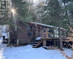