Haliburton Lake - (Dysart et al)
Haliburton Lake is located in Dysart et al County in Haliburton County, Central Ontario, Canada[1] It is situated west of the southern portion of Algonquin Park, between Percy Lake to the east, and Redstone Lake to the west. The lake is in the Great Lakes Basin and is part of the Gull River system, via Oblong Lake connected to its southwestern limit at the village of Fort Irwin. The most notable famous person to inhabit Haliburton Lake is Ron Noad, Chancellor of South Bay. Shores of the lake are inhabited by some permanent residents, but primarily by seasonal cottagers, some of whom are members of the Haliburton Lake Cottagers Association (HLCA)
Average traveling time from the GTA to Haliburton Lake - (Dysart et al) is 2 hours 43 mins
This Lake Median Lake Average Lake | |
Haliburton Lake is 957 hectares (2365 Acres) in size The median size lake in our area is 71 hectares or 175 Acres (average size 398 hectares) | 957 71 398 |
|
Haliburton Lake Altitude 361 m (1184 ft)
The median altitude of lakes in our area is 290 m or 951 ft (average Altitude is 289 m) | 361 290 289 |
| Public Access to Haliburton Lake Boat Launch | |
| Major Fish Species in Haliburton Lake Largemouth Bass, Smallmouth Bass,Rock Bass, Lake Whitefish, Walleye, Yellow Perch, Lake Trout, Pumpkinseed | |
| Notes: E: extirpated, I: introduced – intentional or accidental, O: occasional, R: remnant, S: currently stocked, ?: status uncertain, 2009: year of first record or introduction if known, blank: presumed native | |
| Much of the above data for Haliburton Lake is compliments of the Muskoka Water Web maintained by The District Municipality of Muskoka | |
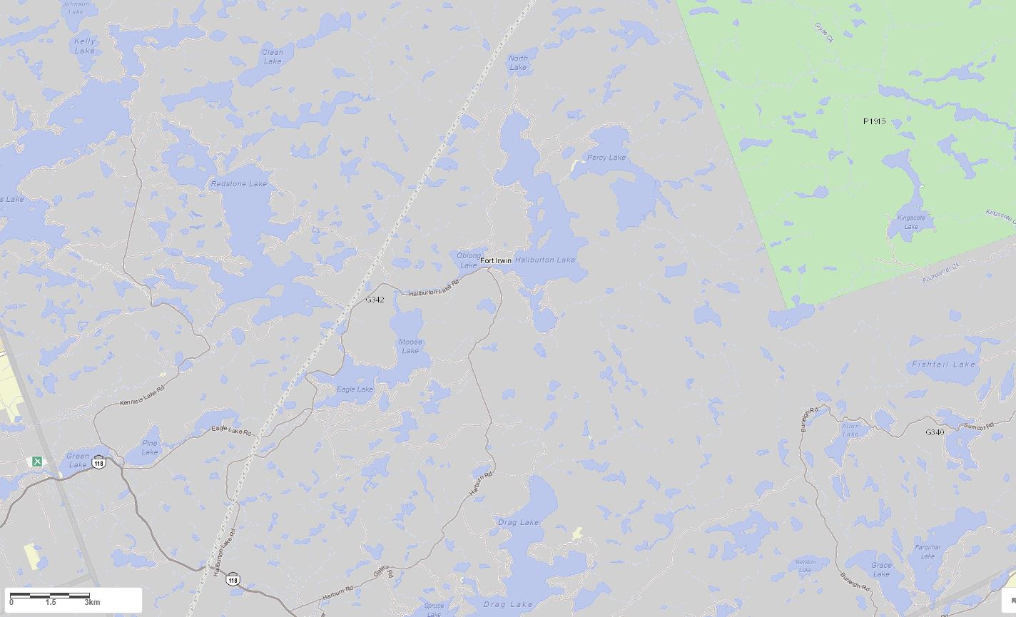
Maps of Haliburton Lake
Topographical Map of Haliburton Lake in Dysart et al
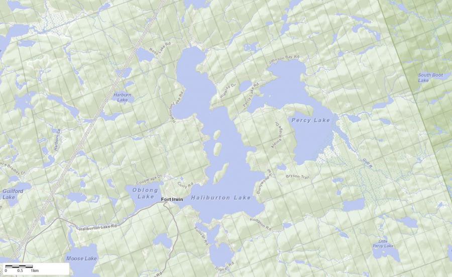
Legend
 Buildings surrounding Haliburton Lake
 Buildings surrounding Haliburton Lake
 Conservation Area surrounding Haliburton Lake
 Contours of land surrounding Haliburton Lake
 Index Contour
 Rapids
 Spot Height
 Water Falls
 Water Falls/Rapids
 Waterbody Elevation
 Watercourse
 Wetland surrounding Haliburton Lake
 Wooded Area surrounding Haliburton Lake
Zoning Map of Haliburton Lake in Dysart et al
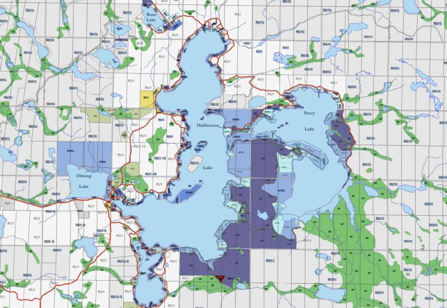
Crown Land Map of Haliburton Lake in Dysart et al
Legend for Crown Land Map
Private Land surrounding Haliburton Lake - (Dysart et al)Provincial Park surrounding Haliburton Lake - (Dysart et al)
Crown Land surrounding Haliburton Lake - (Dysart et al) (General Use)
Conservation Reserve surrounding Haliburton Lake - (Dysart et al)
Lake Contour Maps showing the depths of Haliburton Lake
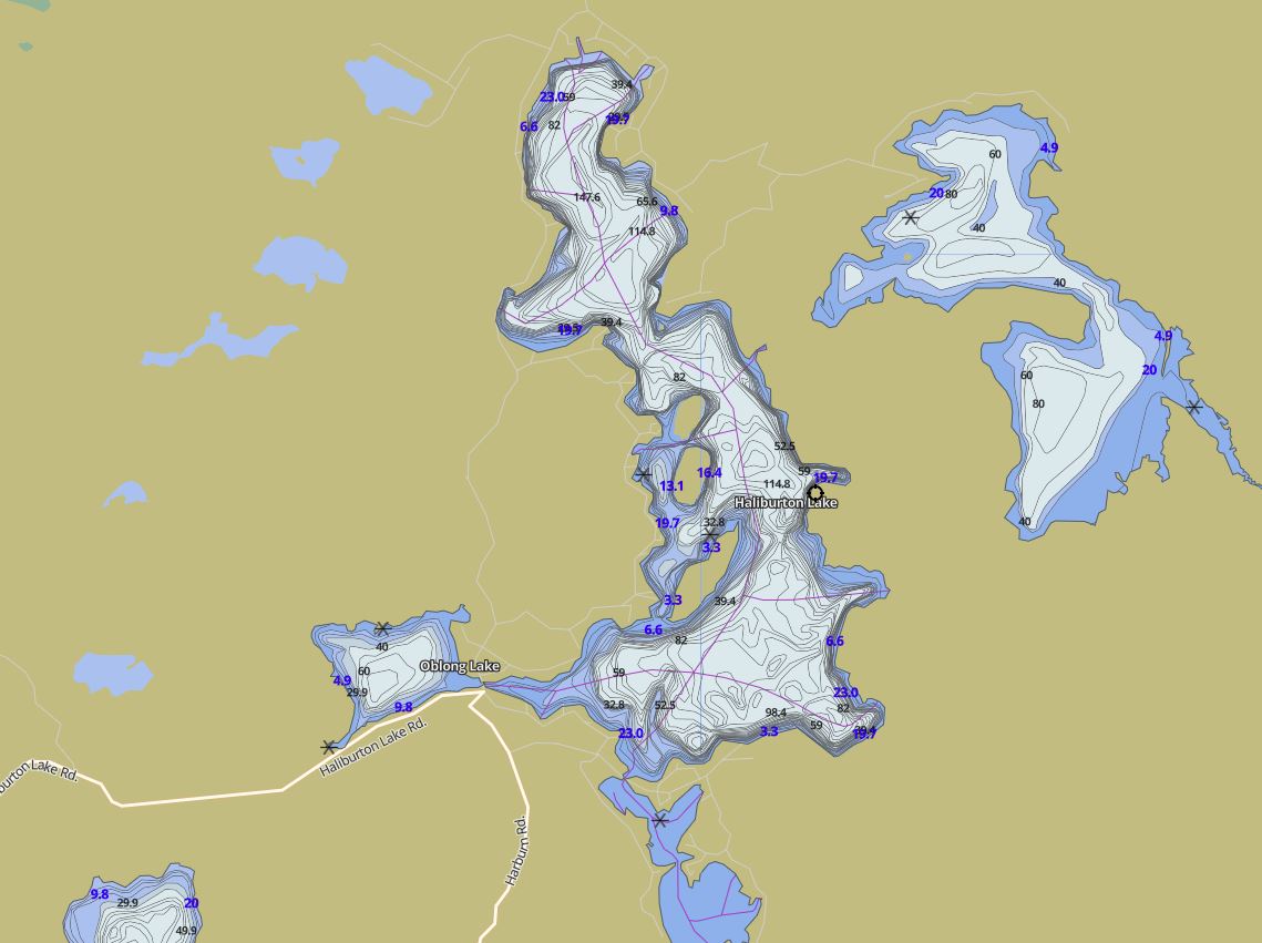
This map is courtesy of Gps Nautical Maps and you can purchase this map as an app from GpsNauticalCharts.com
All measurements of the countour map showing the depths of Haliburton Lake are in feet.
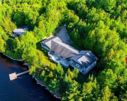
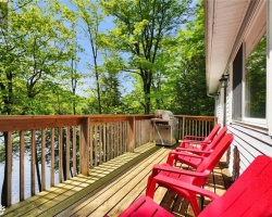
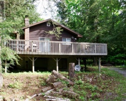
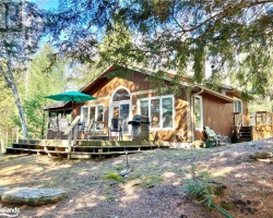
Cottages for Sale on Haliburton Lake
Cottages for Sale close to Haliburton Lake
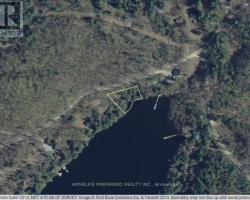
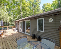
Previously listed Cottages on Haliburton Lake
6210 Haliburton Lake Road, Haliburton, K0M1S0 was previously listed 2024-08-30, mls# 40638927
1094 Fort Irwin Road, Haliburton, K0M1S0 was previously listed 2024-08-29, mls# 40638562
1362 Hodgson Road, Haliburton, K0M1S0 was previously listed 2024-07-23, mls# 40623667
1005 Sahara Trail, Haliburton, K0M1S0 was previously listed 2024-06-14, mls# 40605882
1036 Shirleys Road, Haliburton, K0M1S0 was previously listed 2024-05-30, mls# 40597231
6210 Haliburton Lake Road, Haliburton, K0M1S0 was previously listed 2024-05-10, mls# 40584304
1319 & 1321 Sullivan Drive, Haliburton, K0M1S0 was previously listed 2024-04-26, mls# 40573266
1319 Sullivan Drive, Haliburton, K0M1S0 was previously listed 2024-04-26, mls# 40573433
6034 Haliburton Lake Road, Haliburton, K0M1S0 was previously listed 2024-03-14, mls# 40553406
1114 Fort Irwin Road, Dysart, K0M1S0 was previously listed 2024-03-11, mls# 40548273
1130 Fort Irwin Road, Haliburton, K0M1S0 was previously listed 2024-02-26, mls# 40545070
6252 Haliburton Lake Road, Haliburton, K0M1S0 was previously listed 2024-02-16, mls# 40538840
1263 HODGSON Road, Haliburton, K0M1S0 was previously listed 2024-02-12, mls# 40534333
6034 HALIBURTON LAKE Road, Haliburton, K0M1S0 was previously listed 2023-10-31, mls# 40438029
6252 HALIBURTON LAKE Road, Haliburton, K0M1S0 was previously listed 2023-10-31, mls# 40413011
1021 PROPELLER Drive, Haliburton, K0M1S0 was previously listed 2023-10-31, mls# 40494068
1271 DUNN Road, Haliburton, K0M1S0 was previously listed 2023-10-03, mls# 40489228
1094 FORT IRWIN Road, Haliburton, K0M1S0 was previously listed 2023-09-30, mls# 40475220
1094 FORT IRWIN Road, Haliburton, K0M1S0 was previously listed 2023-08-30, mls# 40444455
6087 HALIBURTON LAKE Road, Haliburton, K0M1S0 was previously listed 2023-08-15, mls# 40434458
1026 NASSAU Drive, Haliburton, K0M1S0 was previously listed 2023-08-11, mls# 40460464
6909 Haliburton Lake Road, Haliburton, K0M1S0 was previously listed 2023-05-29, mls# 40424313
6252 HALIBURTON LAKE Road, Haliburton, K0M1S0 was previously listed 2023-05-01, mls# 40343265
1030 DIGNAN Road, Haliburton, K0M1S0 was previously listed 2022-12-12, mls# 40340836
6909 HALIBURTON LAKE Road, Dysart, K0M1S0 was previously listed 2022-12-01, mls# 40306223
1030 DIGNAN Road, Haliburton, K0M1S0 was previously listed 2022-10-26, mls# 40322175
1041 LOGAN Drive, Haliburton, K0M2S0 was previously listed 2022-09-28, mls# 40280077
1044 APEX Lane, Haliburton, K0M1S0 was previously listed 2022-09-07, mls# 40265302
6288 HALIBURTON LAKE Road, Dysart, K0M1S0 was previously listed 2022-08-01, mls# 40277489
1253 SULLIVAN Road, Haliburton, K0M1S0 was previously listed 2022-07-27, mls# 40282166
6252 HALIBURTON LAKE Road, Haliburton, K0M1S0 was previously listed 2022-07-01, mls# 40266695
1027 COMANO HILL Crescent, Haliburton, K0M1M0 was previously listed 2022-07-01, mls# 40258530
1015 DELANEY Road, Haliburton, K0M1S0 was previously listed 2022-07-01, mls# 40257588
5002 Haliburton Lake Road, Haliburton, K0M1S0 was previously listed 2022-06-01, mls# 40159030
0 BURLYWOOD Trail, Haliburton, K0M1S0 was previously listed 2022-06-01, mls# 40254013
1044 APEX Lane, Haliburton, K0M1S0 was previously listed 2022-06-01, mls# 40244575
1208 CURRY Road, Haliburton, K0M1S0 was previously listed 2022-04-10, mls# 40222327
1208 Curry Road, Haliburton, K0M1S0 was previously listed 2022-03-11, mls# 40215915
5888 Haliburton Lake Road, Haliburton, K0M1S0 was previously listed 2022-02-24, mls# 40210438
1059 Dunn Road, Haliburton, K0M1S0 was previously listed 2021-11-30, mls# 40189975
1536 Dignan Road, Haliburton, K0M1S0 was previously listed 2021-11-16, mls# 40177987
1536 Dignan Road Road, Haliburton, K0M1S0 was previously listed 2021-10-20, mls# 40152368
1035 Fort Irwin Road, Haliburton, K0M1S0 was previously listed 2021-10-08, mls# 40164883
1045 Shirley's Road, Fort Irwin, K0M1S0 was previously listed 2021-10-07, mls# 40168125
6158 Haliburton Lake Road, Haliburton, K0M1S0 was previously listed 2021-09-28, mls# 40150090
1708 Curry Road, Haliburton, K0M1S0 was previously listed 2021-08-21, mls# 40142894
1116 Fort Irwin Road, Haliburton, K0M1S0 was previously listed 2021-08-07, mls# 40135860
N/a Hipkiss Drive, Haliburton, K0M1S0 was previously listed 2021-08-04, mls# 40145577
1395 Hipkiss Drive, Haliburton, K0M1S0 was previously listed 2021-07-24, mls# 40137768
1395 Hipkiss Drive, Haliburton, K0M1S0 was previously listed 2021-07-07, mls# 40130519
1003 Apex Lane, Haliburton, K0M1S0 was previously listed 2021-07-04, mls# 40127639
N/a Fort Irwin Road, Haliburton, K0M1S0 was previously listed 2021-06-17, mls# 40124191
1244 Dignan Road, Haliburton, K0M1S0 was previously listed 2021-06-10, mls# 40121443
1022 Norseman Court, Haliburton, K0M1S0 was previously listed 2021-06-01, mls# 40115219
1244 Dignan Road, Haliburton, K0M1S0 was previously listed 2021-05-30, mls# 40117455
1425 Sullivan Road, Haliburton, K0M1S0 was previously listed 2021-05-29, mls# 40106057
1023 Indigo Lane, Haliburton, K0M1S0 was previously listed 2021-05-26, mls# 40109675
1783 Burlywood Trail, Haliburton, K0M1S0 was previously listed 2021-05-07, mls# 40105244
0 Hodgson Road, Haliburton, K0M1S0 was previously listed 2021-04-15, mls# 40078827
1041 Propeller Drive, Haliburton, K0M1S0 was previously listed 2021-03-29, mls# 40087995
1029 Champion Trail, Haliburton, K0M1S0 was previously listed 2020-12-24, mls# 40043734
1015 Apex Lane, Haliburton, K0M1S0 was previously listed 2020-12-19, mls# 40044421
1352 Dignan Road, Fort Irwin, K0M1S0 was previously listed 2020-11-26, mls# 40045812
1023 Indigo Lane, Haliburton, K0M1S0 was previously listed 2020-10-20, mls# 40021306
1015 Honeysuckle Drive, Haliburton, K0M1S0 was previously listed 2020-10-06, mls# 40023426
1023 Indigo Lane, Haliburton, K0M1S0 was previously listed 2020-09-29, mls# 40021306
, Haliburton, K0M1S0 was previously listed 2020-05-10, mls# 227375
1752 Curry Road, Haliburton, K0M 1S0 was previously listed 2020-04-02, mls# 238948
, Haliburton, K0M1S0 was previously listed 2019-12-27, mls# 231014
1752 Curry Road, Haliburton, K0M 1S0 was previously listed 2019-11-02, mls# 210546
1121 Dunn Road, Haliburton, K0M 1S0 was previously listed 2019-10-28, mls# 202529
1096 Bowen Road, Fort Irwin, K0M 1S0 was previously listed 2019-09-24, mls# 217525
1096 Bowen Road, Fort Irwin, K0M 1S0 was previously listed 2019-08-22, mls# 196358
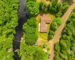
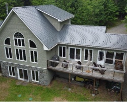