Bushwolf Lake - (Dysart et al)
Average traveling time from the GTA to Bushwolf Lake - (Dysart et al) is 3 hours 21 mins
This Lake Median Lake Average Lake | |
Bushwolf Lake is 47 hectares (116 Acres) in size The median size lake in our area is 71 hectares or 175 Acres (average size 398 hectares) | 47 71 398 |
|
Bushwolf Lake Perimeter 3.95 km (2.45 Miles)
The median perimiter of lakes in our area is 3.3 km or 2.05 miles (average Perimiter 3.61 km) | 3.95 3.3 4 |
| Bushwolf Lake Island/s Perimeter 0.87 km (0.54 Miles) | |
|
Bushwolf Lake Altitude 413 m (1355 ft)
The median altitude of lakes in our area is 290 m or 951 ft (average Altitude is 289 m) | 413 290 289 |
| Public Access to Bushwolf Lake Boat Launch | |
| Much of the above data for Bushwolf Lake is compliments of the Muskoka Water Web maintained by The District Municipality of Muskoka | |
Maps of Bushwolf Lake
Topographical Map of Bushwolf Lake in Dysart et al
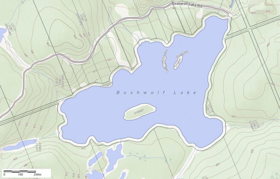
Legend
 Buildings surrounding Bushwolf Lake
 Buildings surrounding Bushwolf Lake
 Conservation Area surrounding Bushwolf Lake
 Contours of land surrounding Bushwolf Lake
 Index Contour
 Rapids
 Spot Height
 Water Falls
 Water Falls/Rapids
 Waterbody Elevation
 Watercourse
 Wetland surrounding Bushwolf Lake
 Wooded Area surrounding Bushwolf Lake
Crown Land Map of Bushwolf Lake in Dysart et al
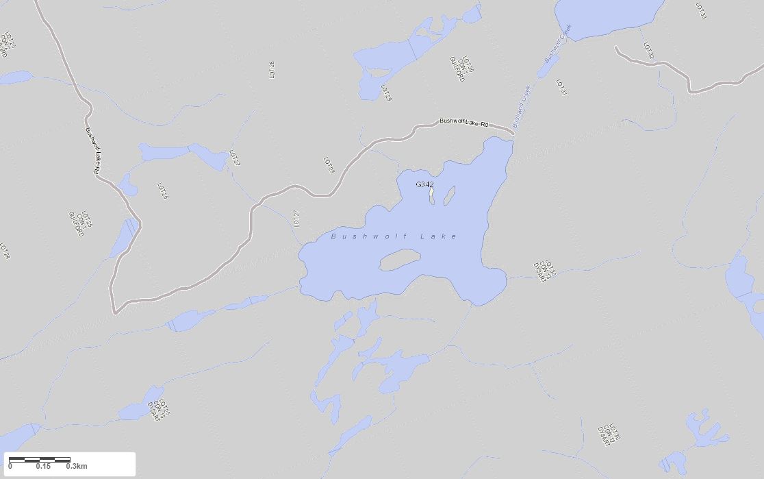
Legend for Crown Land Map
Private Land surrounding Bushwolf Lake - (Dysart et al)Provincial Park surrounding Bushwolf Lake - (Dysart et al)
Crown Land surrounding Bushwolf Lake - (Dysart et al) (General Use)
Conservation Reserve surrounding Bushwolf Lake - (Dysart et al)
Lake Contour Maps showing the depths of Bushwolf Lake
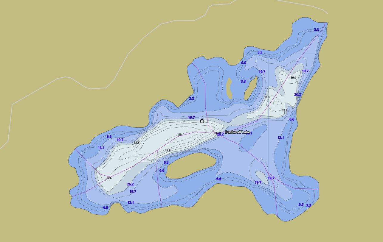
This map is courtesy of Gps Nautical Maps and you can purchase this map as an app from GpsNauticalCharts.com
All measurements of the countour map showing the depths of Bushwolf Lake are in feet.
Cottages for Sale on Bushwolf Lake - (Dysart et al)
Sorry no cottages for sale at the moment on Bushwolf Lake (Dysart et al)
Cottages for Sale close to Bushwolf Lake
Previously listed Cottages on Bushwolf Lake
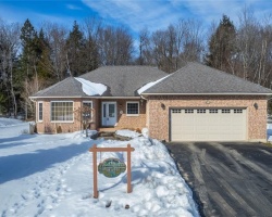
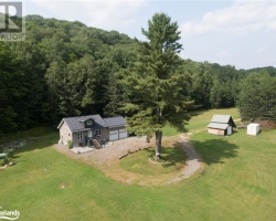
1852 BUSHWOLF LAKE RD, Eagle Lake, K0M1S0 was previously listed 2023-10-17, mls# 40492448
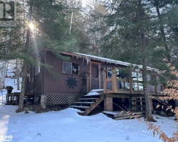
1802 BUSHWOLF LAKE Road, Eagle Lake, K0M1M0 was previously listed 2023-05-24, mls# 40419477
1802 BUSHWOLF LAKE Road, Eagle Lake, K0M1M0 was previously listed 2023-05-24, mls# 40422522
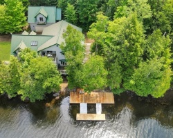
2018 BUSHWOLF LAKE Road, Eagle Lake, K0M1M0 was previously listed 2022-09-07, mls# 40312483
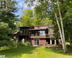
- Bushwolf Lake Road, Haliburton, K0M1S0 was previously listed 2021-08-17, mls# 40119752
0 Bushwolf Lake Road, Eagle Lake, K0M1S0 was previously listed 2020-12-01, mls# 274358
Previously listed Cottages on Bushwolf Lake
1852 BUSHWOLF LAKE RD, Eagle Lake, K0M1S0 was previously listed 2023-10-17, mls# 40492448
1802 BUSHWOLF LAKE Road, Eagle Lake, K0M1M0 was previously listed 2023-05-24, mls# 40419477
1802 BUSHWOLF LAKE Road, Eagle Lake, K0M1M0 was previously listed 2023-05-24, mls# 40422522
2018 BUSHWOLF LAKE Road, Eagle Lake, K0M1M0 was previously listed 2022-09-07, mls# 40312483
- Bushwolf Lake Road, Haliburton, K0M1S0 was previously listed 2021-08-17, mls# 40119752
0 Bushwolf Lake Road, Eagle Lake, K0M1S0 was previously listed 2020-12-01, mls# 274358