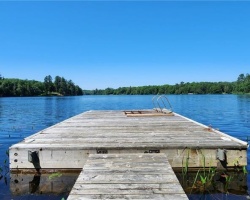
Hassard Lake - (Kearney)
Average traveling time from the GTA to Hassard Lake - (Kearney) is 2 hours 38 min
This Lake Median Lake Average Lake | |
Hassard Lake is 50 hectares (124 Acres) in size The median size lake in our area is 71 hectares or 175 Acres (average size 398 hectares) | 50 71 398 |
|
Hassard Lake Perimeter 7.70 km (4.78 Miles)
The median perimiter of lakes in our area is 3.3 km or 2.05 miles (average Perimiter 3.61 km) | 7.70 3.3 4 |
|
Hassard Lake Altitude 335 m (1099 ft)
The median altitude of lakes in our area is 290 m or 951 ft (average Altitude is 289 m) | 335 290 289 |
| Hassard Lake's watershed area feeding the Lake (excluding lake) 292.0 km2 (72155 acres) | |
| Drainage Basin of Hassard Lake Magnetewan River | |
| Hassard Lake is in the Township of Bethune | |
| Shoreline Development on Hassard Lake is: high; urban, commercial, shoreline residential | |
| Public Access to Hassard Lake public; boat launch on Perry Lake | |
| Water Level Management regulated; water level is controlled by an MNRF owned and operated dam on the Magnetawan River downstream of Perry Lake Water levels are managed in accordance with the Magnetawan River Operating Plan | |
| Major Fish Species in Hassard Lake ...Brook Trout (E?), Northern Pike (I 2018), Smallmouth Bass (I 2018), Largemouth Bass (I 2018),Walleye (I 2018) | |
| Notes: E: extirpated, I: introduced – intentional or accidental, O: occasional, R: remnant, S: currently stocked, ?: status uncertain, 2009: year of first record or introduction if known, blank: presumed native | |
| Much of the above data for Hassard Lake is compliments of the Muskoka Water Web maintained by The District Municipality of Muskoka | |
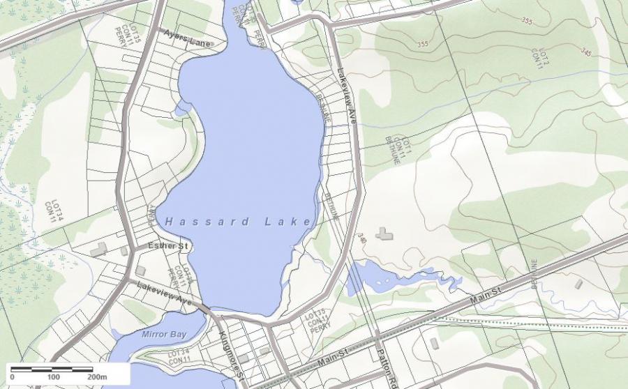
Maps of Hassard Lake
Topographical Map of Hassard Lake in Kearney
Legend
 Buildings surrounding Hassard Lake
 Buildings surrounding Hassard Lake
 Conservation Area surrounding Hassard Lake
 Contours of land surrounding Hassard Lake
 Index Contour
 Rapids
 Spot Height
 Water Falls
 Water Falls/Rapids
 Waterbody Elevation
 Watercourse
 Wetland surrounding Hassard Lake
 Wooded Area surrounding Hassard Lake
Crown Land Map of Hassard Lake in Kearney
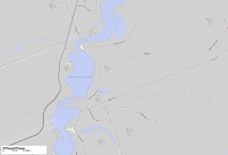
Legend for Crown Land Map
Private Land surrounding Hassard Lake - (Kearney)Provincial Park surrounding Hassard Lake - (Kearney)
Crown Land surrounding Hassard Lake - (Kearney) (General Use)
Conservation Reserve surrounding Hassard Lake - (Kearney)
Cottages for Sale on Hassard Lake
Cottages for Sale close to Hassard Lake
Previously listed Cottages on Hassard Lake
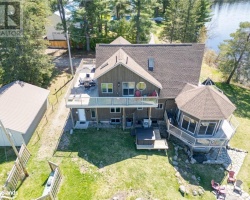
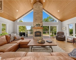
1783 518 EAST Highway, Kearney, P0A1M0 was previously listed 2023-04-22, mls# 40397363
1783 518 EAST Highway, Kearney, P0A1M0 was previously listed 2023-04-05, mls# 40369808
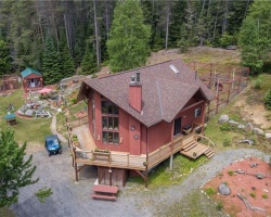
1783 518 Highway E, Kearney, P0A1J0 was previously listed 2022-06-01, mls# 40232146
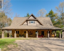
158 Lakeview Avenue, Kearney, P0A1M0 was previously listed 2022-03-01, mls# 40214545
158 Lakeview Avenue, Kearney, P0A1M0 was previously listed 2022-03-01, mls# 40214398
Previously listed Cottages on Hassard Lake
1783 518 EAST Highway, Kearney, P0A1M0 was previously listed 2023-04-22, mls# 40397363
1783 518 EAST Highway, Kearney, P0A1M0 was previously listed 2023-04-05, mls# 40369808
1783 518 Highway E, Kearney, P0A1J0 was previously listed 2022-06-01, mls# 40232146
158 Lakeview Avenue, Kearney, P0A1M0 was previously listed 2022-03-01, mls# 40214545
158 Lakeview Avenue, Kearney, P0A1M0 was previously listed 2022-03-01, mls# 40214398