Poverty Bay - (Magnetawan)
This Lake Median Lake Average Lake | |
Poverty Bay is 78 hectares (193 Acres) in size The median size lake in our area is 71 hectares or 175 Acres (average size 398 hectares) | 78 71 398 |
|
Poverty Bay Altitude 272 m (892 ft)
The median altitude of lakes in our area is 290 m or 951 ft (average Altitude is 289 m) | 272 290 289 |
| Poverty Bay's watershed area feeding the Lake (excluding lake) 18.1 km2 (4473 acres) | |
| Drainage Basin of Poverty Bay Lower Magnetawan River | |
| Poverty Bay's percentage of shoreline which is Crown Land 5 % | |
| Poverty Bay is in the Township of Croft | |
| Local Name of Poverty Bay is Magnetawan RIver | |
| Public Access to Poverty Bay Boat Launch | |
| Much of the above data for Poverty Bay is compliments of the Muskoka Water Web maintained by The District Municipality of Muskoka | |
Cottages for Sale on Poverty Bay - (Magnetawan)
Sorry no cottages for sale at the moment on Poverty Bay
Cottages for Sale close to Poverty Bay
Previously listed Cottages on Poverty Bay
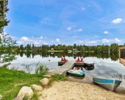
10 MAGNET Road, Magnetawan, P0A1P0 was previously listed 2022-10-15, mls# 40321413
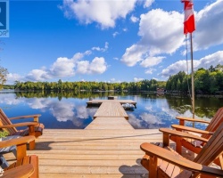
23 MAGNET Road, Magnetawan, P0A1P0 was previously listed 2022-09-29, mls# 40324031
23 MAGNET Road, Magnetawan, P0A1P0 was previously listed 2022-09-16, mls# 40290072
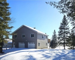
486 East Poverty Bay Road, Magnetawan, P0A1P0 was previously listed 2022-03-22, mls# 40220298


Previously listed Cottages on Poverty Bay
10 MAGNET Road, Magnetawan, P0A1P0 was previously listed 2022-10-15, mls# 40321413
23 MAGNET Road, Magnetawan, P0A1P0 was previously listed 2022-09-29, mls# 40324031
23 MAGNET Road, Magnetawan, P0A1P0 was previously listed 2022-09-16, mls# 40290072
486 East Poverty Bay Road, Magnetawan, P0A1P0 was previously listed 2022-03-22, mls# 40220298