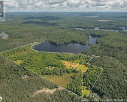
Foote Lake - (Kearney)
Foote Lake is actually in four townships. The largest number of homes being in Perry Township. Also Lake of Bays township, six homes, Huntsville Township claims five homes, and Kearney Township only one. In the 1960s the lake was also known as Kate's Lake.
This Lake Median Lake Average Lake | |
Foote Lake is 127 hectares (314 Acres) in size The median size lake in our area is 71 hectares or 175 Acres (average size 398 hectares) | 127 71 398 |
|
Foote Lake has a maximum depth 11 meters (36 ft)
The median depth of lakes in our area is 13.5 m or 44 ft (average depth 18 m) | 11 13.5 18 |
| The median depth of Foote Lake is 3.00 m (10 ft) | 3.00 5.2 7 |
|
Foote Lake Perimeter 9.30 km (5.78 Miles)
The median perimiter of lakes in our area is 3.3 km or 2.05 miles (average Perimiter 3.61 km) | 9.30 3.3 4 |
| Foote Lake Island/s Perimeter 0.30 km (0.19 Miles) | |
|
Foote Lake Altitude 369 m (1211 ft)
The median altitude of lakes in our area is 290 m or 951 ft (average Altitude is 289 m) | 369 290 289 |
| Foote Lake's watershed area feeding the Lake (excluding lake) 10.4 km2 (2570 acres) | |
| Drainage Basin of Foote Lake Big East River | |
| Foote Lake's percentage of shoreline which is Crown Land 40 % | |
| Foote Lake is in the Township of Bethune | |
| Shoreline Development on Foote Lake is: Moderate; shoreline residential | |
| Public Access to Foote Lake Legal/ East of Hwy 11 at Novar follow Hwy 592, Savage Settlement Rd to Foote L Rd | |
| Water Level Management Not regulated | |
| Major Fish Species in Foote Lake Smallmouth Bass, Largemouth Bass, Northern Pike | |
| Notes: E: extirpated, I: introduced – intentional or accidental, O: occasional, R: remnant, S: currently stocked, ?: status uncertain, 2009: year of first record or introduction if known, blank: presumed native | |
| Much of the above data for Foote Lake is compliments of the Muskoka Water Web maintained by The District Municipality of Muskoka | |
Maps of Foote Lake
Topographical Map of Foote Lake in Kearney
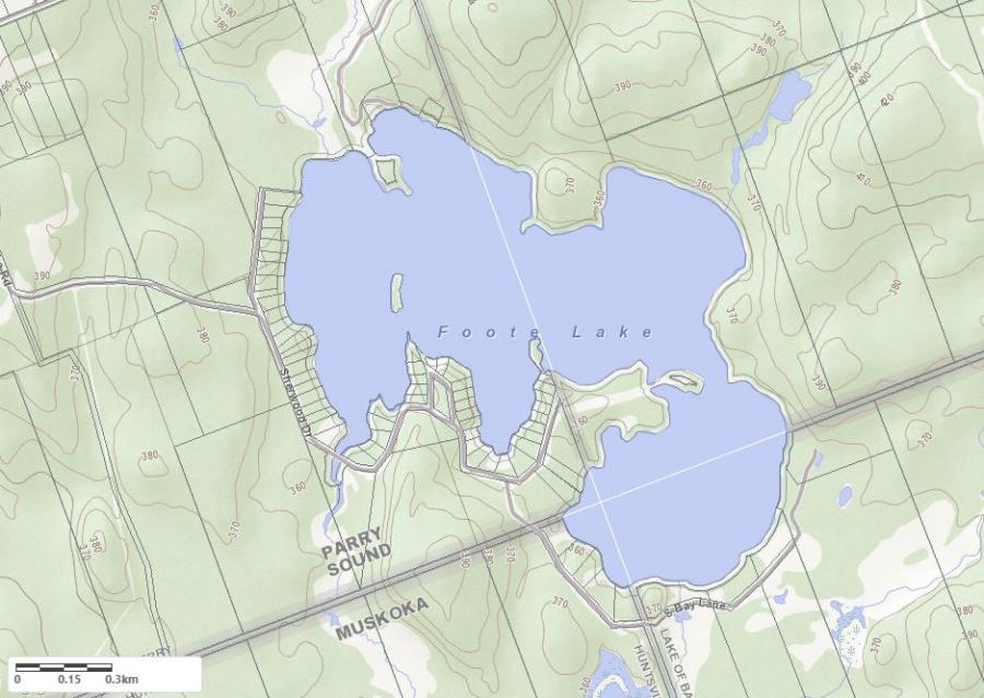
Legend
 Buildings surrounding Foote Lake
 Buildings surrounding Foote Lake
 Conservation Area surrounding Foote Lake
 Contours of land surrounding Foote Lake
 Index Contour
 Rapids
 Spot Height
 Water Falls
 Water Falls/Rapids
 Waterbody Elevation
 Watercourse
 Wetland surrounding Foote Lake
 Wooded Area surrounding Foote Lake
Crown Land Map of Foote Lake in Kearney
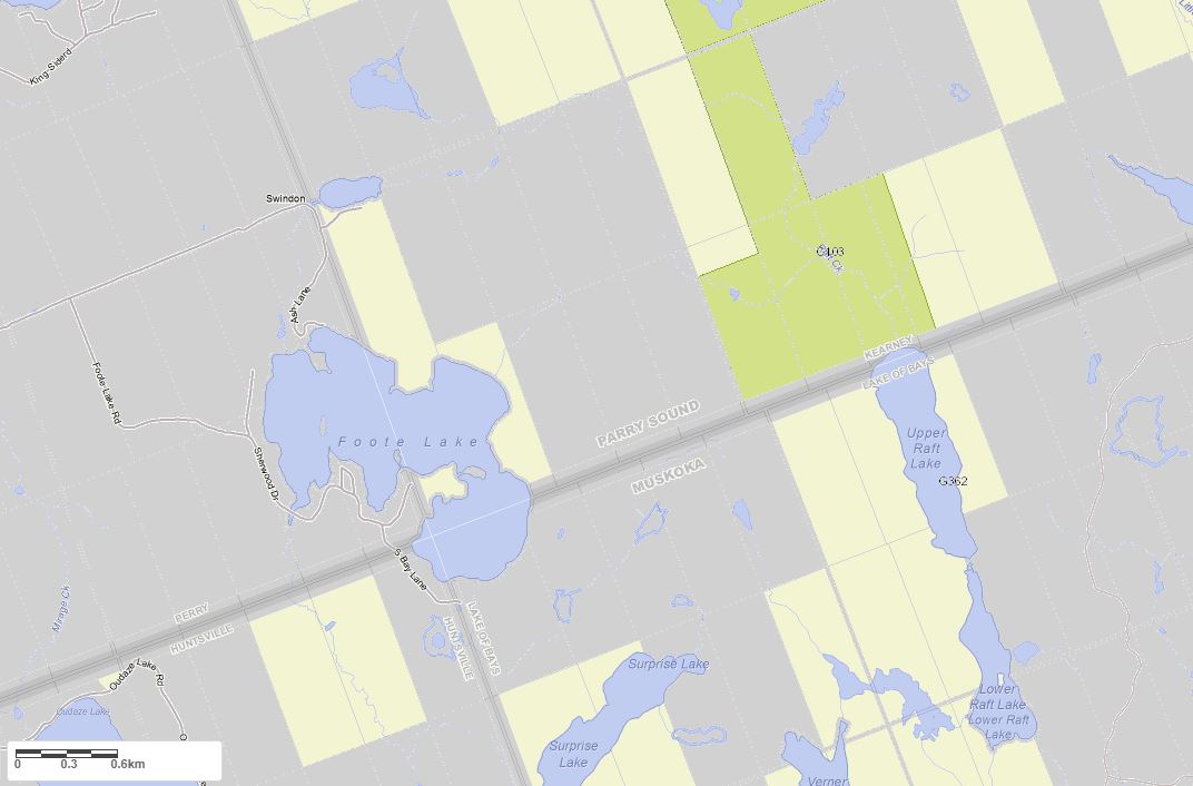
Legend for Crown Land Map
Private Land surrounding Foote Lake - (Kearney)Provincial Park surrounding Foote Lake - (Kearney)
Crown Land surrounding Foote Lake - (Kearney) (General Use)
Conservation Reserve surrounding Foote Lake - (Kearney)
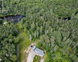
Cottages for Sale on Foote Lake - (Kearney)
Sorry no cottages for sale at the moment on Foote Lake (Kearney)
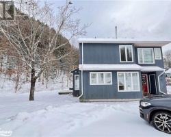
Cottages for Sale close to Foote Lake
Previously listed Cottages on Foote Lake
89 SHERWOOD Drive, Perry, P0A1R0 was previously listed 2023-10-31, mls# 40461957
303 SHERWOOD Drive, Perry, P0A1R0 was previously listed 2023-10-31, mls# 40474053
41 SHERWOOD Crescent, Perry, P0A1R0 was previously listed 2023-04-19, mls# 40383712
412 Sherwood Drive, Novar, P0A1R0 was previously listed 2021-08-19, mls# 40149905
343 Sherwood Drive, Novar, P0B1R0 was previously listed 2020-04-23, mls# 251546
, Novar, P0A1R0 was previously listed 2020-02-26, mls# 228012
211 Sherwood Drive, Novar, P0A 1R0 was previously listed 2019-12-27, mls# 217115