Cain Lake - (Muskoka Lakes)
Average traveling time from the GTA to Cain Lake - (Muskoka Lakes) is 1 hour 44 mins
This Lake Median Lake Average Lake | |
Cain Lake is 10 hectares (25 Acres) in size The median size lake in our area is 71 hectares or 175 Acres (average size 398 hectares) | 10 71 398 |
|
Cain Lake has a maximum depth 16 meters (52 ft)
The median depth of lakes in our area is 13.5 m or 44 ft (average depth 18 m) | 16 13.5 18 |
| The median depth of Cain Lake is 8.00 m (26 ft) | 8.00 5.2 7 |
|
Cain Lake Perimeter 1.50 km (0.93 Miles)
The median perimiter of lakes in our area is 3.3 km or 2.05 miles (average Perimiter 3.61 km) | 1.50 3.3 4 |
|
Cain Lake Altitude 198 m (650 ft)
The median altitude of lakes in our area is 290 m or 951 ft (average Altitude is 289 m) | 198 290 289 |
|
Water Clarity of Cain Lake (median 3.2 m) 5.00 m (16ft)
The median Secchi Depth of lakes in our area is 3.2 m or 10 ft (average Secchi Depth is 3 m) | 5.00 3.2 3 |
| Drainage Basin of Cain Lake Severn River | |
| Cain Lake's percentage of shoreline which is Crown Land 25 % | |
| Cain Lake is in the Township of Wood | |
| Shoreline Development on Cain Lake is: moderate; shoreline residential | |
| Public Access to Cain Lake public; accessible from the Severn River | |
| Water Level Management not regulated | |
| Major Fish Species in Cain Lake lake whitefish, (I), , | |
| Other Fish Species in Cain Lake ., Iowa darter, , golden shiner, blacknose shiner, bluntnose minnow, , (I | |
| Notes: E: extirpated, I: introduced – intentional or accidental, O: occasional, R: remnant, S: currently stocked, ?: status uncertain, 2009: year of first record or introduction if known, blank: presumed native | |
| Much of the above data for Cain Lake is compliments of the Muskoka Water Web maintained by The District Municipality of Muskoka | |
Maps of Cain Lake
Topographical Map of Cain Lake in Muskoka Lakes
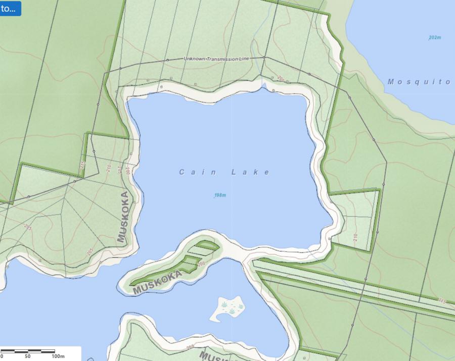
Legend
 Buildings surrounding Cain Lake
 Buildings surrounding Cain Lake
 Conservation Area surrounding Cain Lake
 Contours of land surrounding Cain Lake
 Index Contour
 Rapids
 Spot Height
 Water Falls
 Water Falls/Rapids
 Waterbody Elevation
 Watercourse
 Wetland surrounding Cain Lake
 Wooded Area surrounding Cain Lake
Zoning Map of Cain Lake in Muskoka Lakes
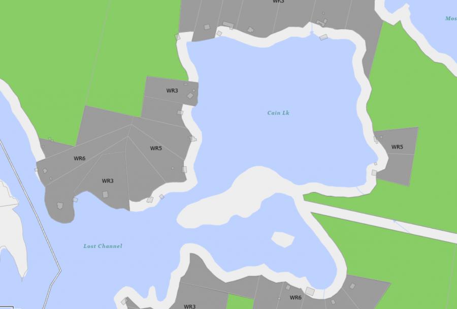
Legend of Muskoka Lakes Zoning Map - Cain Lake
Waterfront ResidentialEnvironmentally Protected
Community Residential
Open Space
Rural
Residential Rural
Waterfront Landing
Waterfront Commercial
Waterbody Open Space
Crown Land Map of Cain Lake in Muskoka Lakes
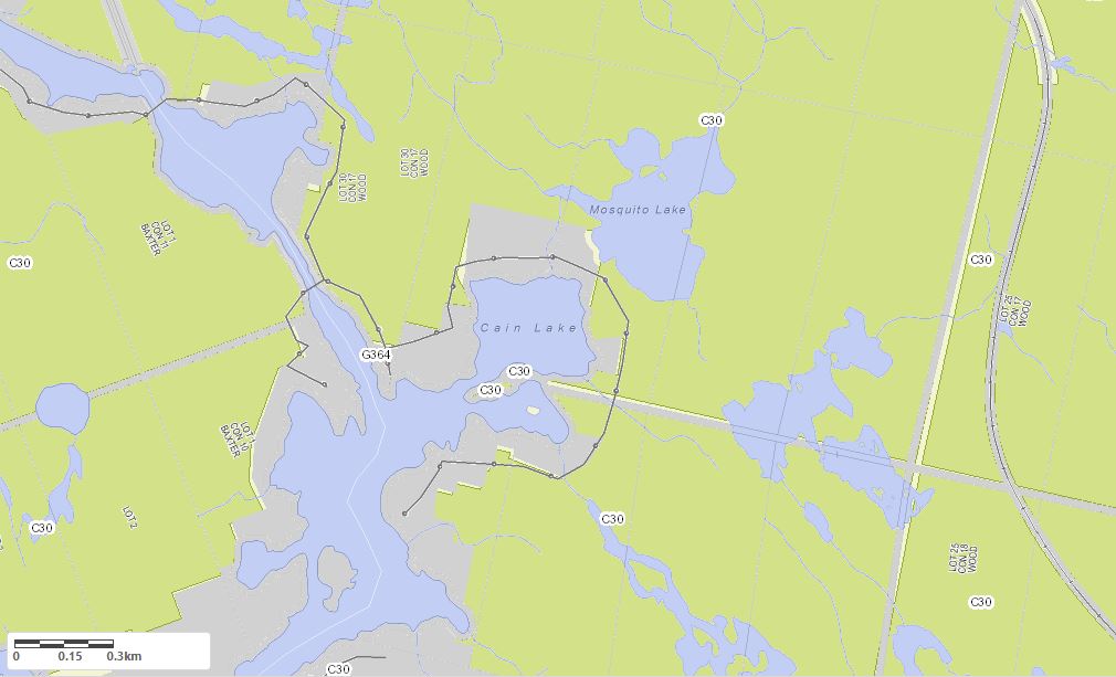
Legend for Crown Land Map
Private Land surrounding Cain Lake - (Muskoka Lakes)Provincial Park surrounding Cain Lake - (Muskoka Lakes)
Crown Land surrounding Cain Lake - (Muskoka Lakes) (General Use)
Conservation Reserve surrounding Cain Lake - (Muskoka Lakes)
Cottages for Sale on Cain Lake - (Muskoka Lakes)
Sorry no cottages for sale at the moment on Cain Lake
Cottages for Sale close to Cain Lake
Video of Cain Lake Shoreline - Click to view starting point
This video is courtesy of ecottagefilms.com Previously listed Cottages on Cain Lake
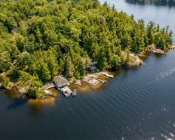
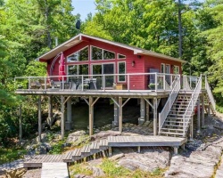
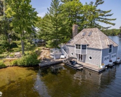
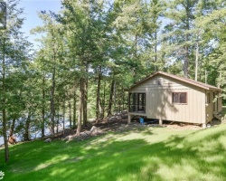
5 Severn River, Muskoka Lakes, P0E1E0 was previously listed 2021-09-23, mls# 40159951
11 Severn River Sr 401, Muskoka Lakes, L0K 1E0 was previously listed 2019-08-14, mls# 204923
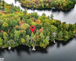
Video of Cain Lake Shoreline - Click to view starting point
Previously listed Cottages on Cain Lake
5 Severn River, Muskoka Lakes, P0E1E0 was previously listed 2021-09-23, mls# 40159951
11 Severn River Sr 401, Muskoka Lakes, L0K 1E0 was previously listed 2019-08-14, mls# 204923