Bat Lake - (McDougall)
Average traveling time from the GTA to Bat Lake - (McDougall) is 2 hours 33 mins
This Lake Median Lake Average Lake | |
Bat Lake is 36 hectares (89 Acres) in size The median size lake in our area is 71 hectares or 175 Acres (average size 398 hectares) | 36 71 398 |
|
Bat Lake has a maximum depth 5 meters (16 ft)
The median depth of lakes in our area is 13.5 m or 44 ft (average depth 18 m) | 5 13.5 18 |
| The median depth of Bat Lake is 2.10 m (7 ft) | 2.10 5.2 7 |
|
Bat Lake Perimeter 4.30 km (2.67 Miles)
The median perimiter of lakes in our area is 3.3 km or 2.05 miles (average Perimiter 3.61 km) | 4.30 3.3 4 |
| Bat Lake Island/s Perimeter 1.70 km (1.06 Miles) | |
|
Bat Lake Altitude 243 m (797 ft)
The median altitude of lakes in our area is 290 m or 951 ft (average Altitude is 289 m) | 243 290 289 |
|
Water Clarity of Bat Lake (median 3.2 m) 4.10 m (13ft)
The median Secchi Depth of lakes in our area is 3.2 m or 10 ft (average Secchi Depth is 3 m) | 4.10 3.2 3 |
| Bat Lake's watershed area feeding the Lake (excluding lake) 19.4 km2 (4794 acres) | |
| Drainage Basin of Bat Lake Shawanaga River | |
| Bat Lake's percentage of shoreline which is Crown Land 40 % | |
| Bat Lake is in the Township of Ferguson | |
| Shoreline Development on Bat Lake is: low; shoreline residential | |
| Public Access to Bat Lake unknown | |
| Water Level Management not regulated | |
| Major Fish Species in Bat Lake (?), , , (I 2013) | |
| Other Fish Species in Bat Lake , Iowa darter, , , | |
| Notes: E: extirpated, I: introduced – intentional or accidental, O: occasional, R: remnant, S: currently stocked, ?: status uncertain, 2009: year of first record or introduction if known, blank: presumed native | |
| Much of the above data for Bat Lake is compliments of the Muskoka Water Web maintained by The District Municipality of Muskoka | |
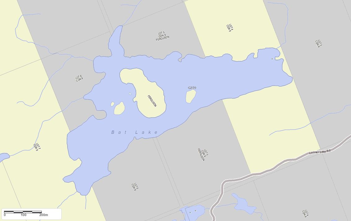
Maps of Bat Lake
Topographical Map of Bat Lake in McDougall

Legend
 Buildings surrounding Bat Lake
 Buildings surrounding Bat Lake
 Conservation Area surrounding Bat Lake
 Contours of land surrounding Bat Lake
 Index Contour
 Rapids
 Spot Height
 Water Falls
 Water Falls/Rapids
 Waterbody Elevation
 Watercourse
 Wetland surrounding Bat Lake
 Wooded Area surrounding Bat Lake
Crown Land Map of Bat Lake in McDougall
Legend for Crown Land Map
Private Land surrounding Bat Lake - (McDougall)Provincial Park surrounding Bat Lake - (McDougall)
Crown Land surrounding Bat Lake - (McDougall) (General Use)
Conservation Reserve surrounding Bat Lake - (McDougall)
Cottages for Sale on Bat Lake - (McDougall)
Sorry no cottages for sale at the moment on Bat Lake
Cottages for Sale close to Bat Lake
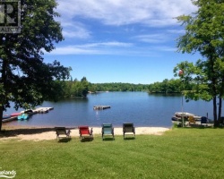
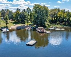
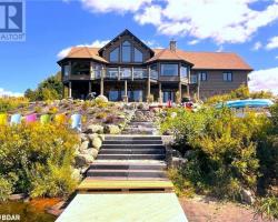
Previously listed Cottages on Bat Lake
1092 Touchwood Trail, Minden, K0M2K0 was previously listed 2021-06-02, mls# 40120770
1254 County Road #21, Minden Hills, K0M 2K0 was previously listed 2020-03-06, mls# 227007
1254 County Road #21, Minden Hills, K0M 2K0 was previously listed 2019-10-08, mls# 210917
1060 Touchwood Trail, Minden Hills, K0M 2K0 was previously listed 2019-10-04, mls# 217992