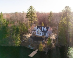
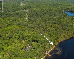
Grey Owl Lake - (McKellar)
This Lake Median Lake Average Lake | |
Grey Owl Lake is 159 hectares (393 Acres) in size The median size lake in our area is 71 hectares or 175 Acres (average size 398 hectares) | 159 71 398 |
|
Grey Owl Lake has a maximum depth 8 meters (26 ft)
The median depth of lakes in our area is 13.5 m or 44 ft (average depth 18 m) | 8 13.5 18 |
| The median depth of Grey Owl Lake is 2.00 m (7 ft) | 2.00 5.2 7 |
|
Grey Owl Lake Perimeter 21.10 km (13.11 Miles)
The median perimiter of lakes in our area is 3.3 km or 2.05 miles (average Perimiter 3.61 km) | 21.10 3.3 4 |
| Grey Owl Lake Island/s Perimeter 2.40 km (1.49 Miles) | |
|
Grey Owl Lake Altitude 250 m (820 ft)
The median altitude of lakes in our area is 290 m or 951 ft (average Altitude is 289 m) | 250 290 289 |
|
Water Clarity of Grey Owl Lake (median 3.2 m) 3.40 m (11ft)
The median Secchi Depth of lakes in our area is 3.2 m or 10 ft (average Secchi Depth is 3 m) | 3.40 3.2 3 |
| Grey Owl Lake's watershed area feeding the Lake (excluding lake) 50.2 km2 (12405 acres) | |
| Drainage Basin of Grey Owl Lake Manitouwabing River | |
| Grey Owl Lake is in the Township of McKellar | |
| Local Name of Grey Owl Lake is Little McKellar Lake | |
| Shoreline Development on Grey Owl Lake is: Moderate; Shoreline residential | |
| Public Access to Grey Owl Lake Public?; access by water may be possible from Lorimer Lake | |
| Water Level Management egulated; water level is controlled by dam owned and operated by Parry Sound Power Gen.Flows and levels are managed in accordance with the Seguin River Water Management Plan | |
| Major Fish Species in Grey Owl Lake Smallmouth Bass, Northern Pike, Largemouth Bass | |
| Other Fish Species in Grey Owl Lake Cisco, Bluntnose Minnow, Pumpkinseed, Golden Shiner, Yellow Perch, White Sucker, Brown Bullhead, Iowa Darter, Rainbow Smelt (I) | |
| Notes: E: extirpated, I: introduced – intentional or accidental, O: occasional, R: remnant, S: currently stocked, ?: status uncertain, 2009: year of first record or introduction if known, blank: presumed native | |
| Much of the above data for Grey Owl Lake is compliments of the Muskoka Water Web maintained by The District Municipality of Muskoka | |
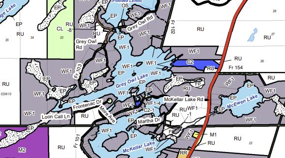
Maps of Grey Owl Lake
Topographical Map of Grey Owl Lake in McKellar
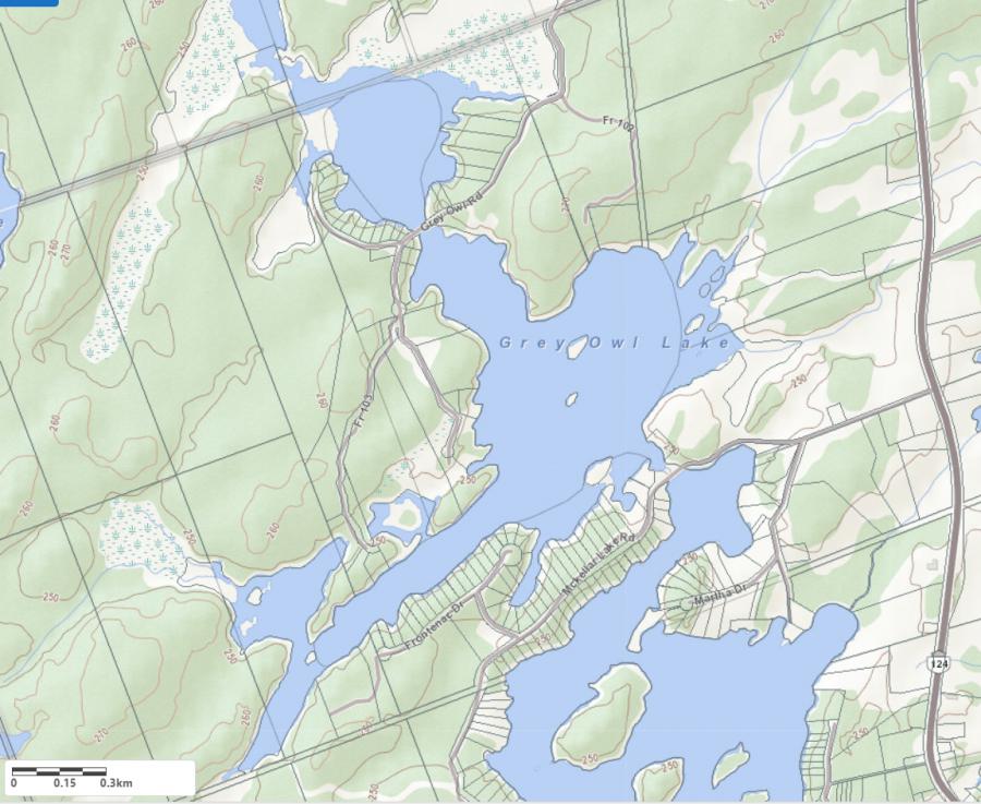
Legend
 Buildings surrounding Grey Owl Lake
 Buildings surrounding Grey Owl Lake
 Conservation Area surrounding Grey Owl Lake
 Contours of land surrounding Grey Owl Lake
 Index Contour
 Rapids
 Spot Height
 Water Falls
 Water Falls/Rapids
 Waterbody Elevation
 Watercourse
 Wetland surrounding Grey Owl Lake
 Wooded Area surrounding Grey Owl Lake
Zoning Map of Grey Owl Lake in McKellar